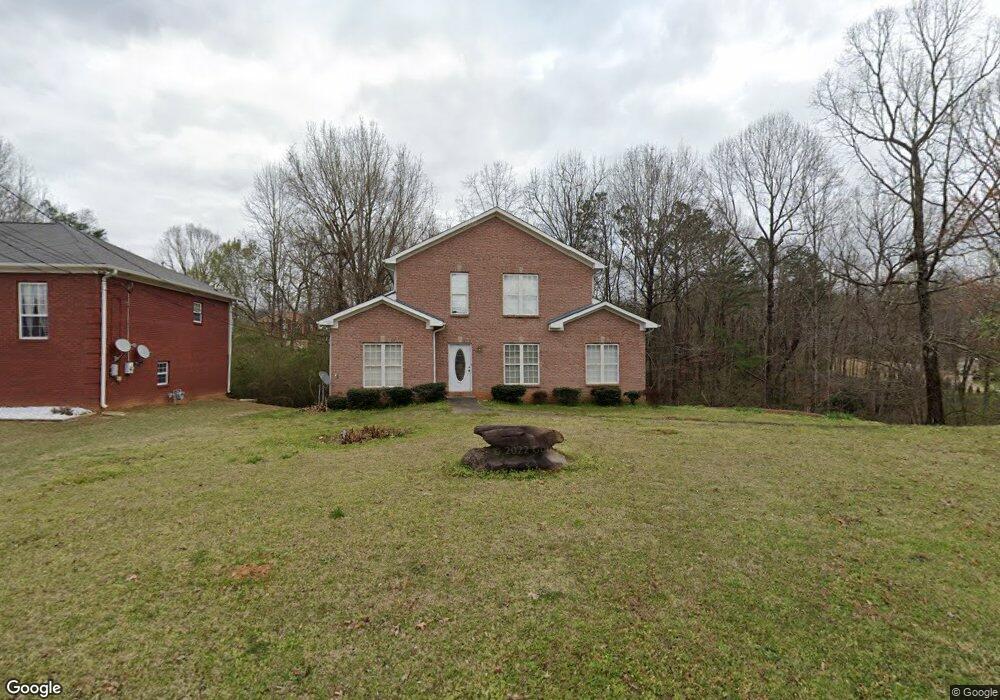
1305 Rolling Ridge Cir Pleasant Grove, AL 35127
Estimated Value: $262,000 - $391,000
4
Beds
4
Baths
2,338
Sq Ft
$135/Sq Ft
Est. Value
About This Home
This home is located at 1305 Rolling Ridge Cir, Pleasant Grove, AL 35127 and is currently estimated at $315,892, approximately $135 per square foot. 1305 Rolling Ridge Cir is a home located in Jefferson County with nearby schools including Pleasant Grove Elementary School, Pleasant Grove High School, and Garywood Christian School.
Ownership History
Date
Name
Owned For
Owner Type
Purchase Details
Closed on
Mar 2, 2010
Sold by
Deutsche Bank National Trust Company
Bought by
Lewis Connie
Current Estimated Value
Home Financials for this Owner
Home Financials are based on the most recent Mortgage that was taken out on this home.
Original Mortgage
$147,959
Interest Rate
5.15%
Mortgage Type
New Conventional
Purchase Details
Closed on
May 21, 2004
Sold by
Mccormick Bruce L
Bought by
Avery Zina
Home Financials for this Owner
Home Financials are based on the most recent Mortgage that was taken out on this home.
Original Mortgage
$207,400
Interest Rate
9.15%
Mortgage Type
Unknown
Create a Home Valuation Report for This Property
The Home Valuation Report is an in-depth analysis detailing your home's value as well as a comparison with similar homes in the area
Home Values in the Area
Average Home Value in this Area
Purchase History
| Date | Buyer | Sale Price | Title Company |
|---|---|---|---|
| Lewis Connie | -- | None Available | |
| Avery Zina | -- | Heritage Title Llc |
Source: Public Records
Mortgage History
| Date | Status | Borrower | Loan Amount |
|---|---|---|---|
| Previous Owner | Lewis Connie | $147,959 | |
| Previous Owner | Avery Zina | $207,400 |
Source: Public Records
Tax History Compared to Growth
Tax History
| Year | Tax Paid | Tax Assessment Tax Assessment Total Assessment is a certain percentage of the fair market value that is determined by local assessors to be the total taxable value of land and additions on the property. | Land | Improvement |
|---|---|---|---|---|
| 2024 | -- | $25,640 | -- | -- |
| 2022 | $0 | $25,030 | $3,770 | $21,260 |
| 2021 | $1,681 | $21,570 | $3,770 | $17,800 |
| 2020 | $1,681 | $20,750 | $3,770 | $16,980 |
| 2019 | $1,681 | $20,260 | $0 | $0 |
| 2018 | $1,676 | $21,580 | $0 | $0 |
| 2017 | $1,634 | $21,060 | $0 | $0 |
| 2016 | $1,634 | $21,060 | $0 | $0 |
| 2015 | $1,634 | $21,060 | $0 | $0 |
| 2014 | $1,613 | $20,740 | $0 | $0 |
| 2013 | $1,613 | $20,740 | $0 | $0 |
Source: Public Records
Map
Nearby Homes
- 0 12th Ct Unit 1322332
- 413 Patterson Ave
- 435 Forest Rd
- 115 Johnson Dr
- 63 Johnson Dr
- 107 Chapel Dr
- 431 Clio St
- 300 Carver Ave
- 130 Huey Ln
- 412 James Ave
- 517 Coalfire Ave
- 230 Marsh Ave
- 120 Huey Ln
- 108 Fair St
- 114 Pinewood Ave
- 507 W Smithfield Terrace
- 1207 12th Ct Unit 1207
- 121 W Crest Rd
- 216 Pinewood Ave
- 119 Wheeler Dr
- 1309 Rolling Ridge Cir
- 1313 Rolling Ridge Cir
- 1304 Rolling Ridge Cir
- 1308 Rolling Ridge Cir
- 1316 Red Rock Cir
- 1320 Red Rock Cir
- 1317 Rolling Ridge Cir
- 1312 Red Rock Cir
- 1324 Red Rock Cir
- 1312 Rolling Ridge Cir
- 1321 Rolling Ridge Cir
- 1301 Rolling Ridge Cir
- 1308 Red Rock Cir
- 1328 Red Rock Cir
- 1321 Red Rock Cir
- 1325 Rolling Ridge Cir
- 1325 Red Rock Cir
- 1317 Red Rock Cir
- 1313 Red Rock Cir
- 1332 Red Rock Cir