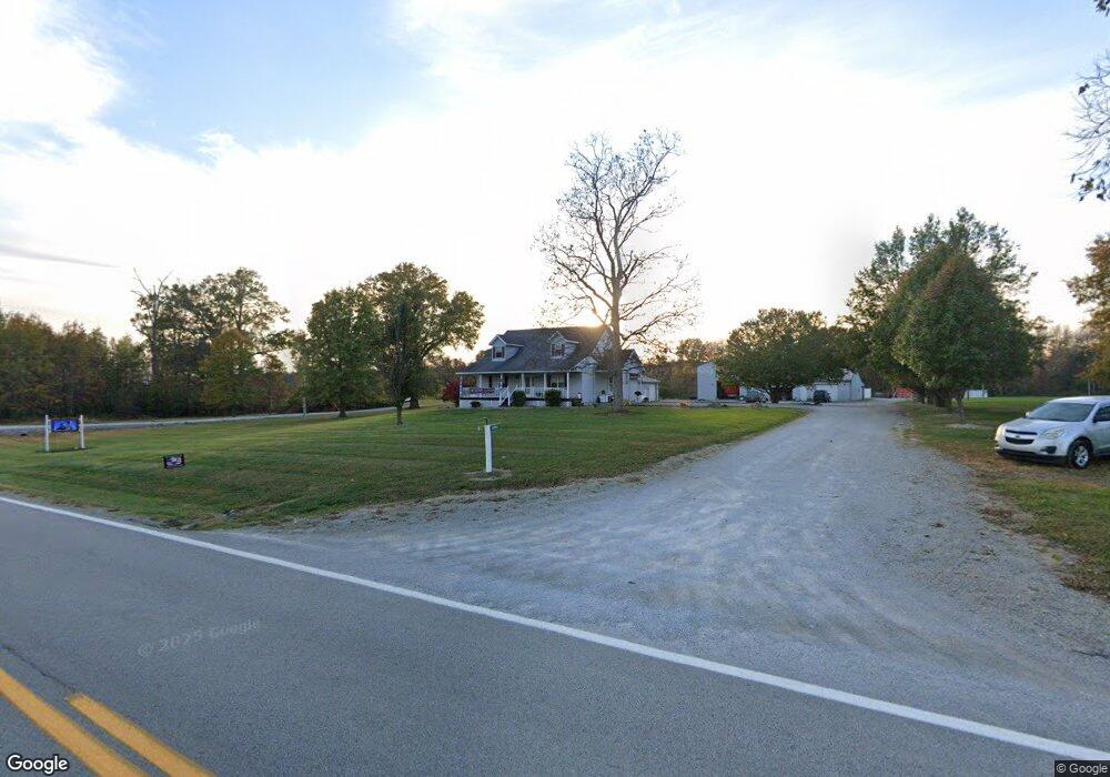
13053 State Route 136 West Union, OH 45693
Estimated Value: $251,000 - $404,474
3
Beds
2
Baths
2,272
Sq Ft
$140/Sq Ft
Est. Value
About This Home
This home is located at 13053 State Route 136, West Union, OH 45693 and is currently estimated at $319,119, approximately $140 per square foot. 13053 State Route 136 is a home located in Adams County with nearby schools including North Adams Elementary School and North Adams High School.
Ownership History
Date
Name
Owned For
Owner Type
Purchase Details
Closed on
Aug 30, 2016
Sold by
Jessee Rick S
Bought by
National Bank Of Adams County
Current Estimated Value
Home Financials for this Owner
Home Financials are based on the most recent Mortgage that was taken out on this home.
Interest Rate
3.43%
Purchase Details
Closed on
Sep 24, 1999
Bought by
Jessee Rick S
Create a Home Valuation Report for This Property
The Home Valuation Report is an in-depth analysis detailing your home's value as well as a comparison with similar homes in the area
Home Values in the Area
Average Home Value in this Area
Purchase History
| Date | Buyer | Sale Price | Title Company |
|---|---|---|---|
| National Bank Of Adams County | -- | -- | |
| Jessee Rick S | $12,000 | -- |
Source: Public Records
Mortgage History
| Date | Status | Borrower | Loan Amount |
|---|---|---|---|
| Closed | National Bank Of Adams County | -- |
Source: Public Records
Tax History Compared to Growth
Tax History
| Year | Tax Paid | Tax Assessment Tax Assessment Total Assessment is a certain percentage of the fair market value that is determined by local assessors to be the total taxable value of land and additions on the property. | Land | Improvement |
|---|---|---|---|---|
| 2024 | $12,417 | $81,410 | $9,800 | $71,610 |
| 2023 | $14,836 | $81,410 | $9,800 | $71,610 |
| 2022 | $2,986 | $70,150 | $8,440 | $61,710 |
| 2021 | $2,937 | $70,150 | $8,440 | $61,710 |
| 2020 | $2,854 | $70,150 | $8,440 | $61,710 |
| 2019 | $2,854 | $70,150 | $8,440 | $61,710 |
| 2018 | $2,427 | $60,800 | $7,140 | $53,660 |
| 2017 | $2,442 | $60,800 | $7,140 | $53,660 |
| 2016 | $2,437 | $60,800 | $7,140 | $53,660 |
| 2015 | $2,535 | $65,140 | $7,390 | $57,750 |
| 2014 | $2,536 | $65,140 | $7,390 | $57,750 |
Source: Public Records
Map
Nearby Homes
- 1689 Eckmansville Rd
- 86 Hawk Hill Rd
- 13529 Ohio 247
- 125 Robinette Rd
- 1717 Foster Rd
- 3287 Chapparal Rd
- 0 Eckmansville Rd
- 831 Tom Brown Rd
- 5021 Ohio 125
- 5087 State Route 125
- 223 Alex Ln
- 155 Redbud Ln
- 17217 Ohio 136
- 195 Silver
- 4400 Chapparal Rd
- 80 Madonna Dr
- 93 Jose Dr
- 3551 Unity Rd
- 3 Chapparal Rd
- 2 Chapparal Rd
- 13031 State Route 136
- 13031 State Route 136
- 12997 State Route 136
- 13132 State Route 136
- 13132 State Route 136
- 13132 State Route 136 Unit 136
- 3661 Narrow Gauge Rd
- 3591 Narrow Gauge Rd
- 12891 State Route 136
- 13288 St Rt 136
- 13288 Ohio 136
- 12843 State Route 136
- 12778 State Route 136
- 12778 St Rt 136
- A St Rt 136
- 12715 State Route 136
- 13370 State Route 136
- 13370 State Route 136
- 12704 State Route 136
- 12704 St Rt 136