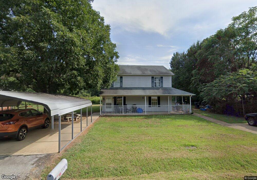
1306 Phyllis Dr Anderson, SC 29621
Estimated Value: $109,561 - $206,000
Studio
--
Bath
2,200
Sq Ft
$79/Sq Ft
Est. Value
About This Home
This home is located at 1306 Phyllis Dr, Anderson, SC 29621 and is currently estimated at $173,390, approximately $78 per square foot. 1306 Phyllis Dr is a home with nearby schools including Nevitt Forest Elementary School, Glenview Middle School, and T.L. Hanna High School.
Ownership History
Date
Name
Owned For
Owner Type
Purchase Details
Closed on
Sep 25, 2006
Sold by
Rauschenbach Kathy and Rauschenbach John
Bought by
Grimmett Michael and Grimmett Living Trust
Current Estimated Value
Home Financials for this Owner
Home Financials are based on the most recent Mortgage that was taken out on this home.
Original Mortgage
$8,500
Interest Rate
6.17%
Mortgage Type
Stand Alone Second
Purchase Details
Closed on
Jul 9, 2004
Sold by
Vernons Hill Inc
Bought by
Rauschenbach Kathy and Rauschenbach John
Create a Home Valuation Report for This Property
The Home Valuation Report is an in-depth analysis detailing your home's value as well as a comparison with similar homes in the area
Home Values in the Area
Average Home Value in this Area
Purchase History
| Date | Buyer | Sale Price | Title Company |
|---|---|---|---|
| Grimmett Michael | $85,000 | None Available | |
| Rauschenbach Kathy | $80,000 | -- |
Source: Public Records
Mortgage History
| Date | Status | Borrower | Loan Amount |
|---|---|---|---|
| Closed | Grimmett Michael | $8,500 | |
| Open | Grimmett Michael | $68,000 |
Source: Public Records
Tax History
| Year | Tax Paid | Tax Assessment Tax Assessment Total Assessment is a certain percentage of the fair market value that is determined by local assessors to be the total taxable value of land and additions on the property. | Land | Improvement |
|---|---|---|---|---|
| 2024 | $1,289 | $3,490 | $610 | $2,880 |
| 2023 | $1,283 | $3,490 | $610 | $2,880 |
| 2022 | $1,196 | $3,490 | $610 | $2,880 |
| 2021 | $1,100 | $3,190 | $480 | $2,710 |
| 2020 | $1,079 | $3,190 | $480 | $2,710 |
| 2019 | $1,182 | $3,240 | $480 | $2,760 |
| 2018 | $1,168 | $3,240 | $480 | $2,760 |
| 2017 | -- | $3,240 | $480 | $2,760 |
| 2016 | $1,460 | $4,290 | $600 | $3,690 |
| 2015 | $1,469 | $4,290 | $600 | $3,690 |
| 2014 | $1,440 | $4,290 | $600 | $3,690 |
Source: Public Records
Map
Nearby Homes
- 1005 Pinecroft Dr
- 335 Blue Ridge Cir
- 1425 Amity Rd
- 129 Bentley Dr
- 0 Highway 29 N Unit 22331557
- 0 Highway 29 N Unit 22331558
- 0 Highway 29 N Unit 22331556
- 707 Kay Dr
- 132 Haynie Mill Rd
- 327 Ritter Ln
- 335 Ritter Ln
- 136 Amberwood Dr
- 126 Olivarri Dr
- 309 Ritter Ln
- 308 Ritter Ln
- 306 Ritter Ln
- 305 Ritter Ln
- 2537 Belhaven Rd
- 211 Durness Ct
- 203 Durness Ct
- 1308 Phyllis Dr
- 1304A Phyllis Dr
- 1305 Phyllis Dr
- 1307 Phyllis Dr
- 1303 Phyllis Dr
- 1309 Phyllis Dr
- 1000 Amity Rd
- 1708 Speedway Dr
- 1710 Speedway Dr
- 1317 Phyllis Dr
- 1100 Amity Rd
- 1712 Speedway Dr
- 1319 Phyllis Dr
- 1714 Speedway Dr
- 1102 Amity Rd
- 1716 Speedway Dr
- 1321 Phyllis Dr
- 1713 Speedway Dr
- 900 Amity Rd
- 1715 Speedway Dr
Your Personal Tour Guide
Ask me questions while you tour the home.