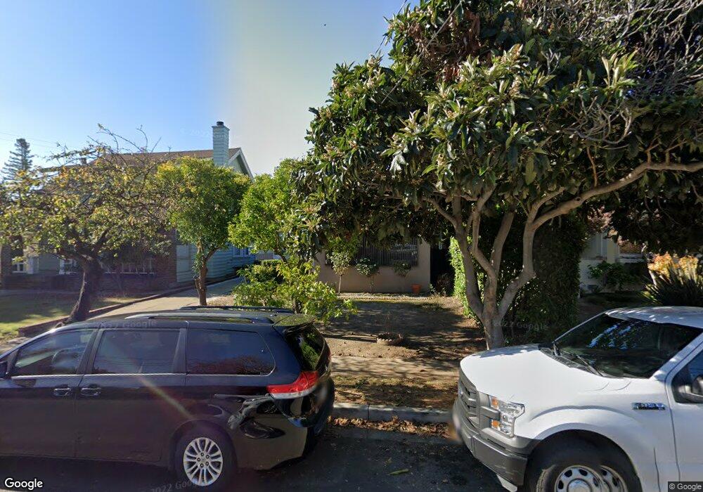
1306 S B St San Mateo, CA 94402
Hayward Park NeighborhoodEstimated Value: $1,629,263 - $2,029,000
2
Beds
1
Bath
1,240
Sq Ft
$1,438/Sq Ft
Est. Value
About This Home
This home is located at 1306 S B St, San Mateo, CA 94402 and is currently estimated at $1,783,316, approximately $1,438 per square foot. 1306 S B St is a home located in San Mateo County with nearby schools including Sunnybrae Elementary School, Borel Middle School, and Aragon High School.
Ownership History
Date
Name
Owned For
Owner Type
Purchase Details
Closed on
Nov 9, 2016
Sold by
Ting Chen Hanson
Bought by
Ting Chen Hanson and Ting Kuei Chiao
Current Estimated Value
Purchase Details
Closed on
Oct 12, 2010
Sold by
Ting Chen Hanson
Bought by
Ting Chen Hanson
Purchase Details
Closed on
Sep 4, 2008
Sold by
Sun Gong Liang and Ting Hansun Situ
Bought by
Ting Pei Chung
Purchase Details
Closed on
Jun 2, 2008
Sold by
Ting Hansun Situ
Bought by
Ting Hansun Situ
Purchase Details
Closed on
Jul 14, 2005
Sold by
Ting Chen Wei and Ting Hansun Situ
Bought by
Ting Chen Wei and Ting Hansun Situ
Purchase Details
Closed on
Nov 17, 1999
Sold by
Wei Ting Chen
Bought by
Ting Chen Wei and Ting Hansun Situ
Purchase Details
Closed on
Feb 13, 1998
Sold by
Hanson Ting Chen
Bought by
Ting Chen Wei
Purchase Details
Closed on
Nov 4, 1997
Sold by
Wei Ting Chen and Hanson Ting Chen
Bought by
Ting Chen Wei and Ting Chen Hanson
Create a Home Valuation Report for This Property
The Home Valuation Report is an in-depth analysis detailing your home's value as well as a comparison with similar homes in the area
Home Values in the Area
Average Home Value in this Area
Purchase History
| Date | Buyer | Sale Price | Title Company |
|---|---|---|---|
| Ting Chen Hanson | -- | None Available | |
| Ting Chen Hanson | -- | None Available | |
| Ting Pei Chung | $300,000 | None Available | |
| Ting Hansun Situ | -- | None Available | |
| Ting Chen Wei | -- | -- | |
| Ting Chen Wei | -- | -- | |
| Ting Chen Wei | -- | -- | |
| Ting Chen Wei | -- | -- | |
| Ting Chen Wei | -- | -- |
Source: Public Records
Tax History
| Year | Tax Paid | Tax Assessment Tax Assessment Total Assessment is a certain percentage of the fair market value that is determined by local assessors to be the total taxable value of land and additions on the property. | Land | Improvement |
|---|---|---|---|---|
| 2025 | $7,007 | $497,234 | $240,033 | $257,201 |
| 2023 | $7,007 | $477,929 | $230,714 | $247,215 |
| 2022 | $7,652 | $468,559 | $226,191 | $242,368 |
| 2021 | $7,891 | $459,374 | $221,757 | $237,617 |
| 2020 | $6,267 | $454,666 | $219,484 | $235,182 |
| 2019 | $6,007 | $445,752 | $215,181 | $230,571 |
| 2018 | $5,545 | $437,013 | $210,962 | $226,051 |
| 2017 | $4,966 | $428,446 | $206,826 | $221,620 |
| 2016 | $6,349 | $420,046 | $202,771 | $217,275 |
| 2015 | $6,059 | $413,738 | $199,726 | $214,012 |
| 2014 | $5,818 | $405,634 | $195,814 | $209,820 |
Source: Public Records
Map
Nearby Homes
- 88 17th Ave Unit 304
- 11 Hayward Ave Unit 1009
- 112 Madison Ave Unit 108
- 112 Madison Ave Unit 109
- 222 8th Ave Unit 306
- 115 Hobart Ave Unit E
- 618 9th Ave
- 1222 Birch Ave
- 745 Birch Ave
- 957 E Grant Place
- 222 6th Ave Unit 302
- 906 Haddon Dr
- 555 Laurel Ave Unit 614
- 1927 Palm Ave
- 1931 Palm Ave
- 1662 Washington St
- 523 Maple St
- 25 Mcaker Ct Unit 103
- 35 W 20th Ave Unit 203
- 35 W 20th Ave Unit 109
Your Personal Tour Guide
Ask me questions while you tour the home.