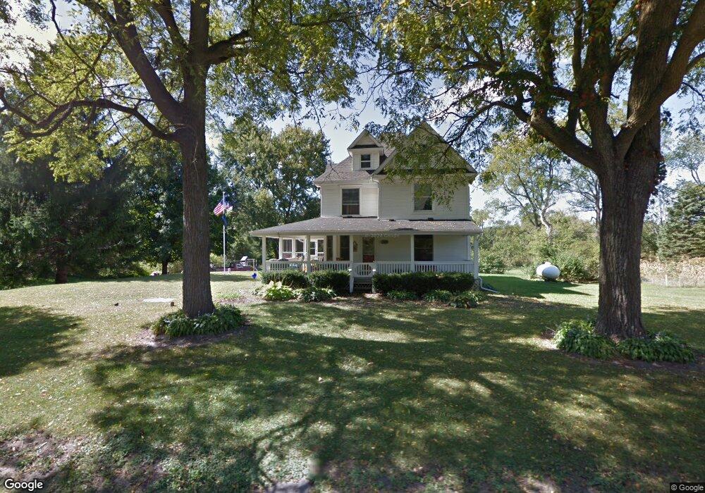
13060 Mayer Rd Munith, MI 49259
Estimated Value: $236,000 - $418,000
4
Beds
2
Baths
2,518
Sq Ft
$142/Sq Ft
Est. Value
About This Home
This home is located at 13060 Mayer Rd, Munith, MI 49259 and is currently estimated at $356,594, approximately $141 per square foot. 13060 Mayer Rd is a home located in Jackson County with nearby schools including Emma Smith Elementary School, Heritage School, and Stockbridge High School.
Ownership History
Date
Name
Owned For
Owner Type
Purchase Details
Closed on
Sep 6, 2013
Sold by
Lindemer Susan and Panoff Dennis
Bought by
Whitaker Joshua J and Whitaker Laura K
Current Estimated Value
Home Financials for this Owner
Home Financials are based on the most recent Mortgage that was taken out on this home.
Original Mortgage
$103,500
Outstanding Balance
$77,174
Interest Rate
4.38%
Mortgage Type
New Conventional
Estimated Equity
$279,420
Create a Home Valuation Report for This Property
The Home Valuation Report is an in-depth analysis detailing your home's value as well as a comparison with similar homes in the area
Purchase History
| Date | Buyer | Sale Price | Title Company |
|---|---|---|---|
| Whitaker Joshua J | $115,000 | At |
Source: Public Records
Mortgage History
| Date | Status | Borrower | Loan Amount |
|---|---|---|---|
| Open | Whitaker Joshua J | $103,500 |
Source: Public Records
Tax History
| Year | Tax Paid | Tax Assessment Tax Assessment Total Assessment is a certain percentage of the fair market value that is determined by local assessors to be the total taxable value of land and additions on the property. | Land | Improvement |
|---|---|---|---|---|
| 2025 | $2,496 | $175,550 | $0 | $0 |
| 2024 | $10 | $164,800 | $0 | $0 |
| 2023 | $912 | $149,350 | $0 | $0 |
| 2022 | $2,292 | $118,600 | $0 | $0 |
| 2021 | $2,182 | $106,450 | $0 | $0 |
| 2020 | $2,154 | $97,050 | $0 | $0 |
| 2019 | $2,074 | $87,750 | $0 | $0 |
| 2018 | $2,027 | $78,500 | $0 | $0 |
| 2017 | $1,901 | $75,450 | $0 | $0 |
| 2016 | $768 | $72,300 | $10,700 | $61,600 |
| 2015 | $1,797 | $73,950 | $73,950 | $0 |
| 2014 | $1,797 | $67,150 | $67,150 | $0 |
| 2013 | -- | $67,150 | $67,150 | $0 |
Source: Public Records
Map
Nearby Homes
- 4845 Moechel Rd
- 216 S Center St
- 0 M-52 Unit 291080
- 0000 Roberts Dr
- 630 W Main St W
- 3515 Morton Rd
- 119 Maple St
- 4740 E Main St
- 4760 E Main St
- 0 Harr Rd Unit 25026824
- 4053 Eastbridge Rd
- 4057 Eastbridge Rd
- 4059 Eastbridge Rd
- 0 Cassidy Rd Unit 25033809
- 2598 Heeney Rd
- 2600 Heeney Rd
- 0000 Chapman Rd
- 9800 Beeman Rd
- 00 N M-52 Ville
- 7762 Coon Hill Rd
- 13101 Mayer Rd
- 13087 Mayer Rd
- 0 Mayer Rd
- Vacant Mayer Rd
- 11600 Territorial Rd
- 11616 Territorial Rd
- 11603 Territorial Rd
- 11530 Territorial Rd
- 13000 Wilmore Rd
- 13000 Wilmore Rd
- 11620 Territorial Rd
- 12934 S M 106
- 11633 Territorial Rd
- 13252 Wilmore Rd
- 13252 Wilmore Rd
- Parcel B Territorial
- 12950 M-106
- 12950 M106
- 11516 Territorial Rd
- 11639 Territorial Rd
Your Personal Tour Guide
Ask me questions while you tour the home.