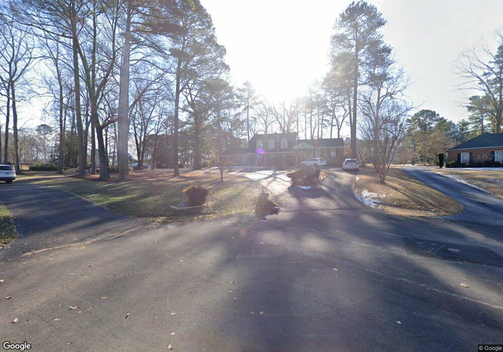
13061 Riverside Cir Ashland, VA 23005
Estimated Value: $523,000 - $641,000
4
Beds
4
Baths
3,080
Sq Ft
$185/Sq Ft
Est. Value
About This Home
This home is located at 13061 Riverside Cir, Ashland, VA 23005 and is currently estimated at $569,236, approximately $184 per square foot. 13061 Riverside Cir is a home located in Hanover County with nearby schools including Henry Clay Elementary School, Liberty Middle School, and Patrick Henry High School.
Ownership History
Date
Name
Owned For
Owner Type
Purchase Details
Closed on
Apr 21, 2017
Sold by
Richardson Leroy F and Patricia Richardson E
Bought by
Page Jonathan K and Page Tina M
Current Estimated Value
Home Financials for this Owner
Home Financials are based on the most recent Mortgage that was taken out on this home.
Original Mortgage
$252,800
Outstanding Balance
$209,963
Interest Rate
4.14%
Mortgage Type
New Conventional
Estimated Equity
$359,273
Create a Home Valuation Report for This Property
The Home Valuation Report is an in-depth analysis detailing your home's value as well as a comparison with similar homes in the area
Home Values in the Area
Average Home Value in this Area
Purchase History
| Date | Buyer | Sale Price | Title Company |
|---|---|---|---|
| Page Jonathan K | $336,000 | Attorney |
Source: Public Records
Mortgage History
| Date | Status | Borrower | Loan Amount |
|---|---|---|---|
| Open | Page Jonathan K | $252,800 |
Source: Public Records
Tax History Compared to Growth
Tax History
| Year | Tax Paid | Tax Assessment Tax Assessment Total Assessment is a certain percentage of the fair market value that is determined by local assessors to be the total taxable value of land and additions on the property. | Land | Improvement |
|---|---|---|---|---|
| 2025 | $3,941 | $486,600 | $144,000 | $342,600 |
| 2024 | $3,941 | $486,600 | $144,000 | $342,600 |
| 2023 | $3,227 | $419,100 | $128,000 | $291,100 |
| 2022 | $3,183 | $392,900 | $112,000 | $280,900 |
| 2021 | $2,976 | $367,400 | $112,000 | $255,400 |
| 2020 | $2,976 | $367,400 | $112,000 | $255,400 |
| 2019 | $2,722 | $343,500 | $112,000 | $231,500 |
| 2018 | $2,722 | $336,000 | $112,000 | $224,000 |
| 2017 | $2,722 | $336,000 | $112,000 | $224,000 |
| 2016 | $2,573 | $317,600 | $96,000 | $221,600 |
| 2015 | $2,573 | $317,600 | $96,000 | $221,600 |
| 2014 | $2,338 | $288,700 | $96,000 | $192,700 |
Source: Public Records
Map
Nearby Homes
- 14383 Country Club Dr
- 14481 Augusta Ln
- 14506 Riverside Dr
- TBD Horseshoe Bridge Rd
- 12601 W Patrick Henry Rd
- 000 Yankeetown Rd
- 13409 Winston Estates Ln
- 14009 Tribe Ln
- 14150 Bear Slash Trail
- 1234 Whitewood Ln
- 14040 W Patrick Henry Rd
- 14198 Windmill Dr
- 15035 Whitewood Ln
- 11115 Stillcroft Ln
- 14166 Independence Rd
- 11121 Stillcroft Ln
- 11494 Riveredge Rd
- 13494 Lakeview Farms Place
- 15489 Campbell Lake Rd
- Rockefeller Plan at StillCroft
- 13063 Riverside Cir
- 13060 Riverside Cir
- 13064 Riverside Cir
- 14358 Riverside Dr
- 14377 Country Club Dr
- 14350 Riverside Dr
- 14389 Country Club Dr
- 14371 Country Club Dr
- 14372 Riverside Dr
- 13059 Riverside Ct
- 13082 Fairway Ln
- 14365 Country Club Dr
- 13065 Riverside Ct
- 13074 Fairway Ln
- 14363 Riverside Dr
- 14357 Riverside Dr
- 14380 Country Club Dr
- 14351 Riverside Dr
- 13071 Riverside Ct
- 14390 Country Club Dr