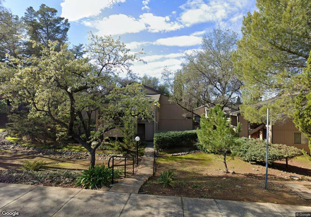
13063 Lincoln Way Unit F Auburn, CA 95603
Estimated Value: $251,000 - $311,000
2
Beds
2
Baths
905
Sq Ft
$305/Sq Ft
Est. Value
About This Home
This home is located at 13063 Lincoln Way Unit F, Auburn, CA 95603 and is currently estimated at $276,277, approximately $305 per square foot. 13063 Lincoln Way Unit F is a home located in Placer County with nearby schools including Skyridge Elementary School, Placer High School, and Alta Vista Community Charter.
Ownership History
Date
Name
Owned For
Owner Type
Purchase Details
Closed on
Jan 17, 2025
Sold by
Chandler Kristin
Bought by
Kristin Chandler 1999 Living Trust and Chandler
Current Estimated Value
Purchase Details
Closed on
May 3, 1999
Sold by
Chandler Kristin and Mckoy Kristin C
Bought by
Chandler Kristin
Create a Home Valuation Report for This Property
The Home Valuation Report is an in-depth analysis detailing your home's value as well as a comparison with similar homes in the area
Home Values in the Area
Average Home Value in this Area
Purchase History
| Date | Buyer | Sale Price | Title Company |
|---|---|---|---|
| Kristin Chandler 1999 Living Trust | -- | Old Republic Title | |
| Chandler Kristin | -- | -- |
Source: Public Records
Tax History Compared to Growth
Tax History
| Year | Tax Paid | Tax Assessment Tax Assessment Total Assessment is a certain percentage of the fair market value that is determined by local assessors to be the total taxable value of land and additions on the property. | Land | Improvement |
|---|---|---|---|---|
| 2025 | $1,717 | $101,418 | $28,697 | $72,721 |
| 2023 | $1,717 | $97,483 | $27,584 | $69,899 |
| 2022 | $1,698 | $95,573 | $27,044 | $68,529 |
| 2021 | $1,662 | $93,700 | $26,514 | $67,186 |
| 2020 | $1,655 | $92,741 | $26,243 | $66,498 |
| 2019 | $1,636 | $90,924 | $25,729 | $65,195 |
| 2018 | $1,586 | $89,142 | $25,225 | $63,917 |
| 2017 | $1,540 | $87,395 | $24,731 | $62,664 |
| 2016 | $1,494 | $85,683 | $24,247 | $61,436 |
| 2015 | $1,447 | $84,397 | $23,883 | $60,514 |
| 2014 | $1,408 | $82,745 | $23,416 | $59,329 |
Source: Public Records
Map
Nearby Homes
- 13061 Lincoln Way Unit B
- 13067 Lincoln Way Unit D
- 13017 Lincoln Way Unit 88
- 101 Lincoln Way
- 1430 Auburn Ravine Rd
- 381 Foresthill Ave
- 681 Foresthill Ave
- 140 Oak St
- 440 Foresthill Ave
- 225 Flood Rd
- 258 Swenson Ct
- 438 Olive Orchard Dr
- 12567 Highland Dr
- 266 Swenson Ct
- 832 Holly Hills Dr
- 374 Kevin Ct
- 771 Auburn Ravine Rd
- 160 Flood Ln
- 831 Auburn Ravine Rd
- 541 Cambridge Ct
- 13063 Lincoln Way Unit 30
- 13063 Lincoln Way Unit H
- 13063 Lincoln Way Unit G
- 13063 Lincoln Way Unit E
- 13063 Lincoln Way Unit D
- 13063 Lincoln Way Unit C
- 13063 Lincoln Way Unit B
- 13063 Lincoln Way Unit A
- 13003 Lincoln Way Unit H
- 13003 Lincoln Way Unit G
- 13003 Lincoln Way Unit F
- 13003 Lincoln Way Unit E
- 13003 Lincoln Way Unit D
- 13003 Lincoln Way Unit C
- 13003 Lincoln Way Unit B
- 13003 Lincoln Way Unit A
- 13057 Lincoln Way
- 13057 Lincoln Way Unit F
- 13057 Lincoln Way Unit E
- 13057 Lincoln Way Unit D