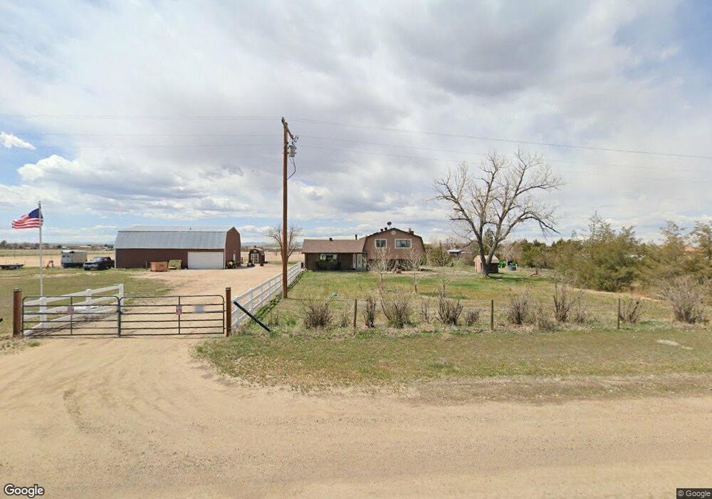
13065 Lanewood St Commerce City, CO 80022
Estimated Value: $683,262 - $772,000
4
Beds
2
Baths
1,908
Sq Ft
$373/Sq Ft
Est. Value
About This Home
This home is located at 13065 Lanewood St, Commerce City, CO 80022 and is currently estimated at $711,816, approximately $373 per square foot. 13065 Lanewood St is a home located in Adams County with nearby schools including Henderson Elementary School, Otho E Stuart Middle School, and Prairie View High School.
Ownership History
Date
Name
Owned For
Owner Type
Purchase Details
Closed on
Dec 1, 2016
Sold by
Lee Janet J
Bought by
Kinder Jeffrey A and Kinder Shannon
Current Estimated Value
Home Financials for this Owner
Home Financials are based on the most recent Mortgage that was taken out on this home.
Original Mortgage
$357,000
Outstanding Balance
$288,271
Interest Rate
3.52%
Mortgage Type
New Conventional
Estimated Equity
$423,545
Create a Home Valuation Report for This Property
The Home Valuation Report is an in-depth analysis detailing your home's value as well as a comparison with similar homes in the area
Home Values in the Area
Average Home Value in this Area
Purchase History
| Date | Buyer | Sale Price | Title Company |
|---|---|---|---|
| Kinder Jeffrey A | $420,000 | First American Title |
Source: Public Records
Mortgage History
| Date | Status | Borrower | Loan Amount |
|---|---|---|---|
| Open | Kinder Jeffrey A | $357,000 |
Source: Public Records
Tax History Compared to Growth
Tax History
| Year | Tax Paid | Tax Assessment Tax Assessment Total Assessment is a certain percentage of the fair market value that is determined by local assessors to be the total taxable value of land and additions on the property. | Land | Improvement |
|---|---|---|---|---|
| 2024 | $4,192 | $41,180 | $10,580 | $30,600 |
| 2023 | $4,171 | $44,020 | $10,180 | $33,840 |
| 2022 | $3,710 | $35,950 | $9,810 | $26,140 |
| 2021 | $3,457 | $35,950 | $9,810 | $26,140 |
| 2020 | $2,853 | $30,970 | $10,100 | $20,870 |
| 2019 | $2,855 | $30,970 | $10,100 | $20,870 |
| 2018 | $1,957 | $21,220 | $6,890 | $14,330 |
| 2017 | $1,955 | $21,220 | $6,890 | $14,330 |
| 2016 | $991 | $18,680 | $7,150 | $11,530 |
| 2015 | $989 | $10,710 | $4,100 | $6,610 |
| 2014 | $965 | $10,630 | $3,880 | $6,750 |
Source: Public Records
Map
Nearby Homes
- 32350 E 137th Way
- 32501 E 137th Way
- 31200 E 145th Ave
- 16590 Watkins Rd
- 32650 E 143rd Ave
- 14651 Hayesmount Rd
- 30522 E 148th Ct
- 14955 Lanewood St
- 6816 E 149th Ave
- 34308 E 139th Ct
- 13350 Imboden Rd
- 2 Imboden Rd
- 15415 Gadsden Dr
- 13400 Harvest Rd
- 0 Harvest Rd Unit REC9194952
- 0 E 152nd Ave
- 30460 E 161st Ave
- 30350 E 161st Ave Unit 25
- 14855 Almstead St
- 28550 E 159th Ave
- 12985 Lanewood St
- 30366 E 131st Ave
- 30467 E 131st Ave
- 30266 E 131st Ave
- 12925 Lanewood St
- 30387 E 131st Ave
- 30337 E 131st Ave
- 12885 Lanewood St
- 30188 E 131st Ave
- 30267 E 131st Ave
- 30187 E 131st Ave
- 30147 E 131st Ave
- 30068 E 131st Ave
- 12815 Lanewood St
- 30086 E 131st Ave
- 30341 E 128th Ave
- 30067 E 131st Ave
- 30241 E 128th Ave
- 29987 E 131st Ave
- 0 Tbd Unit 7031645