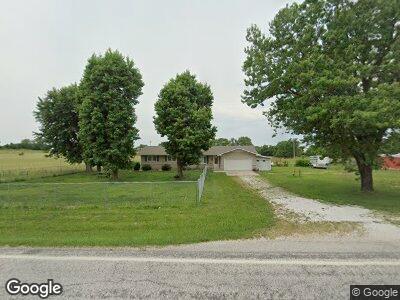
1307 State Highway 125 N Sparta, MO 65753
Estimated Value: $233,000 - $276,126
3
Beds
2
Baths
1,500
Sq Ft
$174/Sq Ft
Est. Value
About This Home
This home is located at 1307 State Highway 125 N, Sparta, MO 65753 and is currently estimated at $261,709, approximately $174 per square foot. 1307 State Highway 125 N is a home located in Christian County with nearby schools including Sparta Elementary School, Sparta Middle School, and Sparta High School.
Ownership History
Date
Name
Owned For
Owner Type
Purchase Details
Closed on
Apr 19, 2019
Sold by
Bertoldie Bonnie
Bought by
Bertholdie Qualified Spousal Trust
Current Estimated Value
Home Financials for this Owner
Home Financials are based on the most recent Mortgage that was taken out on this home.
Original Mortgage
$160,000
Outstanding Balance
$136,869
Interest Rate
4.4%
Mortgage Type
Credit Line Revolving
Estimated Equity
$133,378
Purchase Details
Closed on
Aug 29, 2008
Sold by
Roller Bobby Jean
Bought by
Homesales Inc and Homesales Delaware Inc
Create a Home Valuation Report for This Property
The Home Valuation Report is an in-depth analysis detailing your home's value as well as a comparison with similar homes in the area
Home Values in the Area
Average Home Value in this Area
Purchase History
| Date | Buyer | Sale Price | Title Company |
|---|---|---|---|
| Bertholdie Qualified Spousal Trust | -- | Great American Title | |
| Bertoldie Bonnie | -- | Great American Title | |
| Homesales Inc | $100,000 | None Available |
Source: Public Records
Mortgage History
| Date | Status | Borrower | Loan Amount |
|---|---|---|---|
| Open | Bertoldie Bonnie | $160,000 | |
| Previous Owner | Parham Robert S | $101,000 |
Source: Public Records
Tax History Compared to Growth
Tax History
| Year | Tax Paid | Tax Assessment Tax Assessment Total Assessment is a certain percentage of the fair market value that is determined by local assessors to be the total taxable value of land and additions on the property. | Land | Improvement |
|---|---|---|---|---|
| 2023 | $1,072 | $20,360 | $0 | $0 |
| 2022 | $903 | $17,040 | $0 | $0 |
| 2021 | $906 | $17,040 | $0 | $0 |
| 2020 | $839 | $15,630 | $0 | $0 |
| 2019 | $839 | $15,630 | $0 | $0 |
| 2018 | $640 | $11,880 | $0 | $0 |
| 2017 | $640 | $11,880 | $0 | $0 |
| 2016 | $628 | $11,880 | $0 | $0 |
| 2015 | $641 | $11,880 | $11,880 | $0 |
Source: Public Records
Map
Nearby Homes
- 208 Carter Rd
- 249 Industrial
- 1247 Buckeye Rd
- 000 Missouri 14
- Tbd Missouri 14
- 00 State Highway 14
- 433 Morisset Dr Unit Tracts 4569
- 433 Morisset Dr Unit Tracts 49
- 433 Morisset Dr Unit Tract 6
- 688 Division St
- 261 Renee Ave
- 205 Walnut St
- 241 Barber Ct
- 214/216 Walnut St
- 301 S Oak Ave
- 438 Cedar St
- 393 S Oak Ave
- 000 State Highway Pp
- 226 Missouri 125
- 500 Glenview Dr
- 1307 State Highway 125 N
- 1318 State Highway 125 N
- 1307 Missouri 125
- 1345 Missouri 125
- 0 State Hwy 125 N Unit 10916732
- 0 State Hwy 125 N Unit 60001204
- 1300 Missouri 125
- 1318 Missouri 125
- 371 Green Acres Rd
- 233 Greene Rd
- 1422 State Highway 125 N
- 1466 Missouri 125
- 343 Greene Rd
- 1068 State Highway 125 N
- 340 Greene Rd
- 372 Greene Rd
- 226 McHaffie Dr
- 239 McHaffie Dr
- 212 McHaffie Dr
- 307 Green Acres Rd