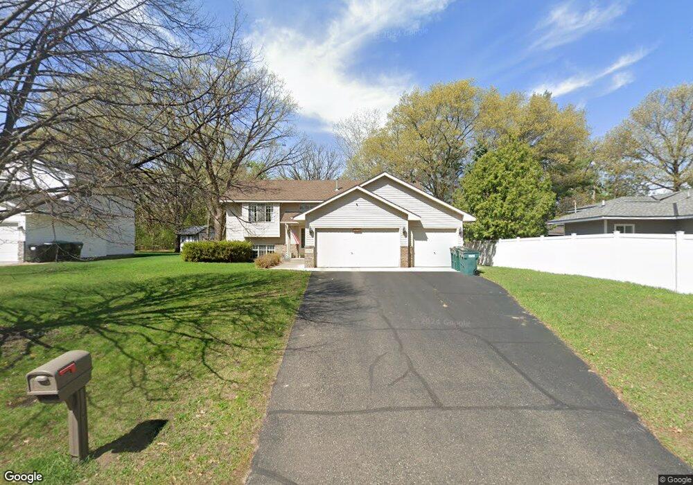
13070 Thrush St NW Coon Rapids, MN 55448
Estimated Value: $384,423 - $397,000
3
Beds
2
Baths
1,138
Sq Ft
$343/Sq Ft
Est. Value
About This Home
This home is located at 13070 Thrush St NW, Coon Rapids, MN 55448 and is currently estimated at $390,856, approximately $343 per square foot. 13070 Thrush St NW is a home located in Anoka County with nearby schools including Lucile Bruner Elementary School, Morris Bye Elementary School, and Laughlin Junior/Senior High School.
Ownership History
Date
Name
Owned For
Owner Type
Purchase Details
Closed on
Jun 28, 2006
Sold by
American Escrow & Closing Co
Bought by
Tummel Bryon J and Tummel Carolyn G
Current Estimated Value
Purchase Details
Closed on
Aug 20, 1999
Sold by
Ley Kevin R and Ley Cynthia S
Bought by
Harren Brian P and Harren Jeanine M
Purchase Details
Closed on
Oct 25, 1996
Sold by
Fenna Construction Inc
Bought by
Ley Kevin R and Ley Cynthia S
Create a Home Valuation Report for This Property
The Home Valuation Report is an in-depth analysis detailing your home's value as well as a comparison with similar homes in the area
Home Values in the Area
Average Home Value in this Area
Purchase History
| Date | Buyer | Sale Price | Title Company |
|---|---|---|---|
| Tummel Bryon J | $255,000 | -- | |
| American Escrow & Closing Co | $255,000 | -- | |
| Harren Brian P | $150,000 | -- | |
| Ley Kevin R | $120,000 | -- |
Source: Public Records
Tax History Compared to Growth
Tax History
| Year | Tax Paid | Tax Assessment Tax Assessment Total Assessment is a certain percentage of the fair market value that is determined by local assessors to be the total taxable value of land and additions on the property. | Land | Improvement |
|---|---|---|---|---|
| 2025 | $3,750 | $344,600 | $90,000 | $254,600 |
| 2024 | $3,750 | $329,600 | $87,000 | $242,600 |
| 2023 | $3,238 | $322,000 | $72,000 | $250,000 |
| 2022 | $2,924 | $331,600 | $72,000 | $259,600 |
| 2021 | $2,831 | $269,400 | $56,000 | $213,400 |
| 2020 | $2,849 | $255,700 | $56,000 | $199,700 |
| 2019 | $2,738 | $247,200 | $56,000 | $191,200 |
| 2018 | $2,555 | $231,900 | $0 | $0 |
| 2017 | $2,388 | $211,700 | $0 | $0 |
| 2016 | $2,419 | $194,500 | $0 | $0 |
| 2015 | $2,359 | $194,500 | $50,000 | $144,500 |
| 2014 | -- | $162,800 | $35,400 | $127,400 |
Source: Public Records
Map
Nearby Homes
- 13416 Swallow St NW
- 13182 Zion St NW
- 12760 Raven St NW
- 2740 132nd Ln NW
- 1930 127th Cir NW
- 13519 Partridge Cir NW
- 2675 128th Ave NW
- 2147 125th Ln NW
- 1776 133rd Ave NW
- 12759 Ibis St NW
- 1687 131st Ln NW
- 2270 137th Ln NW
- 2068 124th Ln NW
- 12554 Grouse St NW
- 1520 129th Ave NW
- 13624 Gladiola St NW
- 12365 Jay St NW
- 1593 126th Ln NW
- 13680 Gladiola St NW
- 13664 Gladiola St NW
- 2316 131st Ave NW
- 2324 131st Ave NW
- 2295 130th Ln NW
- 2290 131st Ave NW
- 2254 131st Ave NW
- 2328 131st Ave NW
- 2349 130th Ln NW
- 2308 130th Ln NW
- 2281 130th Ln NW
- 2292 130th Ln NW
- 2323 131st Ave NW
- 2301 131st Ave NW
- 2286 130th Ln NW
- 2322 130th Ln NW
- 2280 130th Ln NW
- 2329 131st Ave NW
- 2246 131st Ave NW
- 2265 130th Ln NW
- 2259 131st Ave NW
- 2342 131st Ave NW