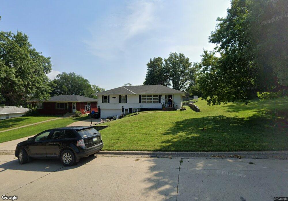
1308 Elm St Atlantic, IA 50022
Estimated Value: $172,000 - $222,000
3
Beds
2
Baths
1,635
Sq Ft
$120/Sq Ft
Est. Value
About This Home
This home is located at 1308 Elm St, Atlantic, IA 50022 and is currently estimated at $195,903, approximately $119 per square foot. 1308 Elm St is a home located in Cass County with nearby schools including Washington Elementary School, Schuler Elementary School, and Atlantic Middle School.
Ownership History
Date
Name
Owned For
Owner Type
Purchase Details
Closed on
Apr 7, 2022
Sold by
Hayes Gwen H
Bought by
Jones Kimberly J and Herman Thomas L
Current Estimated Value
Home Financials for this Owner
Home Financials are based on the most recent Mortgage that was taken out on this home.
Original Mortgage
$4,000
Outstanding Balance
$3,774
Interest Rate
5%
Estimated Equity
$192,129
Create a Home Valuation Report for This Property
The Home Valuation Report is an in-depth analysis detailing your home's value as well as a comparison with similar homes in the area
Home Values in the Area
Average Home Value in this Area
Purchase History
| Date | Buyer | Sale Price | Title Company |
|---|---|---|---|
| Jones Kimberly J | $160,000 | None Listed On Document |
Source: Public Records
Mortgage History
| Date | Status | Borrower | Loan Amount |
|---|---|---|---|
| Open | Jones Kimberly J | $4,000 | |
| Open | Jones Kimberly J | $152,000 |
Source: Public Records
Tax History Compared to Growth
Tax History
| Year | Tax Paid | Tax Assessment Tax Assessment Total Assessment is a certain percentage of the fair market value that is determined by local assessors to be the total taxable value of land and additions on the property. | Land | Improvement |
|---|---|---|---|---|
| 2024 | $2,888 | $160,570 | $12,710 | $147,860 |
| 2023 | $2,724 | $160,570 | $12,710 | $147,860 |
| 2022 | $2,420 | $127,160 | $11,900 | $115,260 |
| 2021 | $2,420 | $127,160 | $11,900 | $115,260 |
| 2020 | $2,316 | $116,680 | $11,900 | $104,780 |
| 2019 | $2,258 | $108,230 | $0 | $0 |
| 2018 | $2,224 | $108,230 | $0 | $0 |
| 2017 | $2,304 | $108,230 | $0 | $0 |
| 2016 | $2,322 | $108,230 | $0 | $0 |
| 2015 | $2,244 | $108,230 | $0 | $0 |
| 2014 | $2,262 | $108,230 | $0 | $0 |
Source: Public Records
Map
Nearby Homes
- 1314 Chestnut St
- 1304 Chestnut St
- 1200 Chestnut St
- 1303 Chestnut St
- 9 Ridge Rd
- 1603 Bryn Mawr Blvd
- 1100 Chestnut St
- 1801 Bryn Mawr Blvd
- 604 Oak St
- 1603 Olive St
- 1806 Sycamore Ave
- 1101 Locust St
- 1006 Locust St
- 906 Locust St
- 1508 Roosevelt Dr
- 611 E 18th St
- 110 W 9th St
- 1104 Birch St
- 605 E 19th St
- 104 E 22nd St
- 202 E 14th St
- 1306 Elm St
- 1309 Maple St
- 1304 Elm St
- 1311 Maple St
- 1307 Maple St
- 1305 Maple St
- 1309 Elm St
- 1302 Elm St
- 1401 Bryn Mawr Blvd
- 1401 Bryn Mawr Dr
- 1305 Elm St
- 1402 Bryn Mawr Dr
- 1402 Bryn Mawr Blvd
- 1303 Maple St
- 1403 Bryn Mawr Blvd
- 1403 Bryn Mawr Dr
- 1303 Elm St
- 1300 Elm St
- 1404 Bryn Mawr Blvd