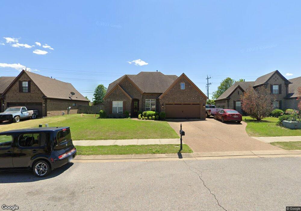
13083 Cades Cove Olive Branch, MS 38654
Center Hill NeighborhoodEstimated Value: $336,000 - $389,000
4
Beds
--
Bath
2,798
Sq Ft
$129/Sq Ft
Est. Value
About This Home
This home is located at 13083 Cades Cove, Olive Branch, MS 38654 and is currently estimated at $361,078, approximately $129 per square foot. 13083 Cades Cove is a home with nearby schools including Overpark Elementary School, Center Hill High School, and Desoto Christian Academy.
Ownership History
Date
Name
Owned For
Owner Type
Purchase Details
Closed on
May 22, 2014
Sold by
Perry Fredrick and Perry Janet
Bought by
Cano Sara and Perry Fredrick
Current Estimated Value
Home Financials for this Owner
Home Financials are based on the most recent Mortgage that was taken out on this home.
Original Mortgage
$198,496
Outstanding Balance
$151,503
Interest Rate
4.37%
Mortgage Type
New Conventional
Estimated Equity
$209,575
Purchase Details
Closed on
Jan 17, 2014
Sold by
Oakhurst Development Inc
Bought by
Westin Homes Llc
Home Financials for this Owner
Home Financials are based on the most recent Mortgage that was taken out on this home.
Original Mortgage
$201,600
Interest Rate
4.44%
Mortgage Type
New Conventional
Create a Home Valuation Report for This Property
The Home Valuation Report is an in-depth analysis detailing your home's value as well as a comparison with similar homes in the area
Home Values in the Area
Average Home Value in this Area
Purchase History
| Date | Buyer | Sale Price | Title Company |
|---|---|---|---|
| Cano Sara | -- | None Available | |
| Perry Fredrick | -- | None Available | |
| Westin Homes Llc | -- | None Available |
Source: Public Records
Mortgage History
| Date | Status | Borrower | Loan Amount |
|---|---|---|---|
| Open | Perry Fredrick | $198,496 | |
| Previous Owner | Westin Homes Llc | $201,600 |
Source: Public Records
Tax History Compared to Growth
Tax History
| Year | Tax Paid | Tax Assessment Tax Assessment Total Assessment is a certain percentage of the fair market value that is determined by local assessors to be the total taxable value of land and additions on the property. | Land | Improvement |
|---|---|---|---|---|
| 2024 | $1,558 | $18,915 | $3,500 | $15,415 |
| 2023 | $1,558 | $18,915 | $0 | $0 |
| 2022 | $1,558 | $18,915 | $3,500 | $15,415 |
| 2021 | $1,558 | $18,915 | $3,500 | $15,415 |
| 2020 | $1,141 | $18,915 | $3,500 | $15,415 |
| 2019 | $1,141 | $18,915 | $3,500 | $15,415 |
| 2017 | $1,116 | $33,662 | $18,581 | $15,081 |
| 2016 | $1,116 | $18,581 | $3,500 | $15,081 |
| 2015 | $1,871 | $33,662 | $18,581 | $15,081 |
| 2014 | $1,564 | $3,938 | $0 | $0 |
| 2013 | $397 | $3,938 | $0 | $0 |
Source: Public Records
Map
Nearby Homes
- 13185 Cades Ln
- 6719 Red Hawk Cove
- 7338 Hunters Horn Dr
- 7350 Hunters Horn Dr
- 7375 Fox Creek Dr
- 7397 Hunters Horn Dr
- 13043 Oxbourne N
- 13881 Goodman Rd
- 7251 Eastern Dr
- 7247 Eastern Rd
- 13850 Wesley Banks Blvd
- 13825 Molly Madeline Ln
- 6610 John Hamilton Way E
- 7015 Stanley Dr
- 6535 Beckett Ln
- 13965 Blvd
- 13827 Jack Thomas Blvd
- 13981 Wesley Banks Blvd
- 6520 Beckett Ln
- 6478 Beckett Ln
- 13103 Cades Cove
- 13073 Cades Cove
- 13063 Cades Cove
- 13098 Cades Cove Unit 103
- 13098 Cades Cove
- 13080 Cades Cove
- 13129 Cades Ln
- 13060 Cades Cove
- 13014 Goodman Rd
- 7054 Whittier Dr
- 13145 Cades Ln
- 7078 Whittier Dr
- 13077 Mingus Ln
- 13095 Mingus Ln
- 13063 Mingus Ln
- 13051 Mingus Ln
- 7053 Carriebrook Dr
- 13021 Mingus Ln
- 13082 Sandbourne N