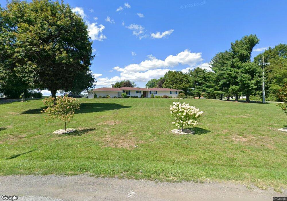
1309 Dolsontown Rd Middletown, NY 10940
Estimated Value: $474,000 - $665,000
5
Beds
3
Baths
2,282
Sq Ft
$253/Sq Ft
Est. Value
About This Home
This home is located at 1309 Dolsontown Rd, Middletown, NY 10940 and is currently estimated at $577,284, approximately $252 per square foot. 1309 Dolsontown Rd is a home located in Orange County with nearby schools including Middletown Twin Towers Middle School, Monhagen Middle School, and Middletown High School.
Ownership History
Date
Name
Owned For
Owner Type
Purchase Details
Closed on
Aug 13, 2014
Sold by
Singh Jarnail
Bought by
Bassi Surjeet
Current Estimated Value
Home Financials for this Owner
Home Financials are based on the most recent Mortgage that was taken out on this home.
Original Mortgage
$100,000
Interest Rate
4.14%
Purchase Details
Closed on
Aug 5, 2005
Sold by
Zara Harvey David
Bought by
Singh Jarnail
Create a Home Valuation Report for This Property
The Home Valuation Report is an in-depth analysis detailing your home's value as well as a comparison with similar homes in the area
Home Values in the Area
Average Home Value in this Area
Purchase History
| Date | Buyer | Sale Price | Title Company |
|---|---|---|---|
| Bassi Surjeet | $264,825 | Christopher Smith | |
| Singh Jarnail | $397,500 | Richard N Lentino |
Source: Public Records
Mortgage History
| Date | Status | Borrower | Loan Amount |
|---|---|---|---|
| Closed | Bassi Surjeet | $100,000 |
Source: Public Records
Tax History Compared to Growth
Tax History
| Year | Tax Paid | Tax Assessment Tax Assessment Total Assessment is a certain percentage of the fair market value that is determined by local assessors to be the total taxable value of land and additions on the property. | Land | Improvement |
|---|---|---|---|---|
| 2024 | $9,470 | $60,900 | $14,800 | $46,100 |
| 2023 | $9,470 | $60,900 | $14,800 | $46,100 |
| 2022 | $9,713 | $60,900 | $14,800 | $46,100 |
| 2021 | $10,310 | $60,900 | $14,800 | $46,100 |
| 2020 | $3,058 | $60,900 | $14,800 | $46,100 |
| 2019 | $6,496 | $60,900 | $14,800 | $46,100 |
| 2018 | $9,501 | $60,900 | $14,800 | $46,100 |
| 2017 | $9,537 | $60,900 | $14,800 | $46,100 |
| 2016 | $9,061 | $60,900 | $14,800 | $46,100 |
| 2015 | -- | $60,900 | $14,800 | $46,100 |
| 2014 | -- | $60,900 | $14,800 | $46,100 |
Source: Public Records
Map
Nearby Homes
- 20 Atwood Dr
- 0 Airport Rd Unit ONEH6195533
- 4 Langton Mews Unit 7
- 3 Allan Park Mews
- 6 Perrins Mews
- 1 Chancery Mews
- 5 Raleigh Close Unit 3
- 2 Danielle Ct
- 318 Ruth Ct
- 8 Ebury Mews
- 49 Ruth Ct
- 19-21 Wilson St
- 147 Ruth Ct
- 215 Ruth Ct
- 30 Wilson St
- 38 Wilson St
- 82 Houston Ave
- 96 Belmont Ave
- 214 Phillips St
- 25 Lafayette Ave
- 295 Genung St
- 1303 Dolsontown Rd
- 0 Schutt & Avenue F Rd Unit H4747935
- 0 Schutt & Avenue F Rd Unit H4908841
- 0 Schutt & Avenue F Rd Unit 4909189
- 0 Schutt & Avenue F Rd Unit 4917664
- 0 Schutt & Avenue F Rd
- 1308 Dolsontown Rd
- 316 Genung St
- 306 Genung St
- 330 Genung St
- 14 Airport Rd
- 280 Genung St
- 35 Lindentree Ln
- 39 Lindentree Ln
- 33 Lindentree Ln
- 41 Lindentree Ln
- 29 Lindentree Ln
- 43 Lindentree Ln
- 27 Lindentree Ln