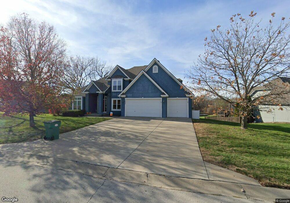
13090 Woodridge St Platte City, MO 64079
Estimated Value: $526,128 - $597,000
4
Beds
4
Baths
2,705
Sq Ft
$210/Sq Ft
Est. Value
About This Home
This home is located at 13090 Woodridge St, Platte City, MO 64079 and is currently estimated at $567,782, approximately $209 per square foot. 13090 Woodridge St is a home located in Platte County with nearby schools including Platte County High School.
Ownership History
Date
Name
Owned For
Owner Type
Purchase Details
Closed on
Jul 14, 2021
Sold by
Coon Richard E and Coon Jane A
Bought by
Coon Richard E and Coon Jane A
Current Estimated Value
Purchase Details
Closed on
Feb 16, 2009
Sold by
Toner Jack W and Toner Victoria M
Bought by
Coon Richard E and Coon Jane A
Home Financials for this Owner
Home Financials are based on the most recent Mortgage that was taken out on this home.
Original Mortgage
$290,000
Outstanding Balance
$181,444
Interest Rate
4.91%
Mortgage Type
VA
Estimated Equity
$386,338
Create a Home Valuation Report for This Property
The Home Valuation Report is an in-depth analysis detailing your home's value as well as a comparison with similar homes in the area
Home Values in the Area
Average Home Value in this Area
Purchase History
| Date | Buyer | Sale Price | Title Company |
|---|---|---|---|
| Coon Richard E | -- | None Available | |
| Coon Richard E | -- | -- |
Source: Public Records
Mortgage History
| Date | Status | Borrower | Loan Amount |
|---|---|---|---|
| Open | Coon Richard E | $290,000 |
Source: Public Records
Tax History Compared to Growth
Tax History
| Year | Tax Paid | Tax Assessment Tax Assessment Total Assessment is a certain percentage of the fair market value that is determined by local assessors to be the total taxable value of land and additions on the property. | Land | Improvement |
|---|---|---|---|---|
| 2024 | $5,289 | $79,519 | $12,542 | $66,977 |
| 2023 | $5,289 | $79,519 | $12,542 | $66,977 |
| 2022 | $5,040 | $75,089 | $12,542 | $62,547 |
| 2021 | $5,054 | $75,089 | $12,542 | $62,547 |
| 2020 | $4,879 | $71,657 | $12,084 | $59,573 |
| 2019 | $4,879 | $71,657 | $12,084 | $59,573 |
| 2018 | $4,512 | $65,729 | $12,350 | $53,379 |
| 2017 | $4,489 | $65,729 | $12,350 | $53,379 |
| 2016 | $4,452 | $65,729 | $12,350 | $53,379 |
| 2015 | $4,450 | $65,729 | $12,350 | $53,379 |
| 2013 | $3,418 | $55,100 | $0 | $0 |
Source: Public Records
Map
Nearby Homes
- 13060 Woodridge St
- 13180 Woodridge St
- 13420 Timber Park Dr
- 15870 NW 126th Terrace
- 15565 NW 127th St
- 15440 NW 127th St
- 13360 Ridgeview Dr
- 12530 NW Riley Ct
- 13657 Oak Valley Dr
- 17120 NW 133rd St
- The York Plan at Seven Bridges
- The Wyndham V Plan at Seven Bridges
- The Wydnham II Plan at Seven Bridges
- The Timberland Reverse Plan at Seven Bridges
- The Timberland Expanded Plan at Seven Bridges
- The Landon Plan at Seven Bridges
- The Tatum Plan at Seven Bridges
- The Sierra V Plan at Seven Bridges
- The Mackenzie Expanded Plan at Seven Bridges
- The Oakwood Plan at Seven Bridges
- 13080 Woodridge St
- 13100 Woodridge St
- 13110 Woodridge St
- 13070 Woodridge St
- 13095 Woodridge St
- 16185 NW 130th Cir
- 13120 Woodridge St
- 15970 NW 131st Ct
- 16205 NW 130th Cir
- 15975 NW 131st Ct
- 0 NW 131st Ct
- 13130 Woodridge St
- 13085 Woodridge St
- 15960 NW 131st Ct
- 16180 NW 130th Cir
- 13075 Woodridge St
- 13115 Woodridge St
- 13050 Woodridge St
- 13055 Woodridge
- 15965 NW 131st Ct