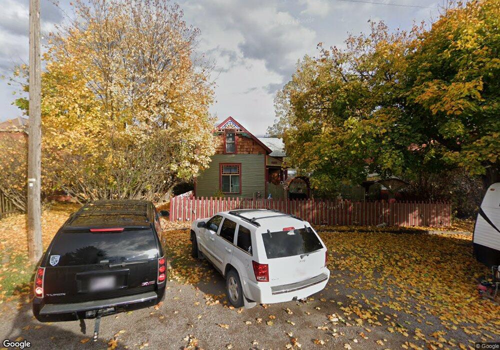
131 1st Ave W Columbia Falls, MT 59912
Estimated Value: $400,819 - $453,000
3
Beds
1
Bath
1,157
Sq Ft
$369/Sq Ft
Est. Value
About This Home
This home is located at 131 1st Ave W, Columbia Falls, MT 59912 and is currently estimated at $427,273, approximately $369 per square foot. 131 1st Ave W is a home located in Flathead County with nearby schools including Glacier Gateway Elementary School, Columbia Falls Junior High School (7-8), and Columbia Falls High School.
Ownership History
Date
Name
Owned For
Owner Type
Purchase Details
Closed on
Feb 13, 2019
Sold by
Mccumbers Lila Fae and Mccumbers Lila F
Bought by
Harris Cynthia E and Harris Steven D
Current Estimated Value
Home Financials for this Owner
Home Financials are based on the most recent Mortgage that was taken out on this home.
Original Mortgage
$80,000
Outstanding Balance
$70,334
Interest Rate
4.5%
Mortgage Type
Commercial
Estimated Equity
$356,939
Create a Home Valuation Report for This Property
The Home Valuation Report is an in-depth analysis detailing your home's value as well as a comparison with similar homes in the area
Home Values in the Area
Average Home Value in this Area
Purchase History
| Date | Buyer | Sale Price | Title Company |
|---|---|---|---|
| Harris Cynthia E | -- | Insured Titles |
Source: Public Records
Mortgage History
| Date | Status | Borrower | Loan Amount |
|---|---|---|---|
| Open | Harris Cynthia E | $80,000 |
Source: Public Records
Tax History Compared to Growth
Tax History
| Year | Tax Paid | Tax Assessment Tax Assessment Total Assessment is a certain percentage of the fair market value that is determined by local assessors to be the total taxable value of land and additions on the property. | Land | Improvement |
|---|---|---|---|---|
| 2025 | $1,818 | $414,600 | $0 | $0 |
| 2024 | $2,369 | $336,400 | $0 | $0 |
| 2023 | $2,463 | $336,400 | $0 | $0 |
| 2022 | $1,500 | $137,850 | $0 | $0 |
| 2021 | $1,526 | $137,850 | $0 | $0 |
| 2020 | $1,214 | $97,225 | $0 | $0 |
| 2019 | $1,675 | $146,600 | $0 | $0 |
| 2018 | $1,505 | $125,200 | $0 | $0 |
| 2017 | $1,457 | $125,200 | $0 | $0 |
| 2016 | $1,257 | $104,600 | $0 | $0 |
| 2015 | $1,248 | $104,600 | $0 | $0 |
| 2014 | $1,335 | $67,999 | $0 | $0 |
Source: Public Records
Map
Nearby Homes
- 221 2nd Ave W
- 324 1st Ave E
- 540 Nucleus Ave Unit 304
- 540 Nucleus Ave Unit 306
- 519 Nucleus Ave Unit Suite 303
- 307 5th St E
- 409 1st Street East N
- 812 4th Ave E
- 12 Mitchell Way
- 1020 3rd Ave E
- 2225 Tamarack Ln
- 875 River Ave
- 929 9th St W
- 830 11th St W
- 9 Cedar Pointe Loop
- 450 Highway 2 E
- 659 Us Highway 2 E
- 1605 & 1629 4th Ave W
- 521 Evening Star Ln
- 1201 14th Ave W
- 121 1st Ave W
- 29 2nd St W
- 105 1st Ave W
- 140 Nucleus Ave
- 120 1st Ave W
- 201 1st Ave W
- 110 Nucleus Ave
- 116 1st Ave W
- 211 1st Ave W
- 204 Nucleus Ave
- 106 1st Ave W
- 214 Nucleus Ave
- 204,214,NHN Nucleus Ave
- 225 1st Ave W
- 212 1st Ave W
- 155 1st Ave W
- 161 Sandy Ct Unit B
- 175 Tierhaven Ln
- 171 Tierhaven Ln
- 163 Tierhaven Ln