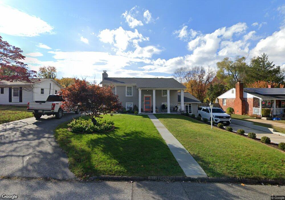
131 Brent Rd Arnold, MD 21012
Estimated Value: $446,238 - $497,000
Studio
2
Baths
1,232
Sq Ft
$376/Sq Ft
Est. Value
About This Home
This home is located at 131 Brent Rd, Arnold, MD 21012 and is currently estimated at $463,810, approximately $376 per square foot. 131 Brent Rd is a home located in Anne Arundel County with nearby schools including Belvedere Elementary School, Severn River Middle School, and Broadneck High School.
Ownership History
Date
Name
Owned For
Owner Type
Purchase Details
Closed on
Feb 10, 2014
Sold by
Seborowski Dorothy L and Seborowski Richard Alan
Bought by
Burns Ian and Davis Michelle
Current Estimated Value
Home Financials for this Owner
Home Financials are based on the most recent Mortgage that was taken out on this home.
Original Mortgage
$205,763
Outstanding Balance
$154,964
Interest Rate
4.25%
Mortgage Type
FHA
Estimated Equity
$308,846
Purchase Details
Closed on
Jun 22, 2011
Sold by
Seborowski Dorothy L
Bought by
Seborowski Dorothy L and Seborowski Richard Alan
Create a Home Valuation Report for This Property
The Home Valuation Report is an in-depth analysis detailing your home's value as well as a comparison with similar homes in the area
Home Values in the Area
Average Home Value in this Area
Purchase History
| Date | Buyer | Sale Price | Title Company |
|---|---|---|---|
| Burns Ian | $218,000 | Title Rite Services Inc | |
| Seborowski Dorothy L | -- | None Available |
Source: Public Records
Mortgage History
| Date | Status | Borrower | Loan Amount |
|---|---|---|---|
| Open | Burns Ian | $205,763 |
Source: Public Records
Tax History
| Year | Tax Paid | Tax Assessment Tax Assessment Total Assessment is a certain percentage of the fair market value that is determined by local assessors to be the total taxable value of land and additions on the property. | Land | Improvement |
|---|---|---|---|---|
| 2025 | $4,426 | $368,167 | -- | -- |
| 2024 | $4,426 | $345,000 | $241,700 | $103,300 |
| 2023 | $4,291 | $338,533 | $0 | $0 |
| 2022 | $3,999 | $332,067 | $0 | $0 |
| 2020 | $3,751 | $317,167 | $0 | $0 |
| 2019 | $3,660 | $308,733 | $0 | $0 |
| 2018 | $3,045 | $300,300 | $191,300 | $109,000 |
| 2017 | $3,370 | $287,300 | $0 | $0 |
| 2016 | -- | $274,300 | $0 | $0 |
| 2015 | -- | $261,300 | $0 | $0 |
| 2014 | -- | $261,300 | $0 | $0 |
Source: Public Records
Map
Nearby Homes
- 401 Stewart Ave
- 243 and 245 Haverton Rd
- 797 David Dr
- 785 Macsherry Dr
- 201 Mill Ct
- 127 Cresston Rd
- 93 Jones Station Rd
- 404 Alameda Pkwy
- 1078 Brightleaf Ct
- 394 Kings College Dr
- 360 Magothy Rd Unit 8H
- 360 Magothy Rd Unit 5A
- 360 Magothy Rd Unit 4I
- 360 Magothy Rd Unit L2
- 360 Magothy Rd Unit 11K
- 360 Magothy Rd Unit 14H
- 360 Magothy Rd Unit 27J
- 360 Magothy Rd Unit 6I
- 360 Magothy Rd Unit 13C
- 360 Magothy Rd Unit 6B
Your Personal Tour Guide
Ask me questions while you tour the home.