Estimated Value: $311,000 - $319,000
3
Beds
1
Bath
863
Sq Ft
$365/Sq Ft
Est. Value
About This Home
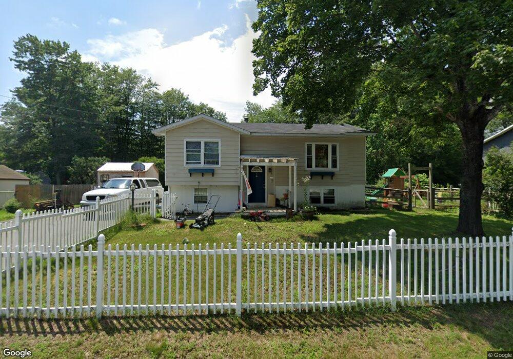
This home is located at 131 Butternut Dr, Keene, NH 03431 and is currently estimated at $315,241, approximately $365 per square foot. 131 Butternut Dr is a home with nearby schools including Fuller Elementary School, Keene High School, and Gathering Waters Charter School (H).
Ownership History
Date
Name
Owned For
Owner Type
Purchase Details
Closed on
Apr 28, 2016
Sold by
Forrest Kevin M and Goldthwaite Dawn B
Bought by
Rowe Travis
Current Estimated Value
Home Financials for this Owner
Home Financials are based on the most recent Mortgage that was taken out on this home.
Original Mortgage
$137,484
Outstanding Balance
$109,696
Interest Rate
3.73%
Mortgage Type
FHA
Estimated Equity
$205,545
Purchase Details
Closed on
Oct 15, 2004
Sold by
Forrest Jodi L
Bought by
Forrest Kevin M
Home Financials for this Owner
Home Financials are based on the most recent Mortgage that was taken out on this home.
Original Mortgage
$127,100
Interest Rate
5.8%
Mortgage Type
Purchase Money Mortgage
Purchase Details
Closed on
May 29, 1998
Sold by
Teitelman Paul and Teitelman Lisa G
Bought by
Forrest Kevin M and Forrest Jodi L
Home Financials for this Owner
Home Financials are based on the most recent Mortgage that was taken out on this home.
Original Mortgage
$46,800
Interest Rate
7.12%
Create a Home Valuation Report for This Property
The Home Valuation Report is an in-depth analysis detailing your home's value as well as a comparison with similar homes in the area
Purchase History
| Date | Buyer | Sale Price | Title Company |
|---|---|---|---|
| Rowe Travis | $140,000 | -- | |
| Forrest Kevin M | $131,100 | -- | |
| Forrest Kevin M | $72,000 | -- |
Source: Public Records
Mortgage History
| Date | Status | Borrower | Loan Amount |
|---|---|---|---|
| Open | Rowe Travis | $137,484 | |
| Previous Owner | Forrest Kevin M | $127,100 | |
| Previous Owner | Forrest Kevin M | $46,800 |
Source: Public Records
Tax History
| Year | Tax Paid | Tax Assessment Tax Assessment Total Assessment is a certain percentage of the fair market value that is determined by local assessors to be the total taxable value of land and additions on the property. | Land | Improvement |
|---|---|---|---|---|
| 2024 | $5,480 | $165,700 | $47,200 | $118,500 |
| 2023 | $5,176 | $162,300 | $47,200 | $115,100 |
| 2022 | $5,036 | $162,300 | $47,200 | $115,100 |
| 2021 | $5,077 | $162,300 | $47,200 | $115,100 |
| 2020 | $5,249 | $140,800 | $55,300 | $85,500 |
| 2019 | $5,294 | $140,800 | $55,300 | $85,500 |
| 2018 | $5,226 | $140,800 | $55,300 | $85,500 |
| 2017 | $5,241 | $140,800 | $55,300 | $85,500 |
| 2016 | $5,124 | $140,800 | $55,300 | $85,500 |
| 2015 | $5,045 | $146,600 | $62,200 | $84,400 |
Source: Public Records
Map
Nearby Homes
- 127 Butternut Dr
- 181 Liberty Ln
- 130 Butternut Dr
- 126 Butternut Dr
- 69 Butternut Dr
- 123 Butternut Dr
- 65 Butternut Dr
- 185 Liberty Ln
- 122 Butternut Dr
- 73 Butternut Dr
- 119 Butternut Dr
- 182 Liberty Ln
- 171 Liberty Ln
- 77 Butternut Dr
- 176 Liberty Ln
- 172 Liberty Ln
- 68 Butternut Dr
- 81 Butternut Dr
- 64 Butternut Dr
- 167 Liberty Ln
Your Personal Tour Guide
Ask me questions while you tour the home.