Estimated Value: $193,000 - $217,000
3
Beds
2
Baths
1,385
Sq Ft
$150/Sq Ft
Est. Value
About This Home
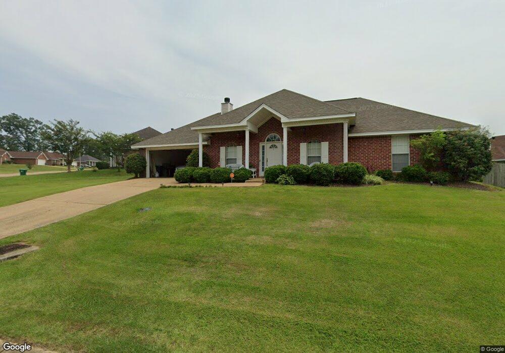
This home is located at 131 Carl Cir, Byram, MS 39272 and is currently estimated at $207,726, approximately $149 per square foot. 131 Carl Cir is a home located in Hinds County with nearby schools including Gary Road Elementary School, Gary Road Intermediate School, and Byram Middle School.
Ownership History
Date
Name
Owned For
Owner Type
Purchase Details
Closed on
Oct 21, 2011
Sold by
Whitetail Realty Llc
Bought by
Stahl Ann M
Current Estimated Value
Home Financials for this Owner
Home Financials are based on the most recent Mortgage that was taken out on this home.
Original Mortgage
$111,295
Outstanding Balance
$76,127
Interest Rate
4.16%
Mortgage Type
New Conventional
Estimated Equity
$131,599
Create a Home Valuation Report for This Property
The Home Valuation Report is an in-depth analysis detailing your home's value as well as a comparison with similar homes in the area
Home Values in the Area
Average Home Value in this Area
Purchase History
| Date | Buyer | Sale Price | Title Company |
|---|---|---|---|
| Stahl Ann M | -- | -- | |
| Stahl Ann M | -- | -- |
Source: Public Records
Mortgage History
| Date | Status | Borrower | Loan Amount |
|---|---|---|---|
| Open | Stahl Ann M | $111,295 | |
| Closed | Stahl Ann M | $111,295 |
Source: Public Records
Tax History Compared to Growth
Tax History
| Year | Tax Paid | Tax Assessment Tax Assessment Total Assessment is a certain percentage of the fair market value that is determined by local assessors to be the total taxable value of land and additions on the property. | Land | Improvement |
|---|---|---|---|---|
| 2025 | $1,430 | $11,059 | $2,500 | $8,559 |
| 2024 | $1,430 | $11,059 | $2,500 | $8,559 |
| 2023 | $1,430 | $11,059 | $2,500 | $8,559 |
| 2022 | $1,701 | $11,059 | $2,500 | $8,559 |
| 2021 | $1,379 | $11,059 | $2,500 | $8,559 |
| 2020 | $1,334 | $10,903 | $2,500 | $8,403 |
| 2019 | $1,326 | $10,903 | $2,500 | $8,403 |
| 2018 | $1,326 | $10,903 | $2,500 | $8,403 |
| 2017 | $1,296 | $10,903 | $2,500 | $8,403 |
| 2016 | $1,296 | $10,903 | $2,500 | $8,403 |
| 2015 | $1,276 | $10,770 | $2,500 | $8,270 |
| 2014 | $1,254 | $10,770 | $2,500 | $8,270 |
Source: Public Records
Map
Nearby Homes
- 104 Lucas Ct
- 109 Lucas Ct
- Cali Plan at Cedars of Byram Estates
- Aria Plan at Cedars of Byram Estates
- 344 Brannan Ave
- 469 Fairway Ave
- 213 Longfellow Cove
- 8834 Gary Rd
- 0 Terry Rd Unit 21325508
- 0 Terry Rd Unit 24270230
- 0 Terry Rd Unit 4130083
- 804 Fairway Ave
- 800 Fairway Ave
- 173 Winchester St
- 608 Carson Dr
- 699 Meadow Ln
- 1213 Lake Shore Dr
- 909 Eagles Nest Dr
- 880 Redwood Cove
- 521 Reel St
- 127 Carol Ave
- 127 Carl Cir
- 324 Martha Dr
- 320 Martha Dr
- 144 Carl Cir
- 316 Martha Dr
- 148 Carl Cir
- 140 Carl Cir
- 123 Carl Cir
- 0 Anthony Cove Unit Lot 13 1168003
- 0 Anthony Cove Unit Lot 14
- 152 Carl Cir
- 0 Carl Cir Unit Lot 5 1160655
- 0 Carl Cir Unit Lot 30 1160660
- 0 Carl Cir Unit Lot 7 1162224
- 0 Carl Cir Unit Lot 33 1164583
- 0 Carl Cir Unit Lot 28 1166855
- 0 Carl Cir Unit Lot 22 1171119
- 0 Carl Cir Unit Lot 19 1166865
- 0 Carl Cir Unit Lot 26 1168008