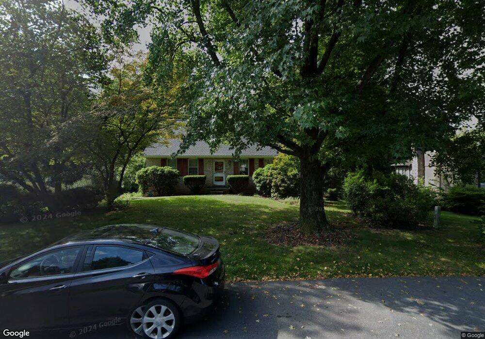
131 Carol Dr Washington Boro, PA 17582
Manor Township NeighborhoodEstimated Value: $351,000 - $407,000
4
Beds
3
Baths
1,768
Sq Ft
$215/Sq Ft
Est. Value
About This Home
This home is located at 131 Carol Dr, Washington Boro, PA 17582 and is currently estimated at $380,026, approximately $214 per square foot. 131 Carol Dr is a home located in Lancaster County with nearby schools including Letort Elementary School, Manor Middle School, and Penn Manor High School.
Ownership History
Date
Name
Owned For
Owner Type
Purchase Details
Closed on
Aug 15, 2023
Sold by
Texter David P and Texter Jean M
Bought by
Texter Philip A
Current Estimated Value
Home Financials for this Owner
Home Financials are based on the most recent Mortgage that was taken out on this home.
Original Mortgage
$224,000
Outstanding Balance
$218,896
Interest Rate
6.81%
Mortgage Type
New Conventional
Estimated Equity
$161,130
Create a Home Valuation Report for This Property
The Home Valuation Report is an in-depth analysis detailing your home's value as well as a comparison with similar homes in the area
Home Values in the Area
Average Home Value in this Area
Purchase History
| Date | Buyer | Sale Price | Title Company |
|---|---|---|---|
| Texter Philip A | $280,000 | None Listed On Document |
Source: Public Records
Mortgage History
| Date | Status | Borrower | Loan Amount |
|---|---|---|---|
| Open | Texter Philip A | $224,000 |
Source: Public Records
Tax History Compared to Growth
Tax History
| Year | Tax Paid | Tax Assessment Tax Assessment Total Assessment is a certain percentage of the fair market value that is determined by local assessors to be the total taxable value of land and additions on the property. | Land | Improvement |
|---|---|---|---|---|
| 2025 | $4,695 | $215,000 | $74,600 | $140,400 |
| 2024 | $4,695 | $215,000 | $74,600 | $140,400 |
| 2023 | $4,695 | $215,000 | $74,600 | $140,400 |
| 2022 | $4,606 | $215,000 | $74,600 | $140,400 |
| 2021 | $4,489 | $215,000 | $74,600 | $140,400 |
| 2020 | $4,489 | $215,000 | $74,600 | $140,400 |
| 2019 | $4,365 | $215,000 | $74,600 | $140,400 |
| 2018 | $3,406 | $215,000 | $74,600 | $140,400 |
| 2017 | $3,671 | $151,300 | $39,600 | $111,700 |
| 2016 | $3,671 | $151,300 | $39,600 | $111,700 |
| 2015 | $756 | $151,300 | $39,600 | $111,700 |
| 2014 | $2,546 | $151,300 | $39,600 | $111,700 |
Source: Public Records
Map
Nearby Homes
- 3016 Miller Rd
- 133 Bender Mill Rd
- 249 Letort Rd
- 12 Knollwood Rd
- 1016 Keystone Dr
- 1046 Letort Rd
- 1027 Keystone Dr
- 53 Knollwood Rd
- 204 Scarborough Ln
- 140 Knollwood Rd
- 340 Knollwood Rd
- 32 S Duke St
- 31 S Duke St
- 18 Laurelgate Place
- 134 Elizabeth St
- Sloane II Plan at Wynfield at Millersville
- Colton II Plan at Wynfield at Millersville
- 102 Village Dr
- Adalee Plan at Wynfield at Millersville
- 105 Village Dr
- 133 Carol Dr
- 129 Carol Dr
- 102 Spring Meadow Ln
- 1275 Central Manor Rd
- 135 Carol Dr
- 104 Spring Meadow Ln
- 132 Carol Dr
- 100 Spring Meadow Ln
- 130 Carol Dr
- 137 Carol Dr
- 136 Carol Dr
- 101 Catalpa Ln
- 100 Catalpa Ln
- 124 Carol Dr
- 123 Carol Dr
- 1303 Central Manor Rd
- 139 Carol Dr
- 140 Carol Dr
- 103 Catalpa Ln
- 102 Catalpa Ln