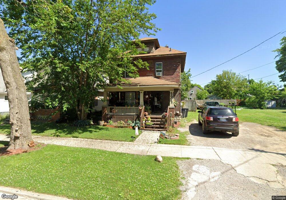
131 E Tobias St Flint, MI 48503
Southside Business District NeighborhoodEstimated Value: $40,000 - $84,000
3
Beds
1
Bath
1,468
Sq Ft
$42/Sq Ft
Est. Value
About This Home
This home is located at 131 E Tobias St, Flint, MI 48503 and is currently estimated at $62,303, approximately $42 per square foot. 131 E Tobias St is a home located in Genesee County with nearby schools including Freeman Elementary School, Flint Southwestern Classical Academy, and International Academy of Flint (K-12).
Ownership History
Date
Name
Owned For
Owner Type
Purchase Details
Closed on
May 27, 2022
Sold by
Frederick Scherret Alfred
Bought by
Mccaskill Calvin and Mccaskill Tiffany
Current Estimated Value
Purchase Details
Closed on
Jun 9, 2017
Sold by
Peto Peto Joseph Joseph and Peto James Edward
Bought by
Shcerret Alfred F
Purchase Details
Closed on
Feb 14, 2008
Sold by
Bossman Investments Inc
Bought by
Peto James E and Scherret Alfred Frederick
Create a Home Valuation Report for This Property
The Home Valuation Report is an in-depth analysis detailing your home's value as well as a comparison with similar homes in the area
Home Values in the Area
Average Home Value in this Area
Purchase History
| Date | Buyer | Sale Price | Title Company |
|---|---|---|---|
| Mccaskill Calvin | $20,000 | -- | |
| Shcerret Alfred F | -- | None Available | |
| Peto James E | $1,500 | None Available |
Source: Public Records
Tax History Compared to Growth
Tax History
| Year | Tax Paid | Tax Assessment Tax Assessment Total Assessment is a certain percentage of the fair market value that is determined by local assessors to be the total taxable value of land and additions on the property. | Land | Improvement |
|---|---|---|---|---|
| 2025 | $1,099 | $17,000 | $0 | $0 |
| 2024 | $991 | $17,000 | $0 | $0 |
| 2023 | $972 | $14,900 | $0 | $0 |
| 2022 | $0 | $10,600 | $0 | $0 |
| 2021 | $741 | $7,900 | $0 | $0 |
| 2020 | $690 | $10,000 | $0 | $0 |
| 2019 | $680 | $9,400 | $0 | $0 |
| 2018 | $652 | $9,200 | $0 | $0 |
| 2017 | $434 | $0 | $0 | $0 |
| 2016 | $432 | $0 | $0 | $0 |
| 2015 | -- | $0 | $0 | $0 |
| 2014 | -- | $0 | $0 | $0 |
| 2012 | -- | $4,100 | $0 | $0 |
Source: Public Records
Map
Nearby Homes
- 133 E Oakley St
- 213 E Lakeview Ave
- 2121 Dwight Ave
- 2224 Crocker Ave
- 2050 Ferris Ave
- 115 E Livingston Dr
- 2221 Howard Ave
- 420 Pingree Ave
- 618 Barrie Ave
- 639 Monroe St
- 647 Monroe St
- 517 Morley Ave
- 657 Barrie Ave
- 3214 S Grand Traverse St
- 615 Freeman Ave
- 2010 Crocker Ave
- 619 Freeman Ave
- 734 Barrie Ave
- 741 Barrie Ave
- 2029 Aitken Ave