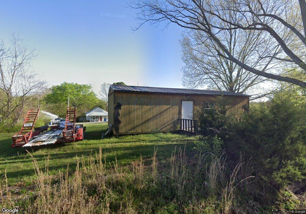
131 E Walnut St Camden, TN 38320
Estimated Value: $35,881 - $192,000
Studio
1
Bath
--
Sq Ft
11,761
Sq Ft Lot
About This Home
This home is located at 131 E Walnut St, Camden, TN 38320 and is currently estimated at $101,960. 131 E Walnut St is a home located in Benton County with nearby schools including Camden Elementary School, Briarwood School, and Camden Junior High School.
Ownership History
Date
Name
Owned For
Owner Type
Purchase Details
Closed on
May 20, 2021
Sold by
Sosnowski Girard P
Bought by
Garcia Sergio and Espinoza Maria
Current Estimated Value
Purchase Details
Closed on
Oct 12, 2018
Sold by
Curtis Matt
Bought by
Sosnowski Giraro P
Purchase Details
Closed on
Jun 11, 2015
Sold by
Benton County Tennessee
Bought by
Curtis Matt and Curtis Sandy
Purchase Details
Closed on
Dec 19, 1999
Bought by
Lawson Jeffery C and Lawson Jean
Purchase Details
Closed on
Mar 8, 1993
Bought by
Berry Edna Corbitt
Purchase Details
Closed on
Feb 8, 1991
Bought by
Greer James Brian and Ruth Denise Gre
Purchase Details
Closed on
Jun 19, 1990
Bought by
Corbitt Edna L
Purchase Details
Closed on
Oct 17, 1978
Bought by
Quinn Oscar R and Mary Ethel
Create a Home Valuation Report for This Property
The Home Valuation Report is an in-depth analysis detailing your home's value as well as a comparison with similar homes in the area
Home Values in the Area
Average Home Value in this Area
Purchase History
| Date | Buyer | Sale Price | Title Company |
|---|---|---|---|
| Garcia Sergio | $7,500 | None Available | |
| Sosnowski Giraro P | $3,500 | -- | |
| Curtis Matt | $2,924 | -- | |
| Lawson Jeffery C | $17,500 | -- | |
| Berry Edna Corbitt | $10,000 | -- | |
| Greer James Brian | $15,000 | -- | |
| Corbitt Edna L | $13,000 | -- | |
| Quinn Oscar R | -- | -- |
Source: Public Records
Tax History
| Year | Tax Paid | Tax Assessment Tax Assessment Total Assessment is a certain percentage of the fair market value that is determined by local assessors to be the total taxable value of land and additions on the property. | Land | Improvement |
|---|---|---|---|---|
| 2025 | $122 | $5,225 | $2,625 | $2,600 |
| 2024 | $134 | $3,650 | $1,500 | $2,150 |
| 2023 | $134 | $3,650 | $1,500 | $2,150 |
| 2022 | $134 | $3,650 | $1,500 | $2,150 |
| 2021 | $134 | $3,650 | $1,500 | $2,150 |
| 2020 | $134 | $3,650 | $1,500 | $2,150 |
| 2019 | $59 | $1,500 | $1,500 | $0 |
| 2018 | $59 | $1,500 | $1,500 | $0 |
| 2017 | $59 | $1,500 | $1,500 | $0 |
| 2016 | $59 | $1,500 | $1,500 | $0 |
| 2015 | $60 | $1,500 | $1,500 | $0 |
| 2014 | $84 | $1,800 | $1,800 | $0 |
| 2013 | $84 | $2,125 | $0 | $0 |
Source: Public Records
Map
Nearby Homes
- 120 Magnolia St
- 6100 Old Highway 69s
- 113 S Forrest Ave
- 134 N Church Ave
- 1 Maple Ave
- 129 S Forrest Ave
- 122 W Lake St
- 000 Wyly St
- 130 Turnpike Ave
- 147 Berry St
- 241 Stigall St
- 162 Factory St
- 172 W Main St
- 181 Washington Ave
- 0 Forrest Ave N
- 170 Westview St
- 0 George St
- 205 Timothy Dr
- 130 Mimosa St
- 0 Higdon Ck Rd Unit RTC2993447
- 105 Magnolia St
- 136 Chestnut St
- 106 N Poplar St
- 131 E Lake St
- 133 Chestnut St
- 129 Chestnut St
- 137 Chestnut St
- 129 E Lake St
- 104 Magnolia St
- 127 Chestnut St
- 139 Chestnut St
- 108 Magnolia St
- 131 Chestnut St
- 138 Chestnut St
- 125 Chestnut St
- 141 Chestnut St
- 143 Chestnut St
- 112 Magnolia St
- 114 Hall Ave
- 136 E Lake St
Your Personal Tour Guide
Ask me questions while you tour the home.