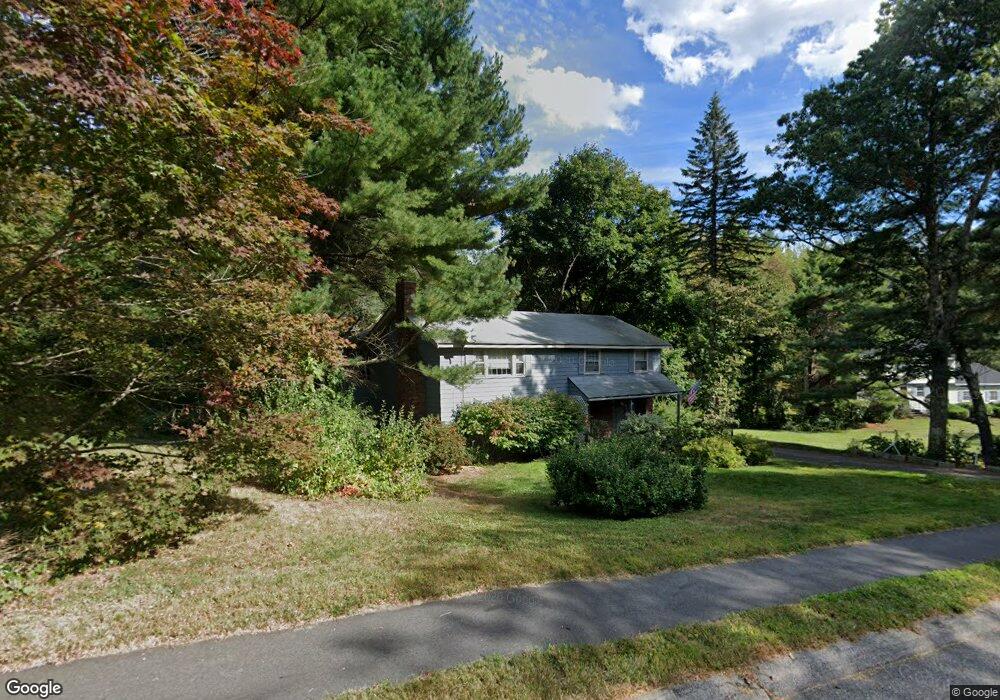
131 Guggins Ln Boxborough, MA 01719
Estimated Value: $667,473 - $793,000
3
Beds
2
Baths
1,500
Sq Ft
$476/Sq Ft
Est. Value
About This Home
This home is located at 131 Guggins Ln, Boxborough, MA 01719 and is currently estimated at $714,118, approximately $476 per square foot. 131 Guggins Ln is a home located in Middlesex County with nearby schools including Acton-Boxborough Regional High School.
Ownership History
Date
Name
Owned For
Owner Type
Purchase Details
Closed on
Apr 18, 2012
Sold by
Megdal Lori M and Lewis Lori M
Bought by
Lewis Lori M
Current Estimated Value
Home Financials for this Owner
Home Financials are based on the most recent Mortgage that was taken out on this home.
Original Mortgage
$237,977
Outstanding Balance
$32,145
Interest Rate
3.89%
Mortgage Type
New Conventional
Estimated Equity
$681,973
Purchase Details
Closed on
Dec 21, 2011
Sold by
Megdal Peter A and Megdal Lori M
Bought by
Megdal Lori M
Purchase Details
Closed on
Jun 16, 1993
Sold by
Rozembersky Rozalia H and Rozembersky John J
Bought by
Megdal Peter A and Megdal Laureen M
Home Financials for this Owner
Home Financials are based on the most recent Mortgage that was taken out on this home.
Original Mortgage
$184,000
Interest Rate
7.38%
Mortgage Type
Purchase Money Mortgage
Create a Home Valuation Report for This Property
The Home Valuation Report is an in-depth analysis detailing your home's value as well as a comparison with similar homes in the area
Home Values in the Area
Average Home Value in this Area
Purchase History
| Date | Buyer | Sale Price | Title Company |
|---|---|---|---|
| Lewis Lori M | -- | -- | |
| Megdal Lori M | -- | -- | |
| Megdal Peter A | $190,000 | -- |
Source: Public Records
Mortgage History
| Date | Status | Borrower | Loan Amount |
|---|---|---|---|
| Open | Lewis Lori M | $237,977 | |
| Previous Owner | Megdal Peter A | $168,000 | |
| Previous Owner | Megdal Peter A | $184,000 | |
| Previous Owner | Megdal Peter A | $138,700 |
Source: Public Records
Tax History Compared to Growth
Tax History
| Year | Tax Paid | Tax Assessment Tax Assessment Total Assessment is a certain percentage of the fair market value that is determined by local assessors to be the total taxable value of land and additions on the property. | Land | Improvement |
|---|---|---|---|---|
| 2025 | $8,468 | $559,300 | $282,900 | $276,400 |
| 2024 | $8,212 | $547,800 | $271,400 | $276,400 |
| 2023 | $7,758 | $499,900 | $244,000 | $255,900 |
| 2022 | $7,719 | $443,100 | $244,000 | $199,100 |
| 2020 | $5,134 | $443,100 | $244,000 | $199,100 |
| 2019 | $7,276 | $443,100 | $244,000 | $199,100 |
| 2018 | $7,043 | $428,400 | $232,600 | $195,800 |
| 2017 | $6,860 | $408,100 | $232,600 | $175,500 |
| 2016 | $6,703 | $409,700 | $232,600 | $177,100 |
| 2015 | $6,147 | $369,200 | $204,000 | $165,200 |
| 2014 | $6,526 | $368,900 | $200,000 | $168,900 |
Source: Public Records
Map
Nearby Homes
- 134 Russet Ln
- 68 Macintosh Ln
- 777 Depot Rd
- 96 Cedarwood Rd
- 5 Elm St Unit 1
- 9 Elm St Unit 1
- 31 Mohawk Dr
- 285 Central St Unit 285
- 62 Waite Rd
- 139 Picnic St
- 92 Willow St Unit 3
- 92 Willow St Unit 2
- 12 Olde Lantern Rd
- 90 Willow St Unit 1
- 89 Windsor Ave
- 4 Huron Rd
- 1155 Burroughs Rd
- 3 Heather Hill Rd
- 63 Leonard Rd Unit 63
- 4,7,8 Crestwood Ln
- 131 Guggins Ln Unit 1
- 131 Guggins Ln Unit 131
- 153 Guggins Ln
- 115 Guggins Ln
- 132 Guggins Ln
- 146 Guggins Ln
- 169 Guggins Ln
- 108 Guggins Ln
- 103 Guggins Ln
- 162 Guggins Ln
- 196 Liberty Square Rd
- 183 Guggins Ln
- 100 Guggins Ln
- 218 Liberty Square Rd
- 228 Liberty Square Rd
- 93 Guggins Ln
- 70 Box Mill Rd
- 188 Liberty Square Rd
- Lot 2 Liberty Square Rd
- LOT A Whitcomb Rd