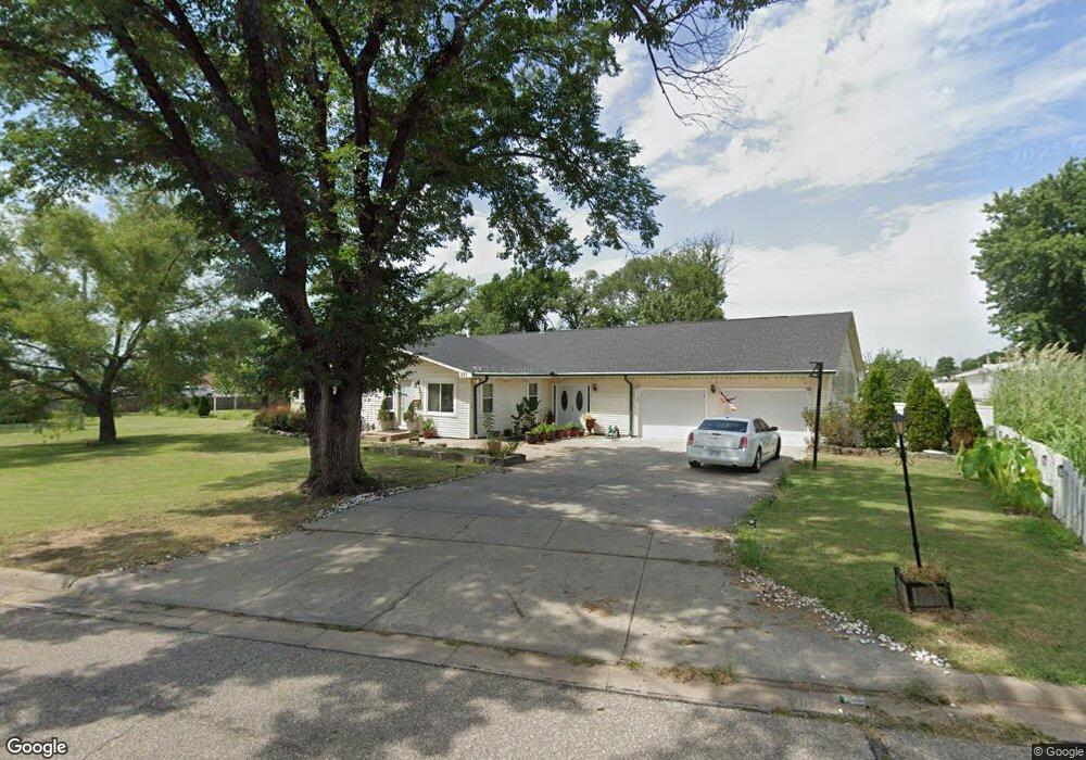
131 Hillside St El Dorado, KS 67042
Estimated Value: $164,000 - $328,000
3
Beds
4
Baths
2,652
Sq Ft
$86/Sq Ft
Est. Value
About This Home
This home is located at 131 Hillside St, El Dorado, KS 67042 and is currently estimated at $229,130, approximately $86 per square foot. 131 Hillside St is a home located in Butler County with nearby schools including El Dorado High School.
Ownership History
Date
Name
Owned For
Owner Type
Purchase Details
Closed on
Apr 6, 2018
Sold by
Blount Jerry and Blount Teresa
Bought by
Parker Katina D
Current Estimated Value
Home Financials for this Owner
Home Financials are based on the most recent Mortgage that was taken out on this home.
Original Mortgage
$107,350
Outstanding Balance
$92,298
Interest Rate
4.43%
Mortgage Type
New Conventional
Estimated Equity
$136,832
Create a Home Valuation Report for This Property
The Home Valuation Report is an in-depth analysis detailing your home's value as well as a comparison with similar homes in the area
Home Values in the Area
Average Home Value in this Area
Purchase History
| Date | Buyer | Sale Price | Title Company |
|---|---|---|---|
| Parker Katina D | -- | None Available | |
| Parker Derek M | $134,188 | Kansas Secured Title |
Source: Public Records
Mortgage History
| Date | Status | Borrower | Loan Amount |
|---|---|---|---|
| Open | Parker Derek M | $107,350 | |
| Closed | Parker Derek M | $107,350 |
Source: Public Records
Tax History Compared to Growth
Tax History
| Year | Tax Paid | Tax Assessment Tax Assessment Total Assessment is a certain percentage of the fair market value that is determined by local assessors to be the total taxable value of land and additions on the property. | Land | Improvement |
|---|---|---|---|---|
| 2025 | $27 | $18,006 | $3,910 | $14,096 |
| 2024 | $27 | $17,313 | $1,659 | $15,654 |
| 2023 | $2,723 | $16,813 | $1,659 | $15,154 |
| 2022 | $2,214 | $14,087 | $1,659 | $12,428 |
| 2021 | $2,214 | $13,691 | $2,142 | $11,549 |
| 2020 | $2,346 | $13,505 | $2,142 | $11,363 |
| 2019 | $2,250 | $12,995 | $2,142 | $10,853 |
| 2018 | $2,506 | $14,436 | $2,142 | $12,294 |
| 2017 | $2,484 | $14,271 | $1,866 | $12,405 |
| 2014 | -- | $111,600 | $17,280 | $94,320 |
Source: Public Records
Map
Nearby Homes
- 109 Eunice St
- 153 Eunice St
- 229 Oil Hill Rd
- 240 State St
- 116 N Arthur St
- 424 N Arthur St
- 405 S Arthur St
- 1503 W Ash Ave
- 131 Residence St
- 208 S Orchard St
- 728 Audrey Dr
- 323 Race St
- 425 Race St
- 701 Sunset Ln
- 111 S Summit St
- 510 N Alleghany St
- 222 Millheisler Rd
- 503 N Summit St
- 616 N Alleghany St
- 620 Frazier St
- 121 Hillside St
- 139 Hillside St
- 201 Hillside St
- 114 Hillside St
- 134 Hillside St
- 113 Hillside St
- 147 Hillside St
- 117A Hillside St
- 142 Hillside St
- 106 Hillside St
- 105 Hillside St
- 303 Hillside St
- 161 Eunice St
- 304 Hillside St
- 127 Oil Hill Rd
- 635 W Central Ave
- 0.96+/- Acres W Central Ave
- 2508 W Central Ave
- 139 Oil Hill Rd
- 305 Hillside St