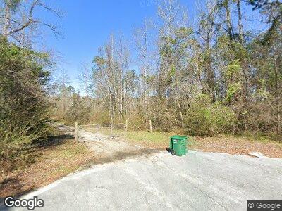
131 Lu Mac Rd Albany, GA 31701
Estimated Value: $278,000 - $405,000
3
Beds
3
Baths
3,306
Sq Ft
$102/Sq Ft
Est. Value
About This Home
This home is located at 131 Lu Mac Rd, Albany, GA 31701 and is currently estimated at $336,089, approximately $101 per square foot. 131 Lu Mac Rd is a home located in Lee County with nearby schools including Kinchafoonee Primary School, Twin Oaks Elementary School, and Lee County Middle School East.
Ownership History
Date
Name
Owned For
Owner Type
Purchase Details
Closed on
Mar 30, 2023
Sold by
Doss Toni Lynne
Bought by
Harrison Kimberly Burnsed and Malburn Enterprises Inc
Current Estimated Value
Purchase Details
Closed on
May 20, 2019
Sold by
Burnsed Teresa F Estate
Bought by
Doss Toni Lynne
Purchase Details
Closed on
Jun 2, 2008
Sold by
Burnsed Malcolm
Bought by
Burnsed Malcolm and Burnsed Teresa F
Home Financials for this Owner
Home Financials are based on the most recent Mortgage that was taken out on this home.
Original Mortgage
$150,000
Interest Rate
5.53%
Mortgage Type
New Conventional
Purchase Details
Closed on
May 27, 2008
Sold by
Burnsed Teresa F
Bought by
Burnsed Malcolm and Burnsed Teresa F
Home Financials for this Owner
Home Financials are based on the most recent Mortgage that was taken out on this home.
Original Mortgage
$150,000
Interest Rate
5.53%
Mortgage Type
New Conventional
Create a Home Valuation Report for This Property
The Home Valuation Report is an in-depth analysis detailing your home's value as well as a comparison with similar homes in the area
Home Values in the Area
Average Home Value in this Area
Purchase History
| Date | Buyer | Sale Price | Title Company |
|---|---|---|---|
| Harrison Kimberly Burnsed | -- | -- | |
| Doss Toni Lynne | -- | -- | |
| Burnsed Malcolm | -- | -- | |
| Burnsed Malcolm | -- | -- |
Source: Public Records
Mortgage History
| Date | Status | Borrower | Loan Amount |
|---|---|---|---|
| Previous Owner | Burnsed Malcolm | $105,000 | |
| Previous Owner | Burnsed Malcolm | $150,000 |
Source: Public Records
Tax History Compared to Growth
Tax History
| Year | Tax Paid | Tax Assessment Tax Assessment Total Assessment is a certain percentage of the fair market value that is determined by local assessors to be the total taxable value of land and additions on the property. | Land | Improvement |
|---|---|---|---|---|
| 2024 | $3,127 | $103,512 | $6,560 | $96,952 |
| 2023 | $2,917 | $103,512 | $6,560 | $96,952 |
| 2022 | $2,917 | $103,512 | $6,560 | $96,952 |
| 2021 | $2,922 | $103,512 | $6,560 | $96,952 |
| 2020 | $2,522 | $76,200 | $7,680 | $68,520 |
| 2019 | $2,567 | $76,200 | $7,680 | $68,520 |
| 2018 | $2,568 | $76,200 | $7,680 | $68,520 |
| 2017 | $2,432 | $76,200 | $7,680 | $68,520 |
| 2016 | $2,432 | $76,200 | $7,680 | $68,520 |
| 2015 | $2,445 | $76,200 | $7,680 | $68,520 |
| 2014 | $2,454 | $76,200 | $7,680 | $68,520 |
| 2013 | -- | $76,200 | $7,680 | $68,520 |
Source: Public Records
Map
Nearby Homes
- 169 Woodstone Cir
- 1726 Philema Rd S
- 400 Philema Rd
- 317 Northampton Rd
- 214 Westfield Rd
- 1406 River Pointe Dr
- 190 Westfield Rd
- 111 Helen St
- 204 Pineridge Dr
- 157 Dogwood Ln
- 178 Pine Summit Dr
- 100 Lazy Acres Way
- 238 Long Pine Dr
- 141 Pineridge Dr
- 1302 Congressional Ct
- 125 Tall Pines Dr
- 1308 Congressional Ct
- 129 Tall Pines Dr
- 1408 River Pointe Dr
- 1812 River Pointe Dr
