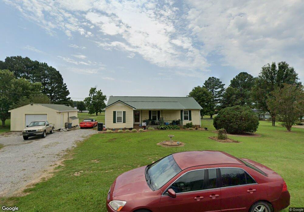
131 Michael Cir Lawrenceburg, TN 38464
Estimated Value: $196,125 - $252,000
--
Bed
2
Baths
1,344
Sq Ft
$169/Sq Ft
Est. Value
About This Home
This home is located at 131 Michael Cir, Lawrenceburg, TN 38464 and is currently estimated at $226,781, approximately $168 per square foot. 131 Michael Cir is a home located in Lawrence County with nearby schools including Ingram Sowell Elementary School, Lawrenceburg Public Elementary School, and David Crockett Elementary School.
Ownership History
Date
Name
Owned For
Owner Type
Purchase Details
Closed on
Sep 9, 1998
Bought by
Curtis David and Curtis Pamela A
Current Estimated Value
Purchase Details
Closed on
Mar 8, 1995
Sold by
Sims Cathy
Bought by
Kelley Cathy
Purchase Details
Closed on
Sep 15, 1989
Bought by
Sims Cathy
Purchase Details
Closed on
Oct 16, 1987
Bought by
Sims Bobby and Wife Cathy
Create a Home Valuation Report for This Property
The Home Valuation Report is an in-depth analysis detailing your home's value as well as a comparison with similar homes in the area
Home Values in the Area
Average Home Value in this Area
Purchase History
| Date | Buyer | Sale Price | Title Company |
|---|---|---|---|
| Curtis David | $56,000 | -- | |
| Kelley Cathy | -- | -- | |
| Sims Cathy | -- | -- | |
| Sims Bobby | -- | -- |
Source: Public Records
Tax History Compared to Growth
Tax History
| Year | Tax Paid | Tax Assessment Tax Assessment Total Assessment is a certain percentage of the fair market value that is determined by local assessors to be the total taxable value of land and additions on the property. | Land | Improvement |
|---|---|---|---|---|
| 2025 | $721 | $35,875 | $0 | $0 |
| 2024 | $721 | $35,875 | $5,000 | $30,875 |
| 2023 | $721 | $35,875 | $5,000 | $30,875 |
| 2022 | $721 | $35,875 | $5,000 | $30,875 |
| 2021 | $608 | $20,550 | $2,500 | $18,050 |
| 2020 | $608 | $20,550 | $2,500 | $18,050 |
| 2019 | $608 | $20,550 | $2,500 | $18,050 |
| 2018 | $608 | $20,550 | $2,500 | $18,050 |
| 2017 | $608 | $20,550 | $2,500 | $18,050 |
| 2016 | $608 | $20,550 | $2,500 | $18,050 |
| 2015 | $563 | $20,550 | $2,500 | $18,050 |
| 2014 | $545 | $19,900 | $2,500 | $17,400 |
Source: Public Records
Map
Nearby Homes
- 1950 Norton Rd
- 206 State Ave
- 380 Lanning Rd
- 2600 Clanton Rd
- 260 Wesley Chapel Rd
- 2073 Choates Creek Rd
- 1194 Harmony Way
- 729 Weakley Creek Rd
- 145 Lantz Rd
- 2342 Pulaski Hwy
- 786 Hillview Dr
- 111 Grandview Dr
- 79 Bishop Rd
- 2024 Powdermill Hill Rd
- 2167 Powdermill Hill Rd
- 2290 Grandview Dr
- 0 Lanning Rd
- 0 Lightfoot Ln
- 123 Quail Dr
- 33 Bishop Rd
- 129 Michael Cir
- 133 Michael Cir
- 120 Michael Cir
- 116 Michael Cir
- 132 Michael Cir
- 130 Michael Cir
- 135 Michael Cir
- 134 Michael Cir
- 122 Michael Cir
- 127 Michael Cir
- 114 Michael Cir
- 121 Michael Cir
- 128 Michael Cir
- 136 Michael Cir
- 137 Michael Cir
- 125 Michael Cir
- 137 1/2 Michael Cir
- 124 Michael Cir
- 113 Michael Cir
- 126 Norton Rd