Estimated Value: $1,828,000 - $2,202,000
3
Beds
3
Baths
2,412
Sq Ft
$863/Sq Ft
Est. Value
About This Home
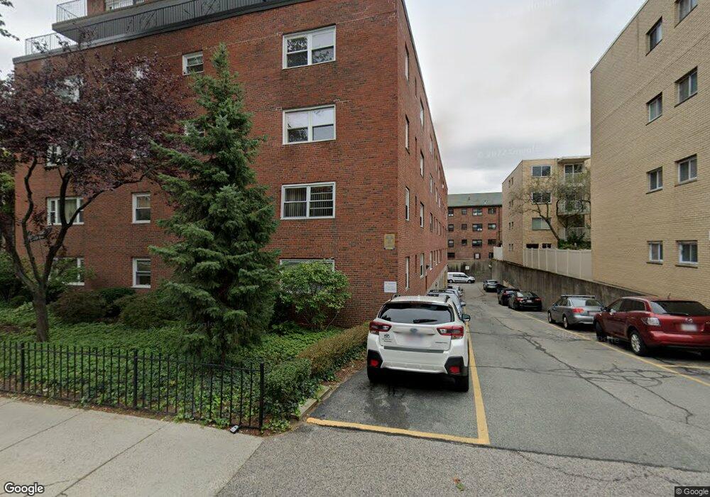
This home is located at 131 Sewall Ave Unit 71, Brookline, MA 02446 and is currently estimated at $2,081,508, approximately $862 per square foot. 131 Sewall Ave Unit 71 is a home located in Norfolk County with nearby schools including Amos A. Lawrence School, St. Mary of the Assumption Elementary School, and Winsor School.
Ownership History
Date
Name
Owned For
Owner Type
Purchase Details
Closed on
Sep 1, 2021
Sold by
Reinharz Jehuda and Reinharz Shulamit
Bought by
Reinbharz Rt
Current Estimated Value
Purchase Details
Closed on
Jun 17, 2002
Sold by
Shaw Samuel E and Shaw Dale D
Bought by
Reinharz Jehuda and Reinharz Shulamit
Home Financials for this Owner
Home Financials are based on the most recent Mortgage that was taken out on this home.
Original Mortgage
$650,000
Interest Rate
6.8%
Mortgage Type
Purchase Money Mortgage
Create a Home Valuation Report for This Property
The Home Valuation Report is an in-depth analysis detailing your home's value as well as a comparison with similar homes in the area
Home Values in the Area
Average Home Value in this Area
Purchase History
| Date | Buyer | Sale Price | Title Company |
|---|---|---|---|
| Reinbharz Rt | -- | None Available | |
| Reinharz Jehuda | $872,000 | -- |
Source: Public Records
Mortgage History
| Date | Status | Borrower | Loan Amount |
|---|---|---|---|
| Previous Owner | Reinharz Jehuda | $650,000 |
Source: Public Records
Tax History Compared to Growth
Tax History
| Year | Tax Paid | Tax Assessment Tax Assessment Total Assessment is a certain percentage of the fair market value that is determined by local assessors to be the total taxable value of land and additions on the property. | Land | Improvement |
|---|---|---|---|---|
| 2025 | $17,876 | $1,811,100 | $0 | $1,811,100 |
| 2024 | $17,347 | $1,775,500 | $0 | $1,775,500 |
| 2023 | $16,495 | $1,654,500 | $0 | $1,654,500 |
| 2022 | $16,529 | $1,622,100 | $0 | $1,622,100 |
| 2021 | $15,740 | $1,606,100 | $0 | $1,606,100 |
| 2020 | $15,028 | $1,590,300 | $0 | $1,590,300 |
| 2019 | $14,191 | $1,514,500 | $0 | $1,514,500 |
| 2018 | $14,143 | $1,495,000 | $0 | $1,495,000 |
| 2017 | $13,677 | $1,384,300 | $0 | $1,384,300 |
| 2016 | $13,113 | $1,258,400 | $0 | $1,258,400 |
| 2015 | $12,218 | $1,144,000 | $0 | $1,144,000 |
| 2014 | $11,458 | $1,006,000 | $0 | $1,006,000 |
Source: Public Records
About This Building
Map
Nearby Homes
- 151 Longwood Ave Unit 1
- 60 Longwood Ave Unit 802
- 60 Longwood Ave Unit 307
- 60 Longwood Ave Unit 403
- 50 Longwood Ave Unit 611
- 20 Chapel St Unit APH4
- 20 Chapel St Unit B712
- 20 Chapel St Unit B811
- 65 Francis St Unit 65
- 65 Francis St
- 98 Saint Paul St Unit A1
- 45 Longwood Ave Unit 812
- 45 Longwood Ave Unit PHA
- 15 James St Unit 2
- 17 James St Unit 1
- 18 Browne St Unit 2
- 30 Stearns Rd Unit 302
- 79 Pleasant St Unit 4
- 63 Green St Unit 3
- 63 Green St Unit 2
- 131 Sewall Ave Unit 1
- 131 Sewall Ave Unit 25
- 131 Sewall Ave Unit 72
- 131 Sewall Ave Unit 67
- 131 Sewall Ave Unit 66
- 131 Sewall Ave Unit 65
- 131 Sewall Ave Unit 64
- 131 Sewall Ave Unit 63
- 131 Sewall Ave Unit 62
- 131 Sewall Ave Unit 61
- 131 Sewall Ave Unit 57
- 131 Sewall Ave Unit 56
- 131 Sewall Ave Unit 55
- 131 Sewall Ave Unit 54
- 131 Sewall Ave Unit 53
- 131 Sewall Ave Unit 52
- 131 Sewall Ave Unit 51
- 131 Sewall Ave Unit 49
- 131 Sewall Ave Unit 48
- 131 Sewall Ave Unit 47