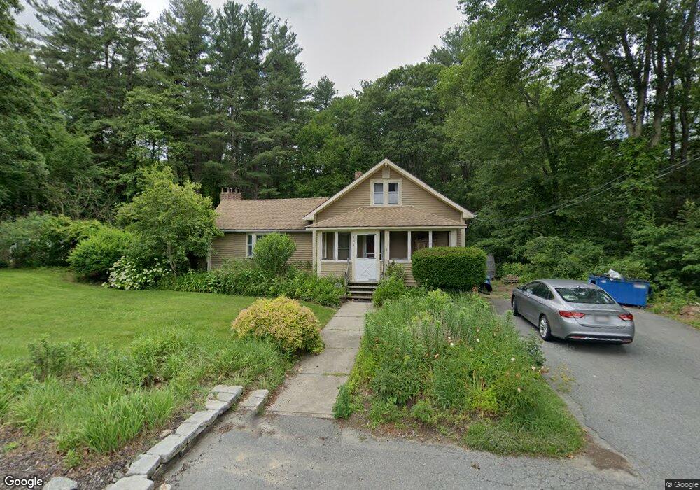
131 Singletary Ave Sutton, MA 01590
Estimated Value: $444,000 - $525,000
3
Beds
1
Bath
1,308
Sq Ft
$363/Sq Ft
Est. Value
About This Home
This home is located at 131 Singletary Ave, Sutton, MA 01590 and is currently estimated at $475,359, approximately $363 per square foot. 131 Singletary Ave is a home located in Worcester County with nearby schools including Sutton Elementary School, Sutton Middle School, and Sutton High School.
Ownership History
Date
Name
Owned For
Owner Type
Purchase Details
Closed on
Oct 23, 2012
Sold by
Labelle Timothy and Labelle Julie
Bought by
Labelle Timothy
Current Estimated Value
Purchase Details
Closed on
Mar 20, 2001
Sold by
Doane David P and Doane Mary K
Bought by
Labelle Timothy J and Bunce Julie A
Home Financials for this Owner
Home Financials are based on the most recent Mortgage that was taken out on this home.
Original Mortgage
$141,200
Interest Rate
7.01%
Mortgage Type
Purchase Money Mortgage
Purchase Details
Closed on
Jul 31, 2000
Sold by
Curtis Gary E and Curtis Cynthia E
Bought by
Doane David P and Doane Mary K
Home Financials for this Owner
Home Financials are based on the most recent Mortgage that was taken out on this home.
Original Mortgage
$171,450
Interest Rate
8.18%
Mortgage Type
Purchase Money Mortgage
Purchase Details
Closed on
Apr 30, 1990
Sold by
Beardsley Richard A
Bought by
Curtis Gary E
Create a Home Valuation Report for This Property
The Home Valuation Report is an in-depth analysis detailing your home's value as well as a comparison with similar homes in the area
Home Values in the Area
Average Home Value in this Area
Purchase History
| Date | Buyer | Sale Price | Title Company |
|---|---|---|---|
| Labelle Timothy | -- | -- | |
| Labelle Timothy J | $176,500 | -- | |
| Doane David P | $166,500 | -- | |
| Curtis Gary E | $128,000 | -- |
Source: Public Records
Mortgage History
| Date | Status | Borrower | Loan Amount |
|---|---|---|---|
| Previous Owner | Curtis Gary E | $141,200 | |
| Previous Owner | Curtis Gary E | $171,450 | |
| Previous Owner | Curtis Gary E | $110,700 |
Source: Public Records
Tax History
| Year | Tax Paid | Tax Assessment Tax Assessment Total Assessment is a certain percentage of the fair market value that is determined by local assessors to be the total taxable value of land and additions on the property. | Land | Improvement |
|---|---|---|---|---|
| 2025 | $4,872 | $405,300 | $172,300 | $233,000 |
| 2024 | $5,095 | $401,800 | $165,200 | $236,600 |
| 2023 | $5,091 | $367,600 | $149,500 | $218,100 |
| 2022 | $4,173 | $274,900 | $119,600 | $155,300 |
| 2021 | $4,064 | $254,000 | $119,600 | $134,400 |
| 2020 | $4,028 | $254,000 | $119,600 | $134,400 |
| 2019 | $3,961 | $239,800 | $119,600 | $120,200 |
| 2018 | $7,478 | $214,400 | $101,700 | $112,700 |
| 2017 | $3,386 | $205,200 | $89,500 | $115,700 |
| 2016 | $3,348 | $200,700 | $89,500 | $111,200 |
| 2015 | $3,248 | $194,700 | $89,500 | $105,200 |
| 2014 | $3,184 | $188,600 | $88,900 | $99,700 |
Source: Public Records
Map
Nearby Homes
- 37 Sutton Rd
- 11 Laurel Dr
- 0 W Main St
- 168 Burbank Rd
- 152 W Main St Unit A
- 196 Horne Way Unit 196
- 100 Horne Way
- 99 Burbank Road Lot 182
- 99 Burbank Rd
- 128 Worcester Providence Turnpike
- 124 Worcester Providence Turnpike
- 5 Mogren Dr
- 4 Jessica j Dr
- 2 Jessica j Dr
- 38 W Main St
- 5 Putnam Hill Rd
- 1 Burbank Rd
- 0 Auburn Rd
- 303 W Main St
- 8 Sycamore Cir
- 134 Singletary Ave
- 128 Singletary Ave
- 125 Singletary Ave
- 125 Singletary Ave
- 127 Singletary Ave
- 138 Singletary Ave
- 124 Singletary Ave
- 122 Singletary Ave
- 120 Singletary Ave
- 147 Singletary Ave
- 117 Singletary Ave
- 34 Winwood Rd
- 118 Singletary Ave
- 151 Singletary Ave
- 114 Singletary Ave
- 153 Singletary Ave
- 154 Singletary Ave
- 23 Winwood Rd
- 19 Hemlock Dr
- 110 Singletary Ave
Your Personal Tour Guide
Ask me questions while you tour the home.