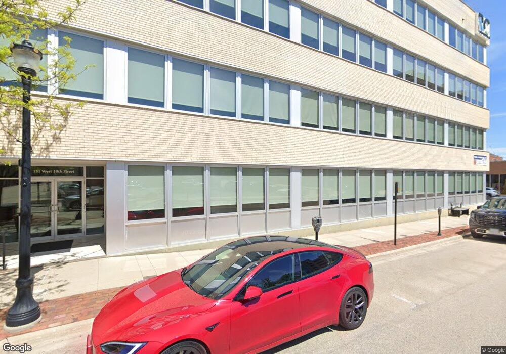
131 W 10th St Unit 1st Floor Dubuque, IA 52001
--
Bed
--
Bath
5,000
Sq Ft
5,793
Sq Ft Lot
About This Home
This home is located at 131 W 10th St Unit 1st Floor, Dubuque, IA 52001. 131 W 10th St Unit 1st Floor is a home located in Dubuque County with nearby schools including Prescott Elementary School, George Washington Middle School, and Dubuque Senior High School.
Ownership History
Date
Name
Owned For
Owner Type
Purchase Details
Closed on
Mar 24, 2007
Sold by
Gkp Iowa Llc
Bought by
Interstate Bulding Lllp
Home Financials for this Owner
Home Financials are based on the most recent Mortgage that was taken out on this home.
Original Mortgage
$1,800,000
Outstanding Balance
$1,085,932
Interest Rate
6.2%
Mortgage Type
Purchase Money Mortgage
Create a Home Valuation Report for This Property
The Home Valuation Report is an in-depth analysis detailing your home's value as well as a comparison with similar homes in the area
Home Values in the Area
Average Home Value in this Area
Purchase History
| Date | Buyer | Sale Price | Title Company |
|---|---|---|---|
| Interstate Bulding Lllp | $375,000 | None Available | |
| Interstate Bulding Lllp | $375,000 | None Available |
Source: Public Records
Mortgage History
| Date | Status | Borrower | Loan Amount |
|---|---|---|---|
| Open | Interstate Bulding Lllp | $1,800,000 |
Source: Public Records
Tax History Compared to Growth
Tax History
| Year | Tax Paid | Tax Assessment Tax Assessment Total Assessment is a certain percentage of the fair market value that is determined by local assessors to be the total taxable value of land and additions on the property. | Land | Improvement |
|---|---|---|---|---|
| 2025 | $33,362 | $1,300,000 | $46,800 | $1,253,200 |
| 2024 | $33,362 | $1,293,600 | $41,600 | $1,252,000 |
| 2023 | $33,098 | $1,293,600 | $41,600 | $1,252,000 |
| 2022 | $32,252 | $1,255,430 | $41,630 | $1,213,800 |
| 2021 | $32,252 | $1,255,430 | $41,630 | $1,213,800 |
| 2020 | $34,008 | $1,255,430 | $41,630 | $1,213,800 |
| 2019 | $31,726 | $1,255,430 | $41,630 | $1,213,800 |
| 2018 | $31,976 | $1,171,722 | $38,853 | $1,132,869 |
| 2017 | $32,782 | $1,171,722 | $38,853 | $1,132,869 |
| 2016 | $32,782 | $1,171,722 | $38,853 | $1,132,869 |
| 2015 | $32,874 | $1,171,722 | $38,853 | $1,132,869 |
| 2014 | $29,010 | $1,046,180 | $34,690 | $1,011,490 |
Source: Public Records
Map
Nearby Homes
- 1199 Central Ave
- 1255 - 1257 Locust St
- 1252 White St
- 1337 Main St
- 1374 Main St
- 1328 Jackson St
- 460 Loras Blvd
- 1477 Locust St
- 563 W 11th St
- 1500 Central Ave
- 604 Chestnut St
- 504 Bluff St
- 568 Loras Blvd
- 945 Spruce St
- 603 Arlington St
- 609 Arlington St
- 623 Arlington St
- 642 Arlington St
- 364 W Locust St Unit 366 W Locust Street
- 1567 Elm St
- 131 W 10th St
- 131 W 10th St Unit Floors 1-4
- 131 W 10th St Unit Floors 1-3
- 131 W 10th St Unit 2 Floors
- 131 W 10th St Unit 3rd & 4th Floor
- 999 Iowa St Unit Parking lot and bill
- 1030 Main St
- 1030 Main St Unit 1030 Main Street
- 160 W 10th St
- 980 Main St
- 1044 Iowa St
- 962 Main Street Suite 2 St
- 962 Main Street Suite 4 St
- 962 Main Street Suite 6 St
- 962 Main Street Suite 7 St
- 962 Main Street Suite 8 St
- 962 Main Street Suite 9 St
- 962 Main Street Suite 10 St
- 962 Main Street Suite 11 St
- 962 Main Street Suite 1 St