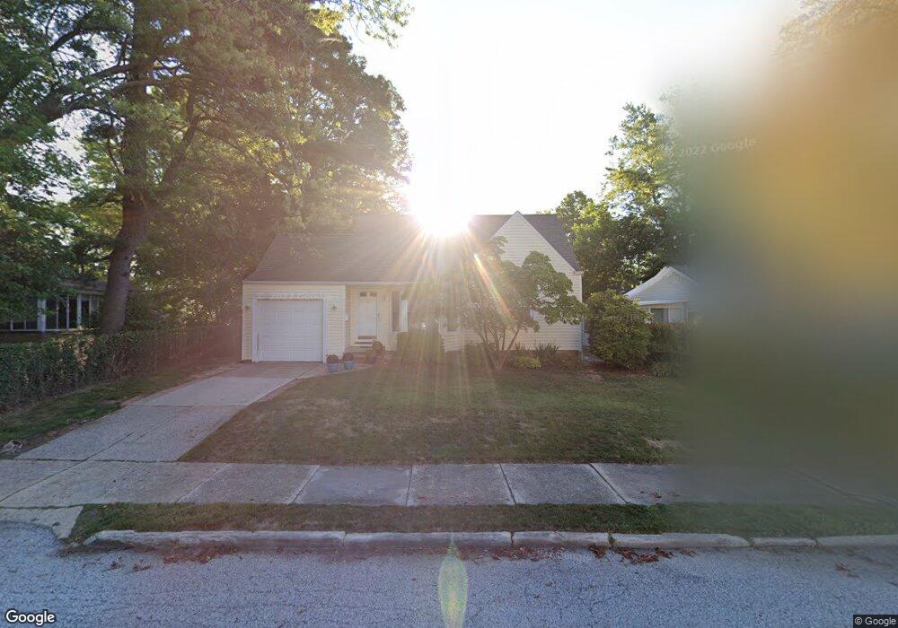
131 Westbrook Dr Euclid, OH 44132
Estimated Value: $153,360 - $208,000
3
Beds
1
Bath
1,436
Sq Ft
$128/Sq Ft
Est. Value
About This Home
This home is located at 131 Westbrook Dr, Euclid, OH 44132 and is currently estimated at $184,090, approximately $128 per square foot. 131 Westbrook Dr is a home located in Cuyahoga County with nearby schools including Shoreview Elementary School, Euclid High School, and Ss. Robert & William Catholic School.
Ownership History
Date
Name
Owned For
Owner Type
Purchase Details
Closed on
Dec 30, 1985
Sold by
Ely Mark C and Ely Patricia K
Bought by
Evers Dan C and Evers Tina M
Current Estimated Value
Purchase Details
Closed on
Sep 25, 1978
Sold by
Greene Lucille A
Bought by
Jochum Frank J
Purchase Details
Closed on
Jan 1, 1975
Bought by
Greene Lucille A
Create a Home Valuation Report for This Property
The Home Valuation Report is an in-depth analysis detailing your home's value as well as a comparison with similar homes in the area
Home Values in the Area
Average Home Value in this Area
Purchase History
| Date | Buyer | Sale Price | Title Company |
|---|---|---|---|
| Evers Dan C | $58,000 | -- | |
| Ely Mark C | -- | -- | |
| Jochum Frank J | $34,500 | -- | |
| Greene Lucille A | -- | -- |
Source: Public Records
Tax History Compared to Growth
Tax History
| Year | Tax Paid | Tax Assessment Tax Assessment Total Assessment is a certain percentage of the fair market value that is determined by local assessors to be the total taxable value of land and additions on the property. | Land | Improvement |
|---|---|---|---|---|
| 2024 | $2,543 | $47,145 | $10,570 | $36,575 |
| 2023 | $2,478 | $38,300 | $8,720 | $29,580 |
| 2022 | $2,454 | $38,290 | $8,720 | $29,580 |
| 2021 | $2,741 | $38,290 | $8,720 | $29,580 |
| 2020 | $2,717 | $35,460 | $8,090 | $27,370 |
| 2019 | $3,278 | $101,300 | $23,100 | $78,200 |
| 2018 | $3,271 | $35,460 | $8,090 | $27,370 |
| 2017 | $3,508 | $31,400 | $6,930 | $24,470 |
| 2016 | $3,516 | $31,400 | $6,930 | $24,470 |
| 2015 | $3,198 | $31,400 | $6,930 | $24,470 |
| 2014 | $3,198 | $31,400 | $6,930 | $24,470 |
Source: Public Records
Map
Nearby Homes
- 150 Westbrook Dr
- 278 E 286th St
- 295 E 276th St
- 251 E 286th St
- 557 Ezmor Ln
- 28805 Cresthaven Dr
- 27709 Parkwood Dr
- 28812 Cresthaven Dr
- 335 Blissfield Dr
- 459 Lloyd Rd
- 260 E 293rd St
- 625 Lloyd Rd
- 29616 Grand Blvd
- 369 E 270th St
- 29524 Bruce Dr
- 445 E 275th St
- 840 Talmadge Ave
- 25801 Lake Shore Blvd Unit 23
- 25801 Lake Shore Blvd Unit 64
- 25801 Lake Shore Blvd Unit 130
- 135 Westbrook Dr
- 141 Westbrook Dr
- 130 Eastbrook Dr
- 134 Eastbrook Dr
- 120 Eastbrook Dr
- 134 Westbrook Dr
- 151 Westbrook Dr
- 144 Eastbrook Dr
- 140 Westbrook Dr
- 28130 Gilchrist Dr
- 150 Eastbrook Dr
- 144 Westbrook Dr
- 155 Westbrook Dr
- 160 Eastbrook Dr
- 28150 Gilchrist Dr
- 161 Westbrook Dr
- 135 E 280th St
- 131 E 280th St
- 135 Eastbrook Dr
- 125 E 280th St