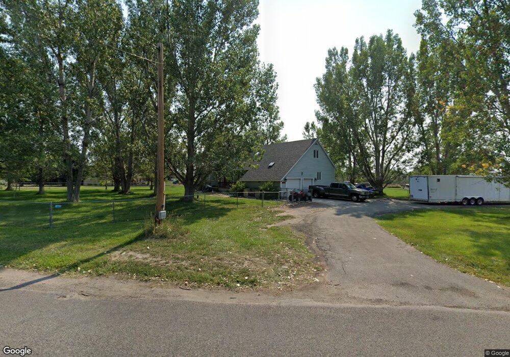
1310 E Maryland Ln Laurel, MT 59044
Estimated Value: $461,000 - $636,000
5
Beds
3
Baths
2,246
Sq Ft
$247/Sq Ft
Est. Value
About This Home
This home is located at 1310 E Maryland Ln, Laurel, MT 59044 and is currently estimated at $554,647, approximately $246 per square foot. 1310 E Maryland Ln is a home located in Yellowstone County with nearby schools including Fred W. Graff School, West School, and Laurel Middle School.
Ownership History
Date
Name
Owned For
Owner Type
Purchase Details
Closed on
Jan 31, 2008
Sold by
Lacasse Shane K and Lacasse Kristie H
Bought by
Newton David
Current Estimated Value
Home Financials for this Owner
Home Financials are based on the most recent Mortgage that was taken out on this home.
Original Mortgage
$272,650
Outstanding Balance
$172,250
Interest Rate
6.09%
Mortgage Type
Unknown
Estimated Equity
$382,397
Purchase Details
Closed on
Apr 21, 2005
Sold by
Roberts Linda L
Bought by
Lacasse Shane K and Lacasse Kristie H
Home Financials for this Owner
Home Financials are based on the most recent Mortgage that was taken out on this home.
Original Mortgage
$166,400
Interest Rate
5.84%
Mortgage Type
New Conventional
Create a Home Valuation Report for This Property
The Home Valuation Report is an in-depth analysis detailing your home's value as well as a comparison with similar homes in the area
Home Values in the Area
Average Home Value in this Area
Purchase History
| Date | Buyer | Sale Price | Title Company |
|---|---|---|---|
| Newton David | -- | None Available | |
| Lacasse Shane K | -- | None Available |
Source: Public Records
Mortgage History
| Date | Status | Borrower | Loan Amount |
|---|---|---|---|
| Open | Newton David | $272,650 | |
| Previous Owner | Lacasse Shane K | $166,400 |
Source: Public Records
Tax History
| Year | Tax Paid | Tax Assessment Tax Assessment Total Assessment is a certain percentage of the fair market value that is determined by local assessors to be the total taxable value of land and additions on the property. | Land | Improvement |
|---|---|---|---|---|
| 2025 | $3,049 | $634,400 | $116,954 | $517,446 |
| 2024 | $3,049 | $424,700 | $76,935 | $347,765 |
| 2023 | $2,752 | $391,000 | $76,935 | $314,065 |
| 2022 | $2,239 | $346,900 | $0 | $0 |
| 2021 | $2,488 | $346,900 | $0 | $0 |
| 2020 | $2,320 | $315,500 | $0 | $0 |
| 2019 | $2,235 | $315,500 | $0 | $0 |
| 2018 | $2,556 | $307,500 | $0 | $0 |
| 2017 | $2,338 | $307,500 | $0 | $0 |
| 2016 | $2,254 | $302,100 | $0 | $0 |
| 2015 | $2,221 | $302,100 | $0 | $0 |
| 2014 | $2,118 | $154,495 | $0 | $0 |
Source: Public Records
Map
Nearby Homes
- 1031 Fir Ave
- 1108 E 8th St
- 1104 E 8th St
- 605 Date Ave
- 717 E 5th, 506 Alder Ave
- 717 E 5th St
- 801 E 4th St
- 601 E 5th St
- 414 Wyoming Ave
- 516 Pennsylvania Ave
- 110 E 5th St
- 1319 Valley Dr
- 1665 Wild Lupine Ln
- 603 5th Ave
- 1631 Valley Dr
- 116 4th Ave
- 319 6th Ave
- 1216 W 12th Street Cir
- 1254 W Beartooth Dr
- 1109 10th Ave
- 1326 E Maryland Ln
- 1329 E Maryland Ln
- 911 Fir Ave
- 1331 E Maryland Ln
- 1336 E Maryland Ln
- 1057 Fir Ave
- 1333 E Maryland Ln
- 1408 E Maryland Ln
- 907 Fir Ave
- 1409 E Maryland Ln
- 914 Bristol Way
- 1310 Ridge Dr
- 1202 Ridge Dr
- 1107 Fir Ave
- 1505 E Maryland Ln
- 1328 Ridge Dr
- TBA Fir Ave
- 1532 E Maryland Ln
- 815 Fir Ave
- 1424 Ridge Dr
Your Personal Tour Guide
Ask me questions while you tour the home.