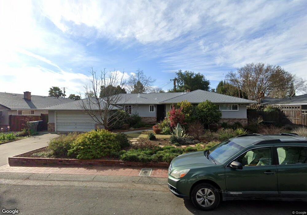
1310 Noonan Dr Sacramento, CA 95822
South Land Park NeighborhoodEstimated Value: $389,000 - $684,000
3
Beds
2
Baths
1,668
Sq Ft
$347/Sq Ft
Est. Value
About This Home
This home is located at 1310 Noonan Dr, Sacramento, CA 95822 and is currently estimated at $578,140, approximately $346 per square foot. 1310 Noonan Dr is a home located in Sacramento County with nearby schools including Sutterville Elementary School, California Middle, and C. K. McClatchy High.
Ownership History
Date
Name
Owned For
Owner Type
Purchase Details
Closed on
Jul 27, 2021
Sold by
Herbert Jacobs Myron
Bought by
Myron H And Regina M Jacobs Family Trust and Fa Regina
Current Estimated Value
Purchase Details
Closed on
Jul 12, 2021
Sold by
Jacobs Daniel H and Jacobs Myron H
Bought by
Jacobs Daniel H and Liv Linda
Purchase Details
Closed on
Jun 12, 2003
Sold by
Jacobs Myron H H and Jacobs Myron H
Bought by
Jacobs Myron H H and Jacobs Myron H
Purchase Details
Closed on
Jun 9, 1999
Sold by
Jacobs Myron H
Bought by
Jacobs Myron H H and Jacobs Myron H
Purchase Details
Closed on
Jan 19, 1994
Sold by
Kawahara Rose and Kawahara Glenn
Bought by
Jacobs Myron H
Home Financials for this Owner
Home Financials are based on the most recent Mortgage that was taken out on this home.
Original Mortgage
$135,000
Interest Rate
7.16%
Create a Home Valuation Report for This Property
The Home Valuation Report is an in-depth analysis detailing your home's value as well as a comparison with similar homes in the area
Home Values in the Area
Average Home Value in this Area
Purchase History
| Date | Buyer | Sale Price | Title Company |
|---|---|---|---|
| Myron H And Regina M Jacobs Family Trust | -- | -- | |
| Jacobs Daniel H | -- | None Available | |
| Jacobs Myron H H | -- | -- | |
| Jacobs Myron H H | -- | -- | |
| Jacobs Myron H | $185,000 | Stewart Title Of Sacramento |
Source: Public Records
Mortgage History
| Date | Status | Borrower | Loan Amount |
|---|---|---|---|
| Previous Owner | Jacobs Myron H | $135,000 |
Source: Public Records
Tax History Compared to Growth
Tax History
| Year | Tax Paid | Tax Assessment Tax Assessment Total Assessment is a certain percentage of the fair market value that is determined by local assessors to be the total taxable value of land and additions on the property. | Land | Improvement |
|---|---|---|---|---|
| 2025 | $3,732 | $314,411 | $134,601 | $179,810 |
| 2024 | $3,732 | $308,247 | $131,962 | $176,285 |
| 2023 | $3,635 | $302,204 | $129,375 | $172,829 |
| 2022 | $3,588 | $296,280 | $126,839 | $169,441 |
| 2021 | $3,410 | $290,471 | $124,352 | $166,119 |
| 2020 | $3,355 | $287,493 | $123,077 | $164,416 |
| 2019 | $3,282 | $281,857 | $120,664 | $161,193 |
| 2018 | $3,194 | $276,332 | $118,299 | $158,033 |
| 2017 | $3,143 | $270,915 | $115,980 | $154,935 |
| 2016 | $3,101 | $265,604 | $113,706 | $151,898 |
| 2015 | $3,048 | $261,616 | $111,999 | $149,617 |
| 2014 | $2,971 | $256,493 | $109,806 | $146,687 |
Source: Public Records
Map
Nearby Homes
- 5200 Pleasant Dr
- 5440 Pleasant Dr
- 1428 Tradewinds Ave
- 1432 Oregon Dr
- 1220 Lucio Ln
- 1224 Nevis Ct
- 1433 32nd Ave
- 4500 Crestwood Way
- 5779 Gloria Dr
- 1621 Fruitridge Rd
- 4801 da Rosa Dr
- 1122 28th Ave
- 5081 Karbet Way
- 1810 Opper Ave
- 1436 Sterling St
- 5531 Michael Way
- 5716 Lonsdale Dr
- 1548 London St
- 5880 Gloria Dr
- 5875 Gloria Dr Unit 4
- 5200 Del Rio Rd
- 5201 Pleasant Dr
- 5210 Del Rio Rd
- 5211 Pleasant Dr
- 1311 Noonan Dr
- 5220 Del Rio Rd
- 5221 Pleasant Dr
- 5130 Del Rio Rd
- 5131 Pleasant Dr
- 5201 Del Rio Rd
- 5211 Del Rio Rd
- 5230 Del Rio Rd
- 5231 Pleasant Dr
- 5151 Del Rio Rd
- 5221 Del Rio Rd
- 5210 Pleasant Dr
- 5130 Pleasant Dr
- 5111 Pleasant Dr
- 5110 Del Rio Rd
- 5131 Del Rio Rd