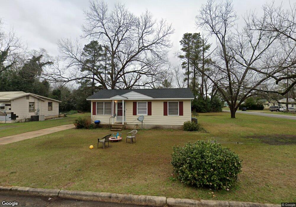
1310 Ridge St Americus, GA 31709
Estimated Value: $52,000 - $79,296
2
Beds
1
Bath
888
Sq Ft
$75/Sq Ft
Est. Value
About This Home
This home is located at 1310 Ridge St, Americus, GA 31709 and is currently estimated at $66,324, approximately $74 per square foot. 1310 Ridge St is a home located in Sumter County with nearby schools including Sumter County Primary School, Sumter County Elementary School, and Sumter County Middle School.
Ownership History
Date
Name
Owned For
Owner Type
Purchase Details
Closed on
Mar 3, 2023
Sold by
Albritton Paula
Bought by
Grubstake Llc
Current Estimated Value
Purchase Details
Closed on
Apr 9, 2010
Sold by
Taylor Malcolm Douglas and Dillard Margie T
Bought by
Albritton Cecil E and Albritton Paula
Home Financials for this Owner
Home Financials are based on the most recent Mortgage that was taken out on this home.
Original Mortgage
$10,937
Interest Rate
4.94%
Mortgage Type
Future Advance Clause Open End Mortgage
Purchase Details
Closed on
Apr 27, 1995
Sold by
Taylor Winnell S
Bought by
Taylor Malcolm D
Purchase Details
Closed on
Apr 14, 1989
Bought by
Taylor Winnell
Purchase Details
Closed on
Jan 1, 1956
Bought by
Taylor Jesse
Create a Home Valuation Report for This Property
The Home Valuation Report is an in-depth analysis detailing your home's value as well as a comparison with similar homes in the area
Home Values in the Area
Average Home Value in this Area
Purchase History
| Date | Buyer | Sale Price | Title Company |
|---|---|---|---|
| Grubstake Llc | $165,000 | -- | |
| Albritton Cecil E | $20,000 | -- | |
| Taylor Malcolm D | -- | -- | |
| Taylor Winnell | -- | -- | |
| Taylor Jesse | -- | -- |
Source: Public Records
Mortgage History
| Date | Status | Borrower | Loan Amount |
|---|---|---|---|
| Previous Owner | Albritton Cecil E | $10,937 |
Source: Public Records
Tax History Compared to Growth
Tax History
| Year | Tax Paid | Tax Assessment Tax Assessment Total Assessment is a certain percentage of the fair market value that is determined by local assessors to be the total taxable value of land and additions on the property. | Land | Improvement |
|---|---|---|---|---|
| 2024 | $570 | $12,640 | $2,560 | $10,080 |
| 2023 | $558 | $12,640 | $2,560 | $10,080 |
| 2022 | $382 | $12,640 | $2,560 | $10,080 |
| 2021 | $559 | $12,640 | $2,560 | $10,080 |
| 2020 | $572 | $12,640 | $2,560 | $10,080 |
| 2019 | $605 | $12,640 | $2,560 | $10,080 |
| 2018 | $398 | $12,640 | $2,560 | $10,080 |
| 2017 | $398 | $12,640 | $2,560 | $10,080 |
| 2016 | $559 | $12,640 | $2,560 | $10,080 |
| 2015 | $435 | $14,200 | $2,840 | $11,360 |
| 2014 | $435 | $14,200 | $2,840 | $11,360 |
| 2013 | -- | $14,800 | $2,840 | $11,960 |
Source: Public Records
Map
Nearby Homes
- 1302 Crawford St
- 403 Sharon Dr
- 118 Sharon Cir
- 303 Sun Valley Dr
- 515 Eastview Dr
- 113 Clearview Cir
- 401 Rigas Rd
- TBD Hillside Dr
- TBD E Lamar St
- 1720 E Lamar St
- 525 Ashby St
- 333 Academy St
- 513 Winn St
- 621 E Church St
- 122 Academy St
- 211 Horne St
- 254 Georgia 49
- 119 Carter St
- 279 Upper River Rd
- 108 Southland Ridge Dr
- 1308 Ridge St
- 802 Copper Hill Cir
- 1306 Ridge St
- 803 Douglas Dr
- 804 Copper Hill Cir
- 801 Douglas Dr
- 1309 Ridge St
- 805 Douglas Dr
- 1307 Ridge St
- 1304 Ridge St
- 807 Douglas Dr
- 806 Copper Hill Cir
- 1305 Ridge St
- 709 Douglas Dr
- 1303 Ridge St
- 809 Douglas Dr
- 1302 Ridge St
- 710 Sunny Dale Cir
- 808 Copper Hill Cir
- 707 Douglas Dr