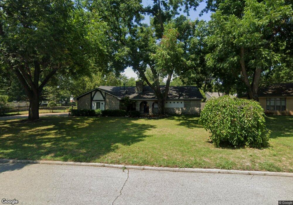
1310 Sherwood Ln Broken Arrow, OK 74011
Indian Springs Estates NeighborhoodEstimated Value: $278,329 - $326,000
3
Beds
2
Baths
2,400
Sq Ft
$123/Sq Ft
Est. Value
About This Home
This home is located at 1310 Sherwood Ln, Broken Arrow, OK 74011 and is currently estimated at $295,832, approximately $123 per square foot. 1310 Sherwood Ln is a home located in Tulsa County with nearby schools including Aspen Creek Elementary School, Oliver Middle School, and Broken Arrow Freshman Academy.
Ownership History
Date
Name
Owned For
Owner Type
Purchase Details
Closed on
Dec 5, 2011
Sold by
Mitchell Ron B and Mitchell Shirley J
Bought by
Mitchell Ron B and Mitchell Shirley J
Current Estimated Value
Home Financials for this Owner
Home Financials are based on the most recent Mortgage that was taken out on this home.
Original Mortgage
$74,000
Outstanding Balance
$50,936
Interest Rate
4.14%
Mortgage Type
New Conventional
Estimated Equity
$244,896
Purchase Details
Closed on
Sep 16, 1998
Sold by
Mitchell Ronald and Mitchell Ron B
Bought by
Mitchell Ron B and Mitchell Shirley J
Purchase Details
Closed on
Jul 31, 1998
Sold by
Martin Jean E
Bought by
Mitchell Ronald and Mitchell Shirley
Purchase Details
Closed on
Nov 1, 1992
Purchase Details
Closed on
Nov 1, 1985
Create a Home Valuation Report for This Property
The Home Valuation Report is an in-depth analysis detailing your home's value as well as a comparison with similar homes in the area
Home Values in the Area
Average Home Value in this Area
Purchase History
| Date | Buyer | Sale Price | Title Company |
|---|---|---|---|
| Mitchell Ron B | -- | First American Title & Abstr | |
| Mitchell Ron B | -- | -- | |
| Mitchell Ronald | $100,000 | Tulsa Abstract & Title Co | |
| -- | $95,000 | -- | |
| -- | $93,500 | -- |
Source: Public Records
Mortgage History
| Date | Status | Borrower | Loan Amount |
|---|---|---|---|
| Open | Mitchell Ron B | $74,000 |
Source: Public Records
Tax History Compared to Growth
Tax History
| Year | Tax Paid | Tax Assessment Tax Assessment Total Assessment is a certain percentage of the fair market value that is determined by local assessors to be the total taxable value of land and additions on the property. | Land | Improvement |
|---|---|---|---|---|
| 2024 | $1,513 | $11,774 | $1,606 | $10,168 |
| 2023 | $1,513 | $12,774 | $1,715 | $11,059 |
| 2022 | $1,526 | $11,775 | $2,224 | $9,551 |
| 2021 | $1,527 | $11,775 | $2,224 | $9,551 |
| 2020 | $1,553 | $11,774 | $2,670 | $9,104 |
| 2019 | $1,555 | $11,774 | $2,670 | $9,104 |
| 2018 | $1,533 | $11,774 | $2,670 | $9,104 |
| 2017 | $1,541 | $12,774 | $2,897 | $9,877 |
| 2016 | $1,539 | $12,774 | $2,897 | $9,877 |
| 2015 | $1,526 | $13,438 | $3,048 | $10,390 |
| 2014 | $1,543 | $13,046 | $2,959 | $10,087 |
Source: Public Records
Map
Nearby Homes
- 1410 Sherwood Ln
- 8413 Shadowood Ave
- 8401 S Fawnwood Ct
- 1114 Oakwood Dr
- 1413 W Ocala St
- 1012 W Ocala St
- The Elm Plan at Aspen Crossing Patio Homes
- 7809 S Redbud Ave
- 1400 W Quinton St
- 1914 W Imperial St
- 1917 E Van Buren St
- 1017 W Quinton St
- 2009 W Huntsville Ct
- 2406 W Kingsport Ct S
- 1413 W Huntsville St
- 1205 W Idyllwild St
- 2010 W Fredericksburg Ct
- 15915 E 131st St S Unit 81
- 1505 W Fredericksburg St
- 7509 S Chestnut Ave
- 1315 Oakwood Dr
- 1306 Sherwood Ln
- 1402 Sherwood Ln
- 1309 Oakwood Dr
- 1305 Sherwood Ln
- 1302 Sherwood Ln
- 1401 Sherwood Ln
- 8410 Doewood Cir
- 1322 Oakwood Dr
- 1318 Oakwood Dr
- 1305 Oakwood Dr
- 1301 Sherwood Ln
- 1405 Sherwood Ln
- 1326 Oakwood Dr
- 1314 Oakwood Dr
- 1301 Oakwood Dr
- 1310 Oakwood Dr
- 8405 Doewood Cir
- 1206 Sherwood Ln
- 1409 Sherwood Ln
