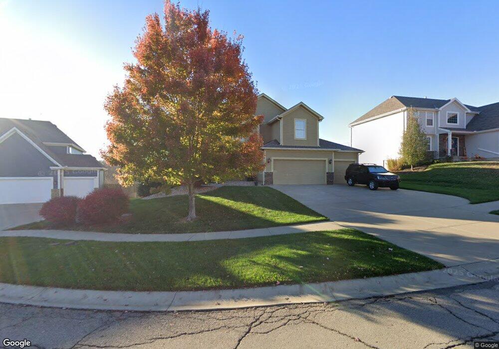
1310 Stone Ln Lansing, KS 66043
Estimated Value: $490,429 - $515,000
6
Beds
4
Baths
2,728
Sq Ft
$184/Sq Ft
Est. Value
About This Home
This home is located at 1310 Stone Ln, Lansing, KS 66043 and is currently estimated at $503,107, approximately $184 per square foot. 1310 Stone Ln is a home located in Leavenworth County with nearby schools including Lansing Elementary School, Lansing Middle 6-8, and Lansing High 9-12.
Ownership History
Date
Name
Owned For
Owner Type
Purchase Details
Closed on
Dec 23, 2011
Sold by
Jkm Partners Llc
Bought by
Dametz Jeffery D and Bobling Kristi K
Current Estimated Value
Home Financials for this Owner
Home Financials are based on the most recent Mortgage that was taken out on this home.
Original Mortgage
$304,237
Outstanding Balance
$208,318
Interest Rate
4.03%
Mortgage Type
New Conventional
Estimated Equity
$294,789
Create a Home Valuation Report for This Property
The Home Valuation Report is an in-depth analysis detailing your home's value as well as a comparison with similar homes in the area
Home Values in the Area
Average Home Value in this Area
Purchase History
| Date | Buyer | Sale Price | Title Company |
|---|---|---|---|
| Dametz Jeffery D | $380,296 | Mccaffree-Short Title Co Inc |
Source: Public Records
Mortgage History
| Date | Status | Borrower | Loan Amount |
|---|---|---|---|
| Open | Dametz Jeffery D | $304,237 |
Source: Public Records
Tax History Compared to Growth
Tax History
| Year | Tax Paid | Tax Assessment Tax Assessment Total Assessment is a certain percentage of the fair market value that is determined by local assessors to be the total taxable value of land and additions on the property. | Land | Improvement |
|---|---|---|---|---|
| 2025 | $7,319 | $55,984 | $6,317 | $49,667 |
| 2024 | $6,757 | $53,832 | $6,317 | $47,515 |
| 2023 | $6,757 | $51,704 | $6,317 | $45,387 |
| 2022 | $6,533 | $47,265 | $5,307 | $41,958 |
| 2021 | $6,447 | $44,620 | $5,307 | $39,313 |
| 2020 | $6,053 | $41,239 | $5,307 | $35,932 |
| 2019 | $5,956 | $40,526 | $5,307 | $35,219 |
| 2018 | $5,953 | $40,526 | $5,307 | $35,219 |
| 2017 | $5,802 | $39,415 | $5,307 | $34,108 |
| 2016 | $5,880 | $39,921 | $5,307 | $34,614 |
| 2015 | -- | $39,921 | $5,307 | $34,614 |
| 2014 | -- | $37,573 | $5,307 | $32,266 |
Source: Public Records
Map
Nearby Homes
- 1221 S Desoto Rd
- 1322 Rock Creek Ct
- 833 Rock Creek Dr
- 875 Clearview Dr
- 866 Clearview Dr
- 811 4-H Rd
- 922 Southfork St
- 24431 139th St
- 13965 Mc Intyre Rd
- 527 S Valley Dr
- 13788 McIntyre1 Rd
- 13788 Mcintyre Rd
- 13788 McIntyre2 Rd
- 00000 Gilman Rd
- 104 Olive St
- 522 Forestglen Ln
- 202 S Main St
- 124 S Main St
- 15251 Dempsey Rd
- 20958 Ida St
- 1308 Stone Ln
- 1312 Stone Ln
- 1306 Stone Ln
- 975 Clearview Dr
- 1313 Stone Ln
- 1311 Stone Ln
- 973 Clearview Dr
- 1304 Stone Ln
- 1309 Stone Ln
- 971 Clearview Dr
- 918 Cottonwood Dr
- 1307 Stone Ln
- 916 Cottonwood Dr
- 1302 Stone Ln
- 914 Cottonwood Dr
- 1360 Granite St
- 1358 Granite St
- 912 Cottonwood Dr
- 1305 Stone Ln
- 1356 Granite St