Estimated Value: $510,000 - $579,000
Studio
3
Baths
1,848
Sq Ft
$288/Sq Ft
Est. Value
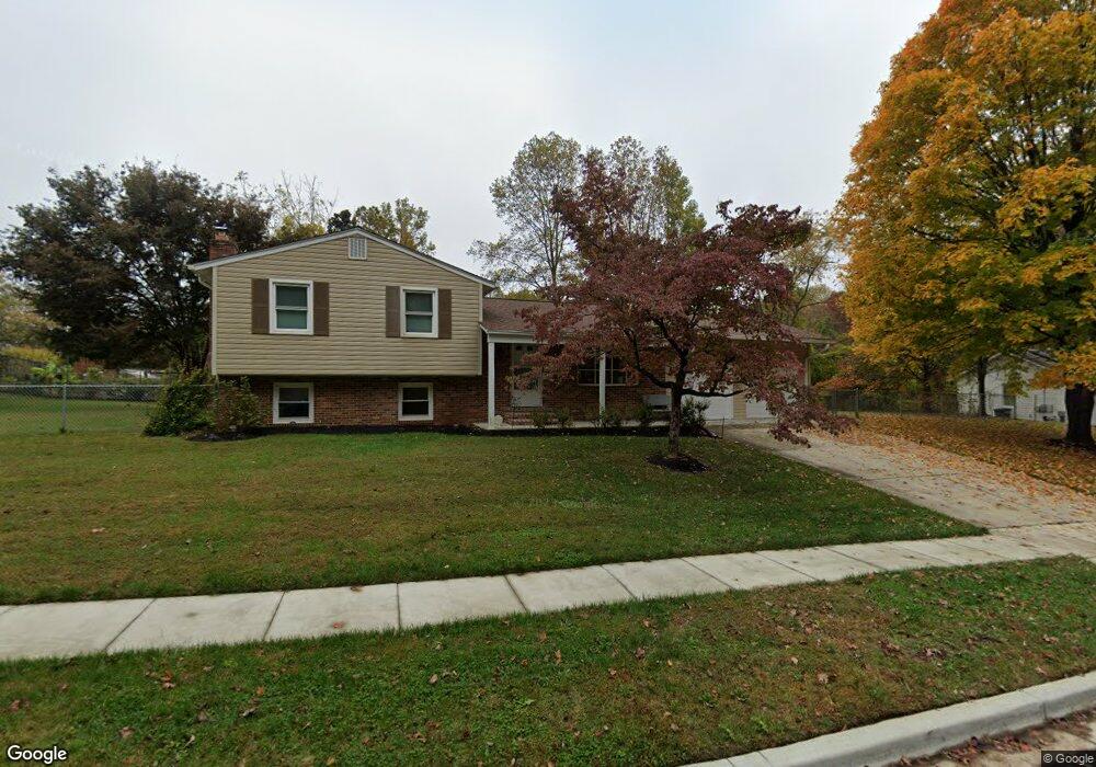
About This Home
This home is located at 13104 Pine Rd, Bowie, MD 20720 and is currently estimated at $532,609, approximately $288 per square foot. 13104 Pine Rd is a home located in Prince George's County with nearby schools including High Bridge Elementary School, Samuel Ogle Middle School, and Bowie High School.
Ownership History
Date
Name
Owned For
Owner Type
Purchase Details
Closed on
Nov 30, 2005
Sold by
Hoffman Bernadette M
Bought by
Clarke Ermine and Clarke Selwyn
Current Estimated Value
Purchase Details
Closed on
Sep 25, 2002
Sold by
Bean Bernadette M H
Bought by
Hoffman Bernadette M
Purchase Details
Closed on
Dec 12, 1996
Sold by
Bean Francis E Etal
Bought by
Bean Bernadette M H
Purchase Details
Closed on
Apr 3, 1995
Sold by
Sniffin Robert A
Bought by
Bean Francis E
Home Financials for this Owner
Home Financials are based on the most recent Mortgage that was taken out on this home.
Original Mortgage
$163,400
Interest Rate
8.8%
Create a Home Valuation Report for This Property
The Home Valuation Report is an in-depth analysis detailing your home's value as well as a comparison with similar homes in the area
Home Values in the Area
Average Home Value in this Area
Purchase History
| Date | Buyer | Sale Price | Title Company |
|---|---|---|---|
| Clarke Ermine | $377,000 | -- | |
| Hoffman Bernadette M | -- | -- | |
| Bean Bernadette M H | -- | -- | |
| Bean Francis E | $172,000 | -- |
Source: Public Records
Mortgage History
| Date | Status | Borrower | Loan Amount |
|---|---|---|---|
| Previous Owner | Bean Francis E | $163,400 |
Source: Public Records
Tax History
| Year | Tax Paid | Tax Assessment Tax Assessment Total Assessment is a certain percentage of the fair market value that is determined by local assessors to be the total taxable value of land and additions on the property. | Land | Improvement |
|---|---|---|---|---|
| 2025 | $3,446 | $405,800 | $103,200 | $302,600 |
| 2024 | $3,446 | $386,500 | -- | -- |
| 2023 | $4,083 | $367,200 | $0 | $0 |
| 2022 | $3,257 | $347,900 | $103,200 | $244,700 |
| 2021 | $4,831 | $330,600 | $0 | $0 |
| 2020 | $4,719 | $313,300 | $0 | $0 |
| 2019 | $4,580 | $296,000 | $101,600 | $194,400 |
| 2018 | $5,469 | $286,733 | $0 | $0 |
| 2017 | $4,358 | $277,467 | $0 | $0 |
| 2016 | -- | $268,200 | $0 | $0 |
| 2015 | $4,637 | $261,633 | $0 | $0 |
| 2014 | $4,637 | $255,067 | $0 | $0 |
Source: Public Records
Map
Nearby Homes
- 12626 Hillmeade Station Dr
- 12941 Fletchertown Rd
- 13610 Woodedge Dr
- 6102 Gallery St
- 13121 Old Fletchertown Rd
- 7011 Old Chapel Dr
- 6809 Glenwood Ct
- 6207 Gothic Ln
- 12813 Vicar Woods Ln
- 6911 Pine Valley Dr
- 12318 Quilt Patch Ln
- 12302 Quintette Ln
- 5904 Chivalry Ct
- 8217 Quill Point Dr
- 12340 Quiet Owl Ln
- 12801 Willow Marsh Ln
- 11900 Wynnifred Place
- 11824 Wynnifred Place
- 12330 Quarterback Ct
- 7400 Prospect Hill Ct
- 13212 Dangelo Dr
- 13210 Dangelo Dr
- 6803 Dangelo Ct
- 13106 Pine Rd
- 13105 Pine Rd
- 13101 Pine Rd
- 6801 Dangelo Ct
- 6805 Dangelo Ct
- 13218 Dangelo Dr
- 13005 Pine Ct
- 13211 Dangelo Dr
- 13213 Dangelo Dr
- 13003 Pine Ct
- 6800 Dangelo Ct
- 13209 Dangelo Dr
- 13215 Dangelo Dr
- 6802 Dangelo Ct
- 6806 Dangelo Ct
- 13207 Dangelo Dr
- 13220 Dangelo Dr
Your Personal Tour Guide
Ask me questions while you tour the home.