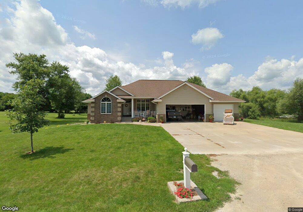
1311 Boundary Ave Center Point, IA 52213
Estimated Value: $322,000 - $458,973
4
Beds
6
Baths
1,902
Sq Ft
$195/Sq Ft
Est. Value
About This Home
This home is located at 1311 Boundary Ave, Center Point, IA 52213 and is currently estimated at $370,991, approximately $195 per square foot. 1311 Boundary Ave is a home located in Linn County with nearby schools including Center Point-Urbana Primary School, Center Point-Urbana Intermediate School, and Center Point-Urbana Middle School.
Ownership History
Date
Name
Owned For
Owner Type
Purchase Details
Closed on
Oct 21, 2004
Sold by
Dunn Conrad M and Dunn Naomi
Bought by
Wilkinson Joe A and Wilkinson Carrie
Current Estimated Value
Create a Home Valuation Report for This Property
The Home Valuation Report is an in-depth analysis detailing your home's value as well as a comparison with similar homes in the area
Home Values in the Area
Average Home Value in this Area
Purchase History
| Date | Buyer | Sale Price | Title Company |
|---|---|---|---|
| Wilkinson Joe A | $37,500 | -- |
Source: Public Records
Tax History Compared to Growth
Tax History
| Year | Tax Paid | Tax Assessment Tax Assessment Total Assessment is a certain percentage of the fair market value that is determined by local assessors to be the total taxable value of land and additions on the property. | Land | Improvement |
|---|---|---|---|---|
| 2025 | $7,400 | $496,100 | $52,600 | $443,500 |
| 2024 | $7,520 | $417,800 | $52,600 | $365,200 |
| 2023 | $7,520 | $417,800 | $52,600 | $365,200 |
| 2022 | $7,316 | $358,100 | $52,600 | $305,500 |
| 2021 | $7,012 | $349,400 | $52,600 | $296,800 |
| 2020 | $7,012 | $318,400 | $52,600 | $265,800 |
| 2019 | $6,376 | $297,700 | $52,600 | $245,100 |
| 2018 | $6,230 | $297,700 | $52,600 | $245,100 |
| 2017 | $6,340 | $294,100 | $52,600 | $241,500 |
| 2016 | $6,303 | $294,100 | $52,600 | $241,500 |
| 2015 | $6,309 | $294,100 | $52,600 | $241,500 |
| 2014 | $6,122 | $290,300 | $48,800 | $241,500 |
| 2013 | $5,998 | $290,300 | $48,800 | $241,500 |
Source: Public Records
Map
Nearby Homes
- 1109 Grubbs St
- 1010 Northview Dr
- 1120 Central Ave
- 920 E Washington St
- 507 Maplewood Dr
- 702 Central Ave
- 809 Iowa St
- 1208 Franklin St
- 508 Vine St
- 316 E Washington St
- 0 Iowa St
- 115 Main St
- 120 Green St
- 718 Pointer Cir
- 717 Pointer Cir
- 132 Green St
- 708 Rogers Ln
- 603 Pointer Cir
- 31 Acres N Center Point Rd
- 523 Rogers Ln
- 1218 Grubbs St
- 1216 Grubbs St
- 1214 Grubbs St
- 1312 Grande Ave
- 1310 Grande Ave
- 1314 Grande Ave
- 1308 Grande Ave
- 1200 Grubbs St
- 1306 Grande Ave
- 1026 1st St
- 1304 Grande Ave
- 1024 1st St
- 1024 1st St
- 4197 Central City Rd
- 1302 Grande Ave
- 1311 Grande Ave
- 1309 Grande Ave
- 1313 Grande Ave
- 1020 1st St
- 1307 Grande Ave