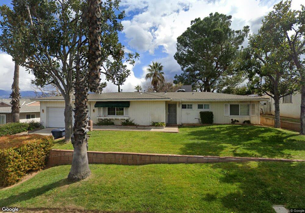
1311 Ford St Redlands, CA 92374
South Redlands NeighborhoodEstimated Value: $589,781 - $702,000
3
Beds
2
Baths
1,673
Sq Ft
$378/Sq Ft
Est. Value
About This Home
This home is located at 1311 Ford St, Redlands, CA 92374 and is currently estimated at $632,195, approximately $377 per square foot. 1311 Ford St is a home located in San Bernardino County with nearby schools including Mariposa Elementary School, Moore Middle School, and Redlands East Valley High School.
Ownership History
Date
Name
Owned For
Owner Type
Purchase Details
Closed on
Mar 13, 1996
Sold by
Pugh Donald L
Bought by
Axelrod Bradley Jay and Axelrod Timberly Rae
Current Estimated Value
Home Financials for this Owner
Home Financials are based on the most recent Mortgage that was taken out on this home.
Original Mortgage
$123,057
Outstanding Balance
$4,818
Interest Rate
7.01%
Mortgage Type
FHA
Estimated Equity
$627,377
Create a Home Valuation Report for This Property
The Home Valuation Report is an in-depth analysis detailing your home's value as well as a comparison with similar homes in the area
Home Values in the Area
Average Home Value in this Area
Purchase History
| Date | Buyer | Sale Price | Title Company |
|---|---|---|---|
| Axelrod Bradley Jay | $124,000 | Fidelity National Title Ins |
Source: Public Records
Mortgage History
| Date | Status | Borrower | Loan Amount |
|---|---|---|---|
| Open | Axelrod Bradley Jay | $123,057 |
Source: Public Records
Tax History Compared to Growth
Tax History
| Year | Tax Paid | Tax Assessment Tax Assessment Total Assessment is a certain percentage of the fair market value that is determined by local assessors to be the total taxable value of land and additions on the property. | Land | Improvement |
|---|---|---|---|---|
| 2025 | $2,418 | $205,995 | $58,144 | $147,851 |
| 2024 | $2,418 | $201,956 | $57,004 | $144,952 |
| 2023 | $2,415 | $197,996 | $55,886 | $142,110 |
| 2022 | $2,381 | $194,114 | $54,790 | $139,324 |
| 2021 | $2,424 | $190,308 | $53,716 | $136,592 |
| 2020 | $2,388 | $188,356 | $53,165 | $135,191 |
| 2019 | $2,322 | $184,663 | $52,123 | $132,540 |
| 2018 | $2,264 | $181,042 | $51,101 | $129,941 |
| 2017 | $2,246 | $177,492 | $50,099 | $127,393 |
| 2016 | $2,221 | $174,012 | $49,117 | $124,895 |
| 2015 | $2,204 | $171,398 | $48,379 | $123,019 |
| 2014 | $2,165 | $168,040 | $47,431 | $120,609 |
Source: Public Records
Map
Nearby Homes
- 1200 E Highland Ave Unit 207
- 1410 Pleasantview Dr
- 1438 Moore St
- 1432 Moore St
- 1442 Moore St
- 1502 Marion Rd
- 1446 Moore St
- Belmont Plan at Havenwood
- Camden Plan at Havenwood
- Lexington Plan at Havenwood
- Windsor Plan at Havenwood
- 0 Ford St
- 1033 Evergreen Ct
- 1550 Marion Rd
- 743 Mcauliffe Ct
- 1556 Gary Ln
- 709 Calle de Silva
- 1563 Gary Ln
- 56 Dearborn Cir
- 110 Judson St
- 1307 Ford St
- 1315 Ford St
- 1314 Rolling Hills Rd
- 1318 Rolling Hills Rd
- 1310 Rolling Hills Rd
- 1319 Ford St
- 1303 Ford St
- 1304 Rolling Hills Rd
- 1322 Rolling Hills Rd
- 1323 Ford St
- 1317 Rolling Hills Rd
- 1313 Rolling Hills Rd
- 1321 Rolling Hills Rd
- 1311 Crestview Rd
- 1300 Farview Ln
- 1315 Crestview Rd
- 1309 Rolling Hills Rd
- 1319 Crestview Rd
- 1324 Farview Ln
- 1320 Farview Ln