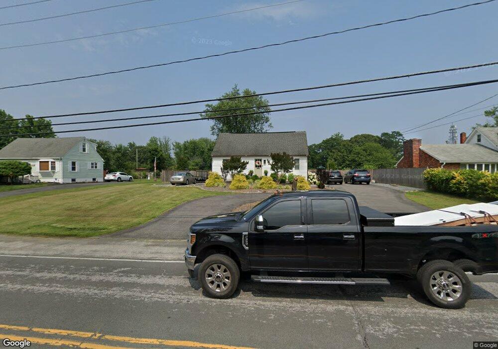
1311 Jones Station Rd Arnold, MD 21012
Estimated Value: $395,000 - $573,000
--
Bed
2
Baths
1,998
Sq Ft
$258/Sq Ft
Est. Value
About This Home
This home is located at 1311 Jones Station Rd, Arnold, MD 21012 and is currently estimated at $514,999, approximately $257 per square foot. 1311 Jones Station Rd is a home located in Anne Arundel County with nearby schools including Arnold Elementary School, Severn River Middle School, and Broadneck High School.
Ownership History
Date
Name
Owned For
Owner Type
Purchase Details
Closed on
Jul 8, 2019
Sold by
Mcmonigle Corey and Hubbard Kailey
Bought by
Mcmonigle Corey Sean and Mcmonigle Angela
Current Estimated Value
Home Financials for this Owner
Home Financials are based on the most recent Mortgage that was taken out on this home.
Original Mortgage
$260,000
Interest Rate
3.7%
Mortgage Type
New Conventional
Purchase Details
Closed on
Oct 11, 2018
Sold by
Mcmonigle Corey and Estate Of Amy C Mcmonigle
Bought by
Mcmonigle Corey and Hubbard Kailey
Purchase Details
Closed on
Jul 22, 1987
Sold by
Leocha John G
Bought by
Mcmonigle Dennis C and Mcmonigle Amy C
Home Financials for this Owner
Home Financials are based on the most recent Mortgage that was taken out on this home.
Original Mortgage
$103,550
Interest Rate
10.23%
Create a Home Valuation Report for This Property
The Home Valuation Report is an in-depth analysis detailing your home's value as well as a comparison with similar homes in the area
Home Values in the Area
Average Home Value in this Area
Purchase History
| Date | Buyer | Sale Price | Title Company |
|---|---|---|---|
| Mcmonigle Corey Sean | $260,000 | Eagle Title Llc | |
| Mcmonigle Corey | -- | None Available | |
| Mcmonigle Dennis C | $109,000 | -- |
Source: Public Records
Mortgage History
| Date | Status | Borrower | Loan Amount |
|---|---|---|---|
| Previous Owner | Mcmonigle Corey Sean | $260,000 | |
| Previous Owner | Mcmonigle Dennis C | $103,550 |
Source: Public Records
Tax History Compared to Growth
Tax History
| Year | Tax Paid | Tax Assessment Tax Assessment Total Assessment is a certain percentage of the fair market value that is determined by local assessors to be the total taxable value of land and additions on the property. | Land | Improvement |
|---|---|---|---|---|
| 2025 | $5,099 | $434,967 | -- | -- |
| 2024 | $5,099 | $419,800 | $271,300 | $148,500 |
| 2023 | $4,535 | $415,267 | $0 | $0 |
| 2022 | $4,722 | $410,733 | $0 | $0 |
| 2021 | $9,350 | $406,200 | $256,300 | $149,900 |
| 2020 | $4,408 | $384,400 | $0 | $0 |
| 2019 | $5,048 | $362,600 | $0 | $0 |
| 2018 | $3,456 | $340,800 | $199,700 | $141,100 |
| 2017 | $2,422 | $331,067 | $0 | $0 |
| 2016 | -- | $321,333 | $0 | $0 |
| 2015 | -- | $311,600 | $0 | $0 |
| 2014 | -- | $310,300 | $0 | $0 |
Source: Public Records
Map
Nearby Homes
- 340 Candle Ridge Dr
- 33 Sheridan Rd
- 1433 Gilbert Rd
- 1217 Springwood Ct
- 1256 Crowell Ct
- 1224 Hickory Hill Cir
- 400 Colonial Ridge Ln
- 150 Merrimack Way
- 1231 Summerwood Ct
- Severn Plan at Ford's Grant
- Magothy Plan at Ford's Grant
- Newport Plan at Ford's Grant
- 330 Carronade Way
- 1512 Winterberry Dr
- 00 Mazie
- 1249 Birchcrest Ct
- 0000 Mazie
- 000 Mazie Way
- 1426 Silver Oak Ln
- 478 Bay Green Dr
- 1309 Jones Station Rd
- 1313 Jones Station Rd
- 1307 Jones Station Rd
- 1315 Jones Station Rd
- 1312 Jones Station Rd
- 1305 Jones Station Rd
- 1317 Jones Station Rd
- 1306 Jones Station Rd
- 135 Church Rd
- 1303 Jones Station Rd
- 132 Church Rd
- 133 Church Rd
- 1325 Jones Station Rd
- 253 Shore Acres Rd
- 1302 Bonito Ct
- 1318 Jones Station Rd
- 251 Shore Acres Rd
- 131 Church Rd
- 255 Shore Acres Rd
- 1319 Jones Station Rd