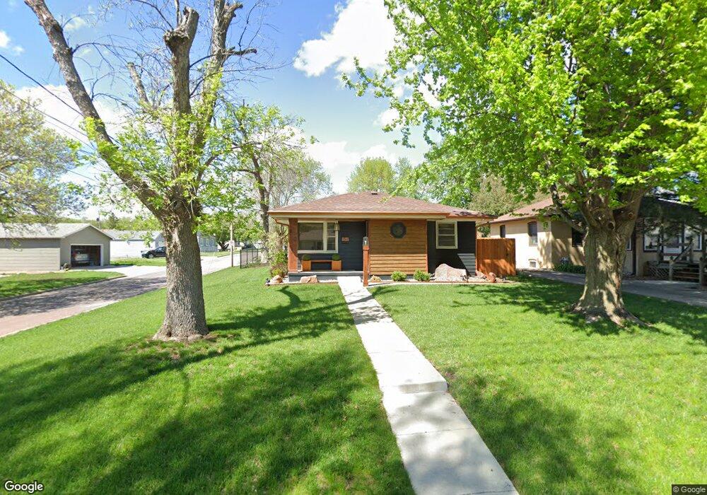
1311 Lewis Ave Des Moines, IA 50315
Watrous South NeighborhoodEstimated Value: $187,000 - $216,000
3
Beds
2
Baths
1,096
Sq Ft
$188/Sq Ft
Est. Value
About This Home
This home is located at 1311 Lewis Ave, Des Moines, IA 50315 and is currently estimated at $205,884, approximately $187 per square foot. 1311 Lewis Ave is a home located in Polk County with nearby schools including Wright Elementary School, Brody Middle School, and Lincoln High School.
Ownership History
Date
Name
Owned For
Owner Type
Purchase Details
Closed on
May 23, 2003
Sold by
Hamilton Leslie D and Hamilton Constance F
Bought by
Stclair Jon E and Leo Victtoria K
Current Estimated Value
Home Financials for this Owner
Home Financials are based on the most recent Mortgage that was taken out on this home.
Original Mortgage
$94,800
Outstanding Balance
$41,682
Interest Rate
5.95%
Mortgage Type
Purchase Money Mortgage
Estimated Equity
$164,202
Purchase Details
Closed on
Mar 18, 1999
Sold by
Gamble Wesley H
Bought by
Hamilton Leslie D and Hamilton Constance F
Home Financials for this Owner
Home Financials are based on the most recent Mortgage that was taken out on this home.
Original Mortgage
$76,000
Interest Rate
6.8%
Create a Home Valuation Report for This Property
The Home Valuation Report is an in-depth analysis detailing your home's value as well as a comparison with similar homes in the area
Home Values in the Area
Average Home Value in this Area
Purchase History
| Date | Buyer | Sale Price | Title Company |
|---|---|---|---|
| Stclair Jon E | $118,000 | -- | |
| Hamilton Leslie D | $79,500 | -- |
Source: Public Records
Mortgage History
| Date | Status | Borrower | Loan Amount |
|---|---|---|---|
| Open | Stclair Jon E | $94,800 | |
| Previous Owner | Hamilton Leslie D | $76,000 |
Source: Public Records
Tax History Compared to Growth
Tax History
| Year | Tax Paid | Tax Assessment Tax Assessment Total Assessment is a certain percentage of the fair market value that is determined by local assessors to be the total taxable value of land and additions on the property. | Land | Improvement |
|---|---|---|---|---|
| 2025 | $3,412 | $207,700 | $30,500 | $177,200 |
| 2024 | $3,412 | $183,900 | $26,600 | $157,300 |
| 2023 | $3,208 | $183,900 | $26,600 | $157,300 |
| 2022 | $3,182 | $145,000 | $21,900 | $123,100 |
| 2021 | $3,166 | $145,000 | $21,900 | $123,100 |
| 2020 | $3,284 | $135,500 | $20,500 | $115,000 |
| 2019 | $3,030 | $135,500 | $20,500 | $115,000 |
| 2018 | $2,994 | $121,300 | $17,900 | $103,400 |
| 2017 | $2,844 | $121,300 | $17,900 | $103,400 |
| 2016 | $2,766 | $113,700 | $16,600 | $97,100 |
| 2015 | $2,766 | $113,700 | $16,600 | $97,100 |
| 2014 | $2,774 | $113,100 | $16,100 | $97,000 |
Source: Public Records
Map
Nearby Homes
- 1223 Emma Ave
- 1219 Elder Ln
- 1207 Emma Ave
- 1204 Elder Ln
- 1203 Herold Ave
- 4108 SW 12th St
- 1116 Herold Ave
- 4020 SW 12th St
- 1229 Evans St
- 1607 Carrie Ave
- 4710 SW 16th St
- 1222 Watrous Ave
- 4506 Wakonda Pkwy
- 4916 SW 13th St
- 930 Emma Ave
- 1243 Hackley Ave
- 5013 SW 16th St
- 3724 SW 13th St
- 3808 SW 12th St
- 936 Mckinley Ave Unit 14