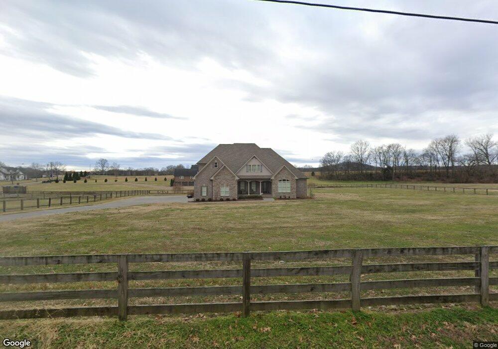
1311 Liberty Ln Gallatin, TN 37066
Estimated Value: $900,000 - $1,246,000
4
Beds
4
Baths
3,896
Sq Ft
$286/Sq Ft
Est. Value
About This Home
This home is located at 1311 Liberty Ln, Gallatin, TN 37066 and is currently estimated at $1,113,779, approximately $285 per square foot. 1311 Liberty Ln is a home with nearby schools including Station Camp High School.
Ownership History
Date
Name
Owned For
Owner Type
Purchase Details
Closed on
Oct 14, 2017
Sold by
Gaffney Stephan Andrew
Bought by
Graffney Stephan Andrew and Gaffney Suzanne
Current Estimated Value
Home Financials for this Owner
Home Financials are based on the most recent Mortgage that was taken out on this home.
Original Mortgage
$420,800
Outstanding Balance
$351,109
Interest Rate
3.78%
Mortgage Type
New Conventional
Estimated Equity
$762,670
Purchase Details
Closed on
Nov 7, 2016
Sold by
Brown Eddy C
Bought by
Gaffney Stephan Andrew
Purchase Details
Closed on
Oct 10, 2016
Sold by
Schrimpf Michael P and Larsen Schrimpf Netha D
Bought by
Brown Eddy C
Purchase Details
Closed on
Oct 5, 2015
Sold by
Brown Eddy C
Bought by
Schrimpf Michael P and Larsen Schrimpf Netha D
Purchase Details
Closed on
Jul 21, 2015
Sold by
Dorris Patricia Janan
Bought by
Brown Eddy C
Create a Home Valuation Report for This Property
The Home Valuation Report is an in-depth analysis detailing your home's value as well as a comparison with similar homes in the area
Home Values in the Area
Average Home Value in this Area
Purchase History
| Date | Buyer | Sale Price | Title Company |
|---|---|---|---|
| Graffney Stephan Andrew | -- | None Available | |
| Gaffney Stephan Andrew | $96,000 | None Available | |
| Brown Eddy C | $85,000 | None Available | |
| Schrimpf Michael P | $72,750 | Attorney | |
| Brown Eddy C | $67,500 | Brentwood Title & Escrow Llc |
Source: Public Records
Mortgage History
| Date | Status | Borrower | Loan Amount |
|---|---|---|---|
| Open | Graffney Stephan Andrew | $420,800 |
Source: Public Records
Tax History Compared to Growth
Tax History
| Year | Tax Paid | Tax Assessment Tax Assessment Total Assessment is a certain percentage of the fair market value that is determined by local assessors to be the total taxable value of land and additions on the property. | Land | Improvement |
|---|---|---|---|---|
| 2024 | $3,286 | $231,250 | $27,550 | $203,700 |
| 2023 | $3,965 | $176,075 | $20,375 | $155,700 |
| 2022 | $3,983 | $176,075 | $20,375 | $155,700 |
| 2021 | $3,983 | $176,075 | $20,375 | $155,700 |
| 2020 | $3,983 | $176,075 | $20,375 | $155,700 |
| 2019 | $3,983 | $0 | $0 | $0 |
| 2018 | $2,734 | $0 | $0 | $0 |
| 2017 | $265 | $0 | $0 | $0 |
| 2016 | $0 | $0 | $0 | $0 |
| 2015 | -- | $0 | $0 | $0 |
Source: Public Records
Map
Nearby Homes
- 662 Neals Ln
- 2045 Liberty Ln
- 650 Neals Ln
- 1176 Liberty Ln
- 315 Cummings Ln
- 1017 Wickshire Dr
- 1869 Tennessee 25
- 1328 Wentworth Dr
- 1036 Middleton Ln
- 305 Remington Ave
- 300 Remington Ave
- 540 Bradford Dr
- 172 Cavalcade Loop
- 1273 Wentworth Dr
- 360 Turfway Park
- The Ridgeport Plan at Carellton
- 137 Cavalcade Loop
- 1245 Amherst Ct
- 608 Bradford Dr
- 1239 Wentworth Dr