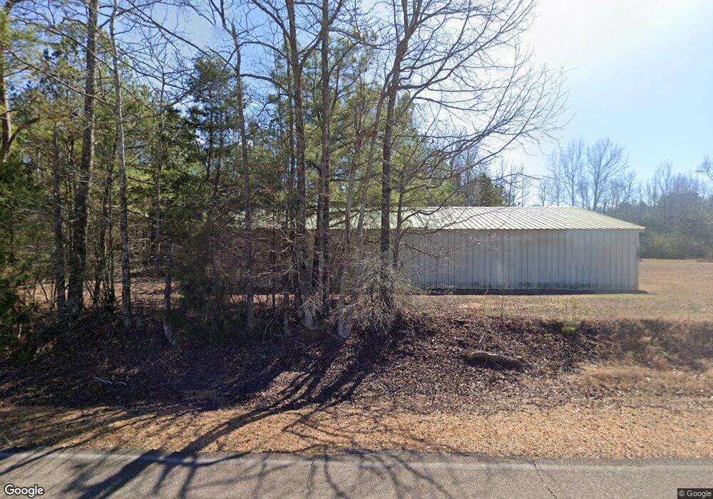
1311 Mac Davis Rd Columbus, MS 39702
Estimated Value: $219,000 - $262,000
Studio
1
Bath
2,277
Sq Ft
$107/Sq Ft
Est. Value
About This Home
This home is located at 1311 Mac Davis Rd, Columbus, MS 39702 and is currently estimated at $243,831, approximately $107 per square foot. 1311 Mac Davis Rd is a home.
Ownership History
Date
Name
Owned For
Owner Type
Purchase Details
Closed on
Jun 26, 2025
Sold by
Sisson David K
Bought by
Tedford Stephen Anthony and Tedford Jessica
Current Estimated Value
Home Financials for this Owner
Home Financials are based on the most recent Mortgage that was taken out on this home.
Original Mortgage
$202,759
Outstanding Balance
$202,063
Interest Rate
6.81%
Mortgage Type
FHA
Estimated Equity
$41,768
Purchase Details
Closed on
Apr 3, 2023
Sold by
Sisson Doyle D
Bought by
Rice Lona T
Purchase Details
Closed on
Aug 16, 2012
Sold by
Sisson Mary Frances Ayres
Bought by
Sisson Doyle D and Sisson David K
Create a Home Valuation Report for This Property
The Home Valuation Report is an in-depth analysis detailing your home's value as well as a comparison with similar homes in the area
Purchase History
| Date | Buyer | Sale Price | Title Company |
|---|---|---|---|
| Tedford Stephen Anthony | -- | None Listed On Document | |
| Tedford Stephen Anthony | -- | None Listed On Document | |
| Rice Lona T | -- | None Listed On Document | |
| Sisson Doyle D | -- | -- |
Source: Public Records
Mortgage History
| Date | Status | Borrower | Loan Amount |
|---|---|---|---|
| Open | Tedford Stephen Anthony | $202,759 | |
| Closed | Tedford Stephen Anthony | $202,759 |
Source: Public Records
Tax History
| Year | Tax Paid | Tax Assessment Tax Assessment Total Assessment is a certain percentage of the fair market value that is determined by local assessors to be the total taxable value of land and additions on the property. | Land | Improvement |
|---|---|---|---|---|
| 2025 | $1,489 | $15,222 | $0 | $0 |
| 2024 | $1,521 | $15,674 | $0 | $0 |
| 2023 | $1,272 | $13,167 | $0 | $0 |
| 2022 | $1,273 | $13,167 | $0 | $0 |
| 2021 | $1,226 | $13,167 | $0 | $0 |
| 2020 | $82 | $8,778 | $0 | $0 |
| 2019 | $85 | $8,473 | $0 | $0 |
| 2018 | $85 | $8,435 | $0 | $0 |
| 2017 | $81 | $8,435 | $0 | $0 |
| 2016 | $81 | $8,435 | $0 | $0 |
| 2015 | $66 | $8,261 | $0 | $0 |
| 2014 | $66 | $8,261 | $0 | $0 |
Source: Public Records
Map
Nearby Homes
- 83 Bowling Green Cir
- Lot 3 Lost Lake Hills Rd
- 0 Lost Lake Hills Rd
- 127 E Cherry St
- 2746 Phillips Hill Rd
- 291 Muddy Ln
- 220 Woodridge Place
- 72 N Colby Ln
- 72 Colby Ln
- 16 Jenny Ln
- 0 Hwy Us-82
- 248 Lakeover Dr W
- 2362 Tabernacle Rd
- 24 Lacy Rd
- 0 Fiesta Dr
- 262 Center Rd
- 142 Lenox Ln
- 159 Lenox Ln
- 29 Lenox Ln
- 17 Paige Cove
- 1141 Mac Davis Rd
- 1196 Mac Davis Rd
- 148 Old McCrary Rd
- 1421 Mac Davis Rd
- 39 Blasingame Dr
- 169 Old McCrary Rd
- 27 Blasingame Dr
- 77 Blasingame Dr
- 30 Bobbitt St
- 1139 Mac Davis Rd
- 101 Blasingame Dr
- 64 Bobbitt St
- 111 Blasingame Dr
- 211 Old McCrary Rd
- 1170 Mac Davis Rd
- 1075 Mac Davis Rd
- 84 Bobbitt St
- 137 Blasingame Dr
- 37 Bobbitt St
- 36 Blasingame Dr
Your Personal Tour Guide
Ask me questions while you tour the home.