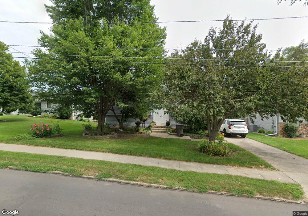
1311 Porter Ave Des Moines, IA 50315
Watrous South NeighborhoodEstimated Value: $259,000 - $301,000
--
Bed
3
Baths
1,379
Sq Ft
$203/Sq Ft
Est. Value
About This Home
This home is located at 1311 Porter Ave, Des Moines, IA 50315 and is currently estimated at $280,448, approximately $203 per square foot. 1311 Porter Ave is a home located in Polk County with nearby schools including Wright Elementary School, Brody Middle School, and Lincoln High School.
Ownership History
Date
Name
Owned For
Owner Type
Purchase Details
Closed on
Sep 23, 1999
Sold by
Mccoy Matthew W and Mccoy Jennifer S
Bought by
Andeson Richard and Anderson Barabara
Current Estimated Value
Home Financials for this Owner
Home Financials are based on the most recent Mortgage that was taken out on this home.
Original Mortgage
$108,800
Interest Rate
7.93%
Mortgage Type
Credit Line Revolving
Create a Home Valuation Report for This Property
The Home Valuation Report is an in-depth analysis detailing your home's value as well as a comparison with similar homes in the area
Home Values in the Area
Average Home Value in this Area
Purchase History
| Date | Buyer | Sale Price | Title Company |
|---|---|---|---|
| Andeson Richard | $143,000 | -- |
Source: Public Records
Mortgage History
| Date | Status | Borrower | Loan Amount |
|---|---|---|---|
| Closed | Andeson Richard | $108,800 |
Source: Public Records
Tax History Compared to Growth
Tax History
| Year | Tax Paid | Tax Assessment Tax Assessment Total Assessment is a certain percentage of the fair market value that is determined by local assessors to be the total taxable value of land and additions on the property. | Land | Improvement |
|---|---|---|---|---|
| 2025 | $4,956 | $304,400 | $37,700 | $266,700 |
| 2024 | $4,956 | $269,400 | $32,900 | $236,500 |
| 2023 | $5,006 | $269,400 | $32,900 | $236,500 |
| 2022 | $4,966 | $221,300 | $28,000 | $193,300 |
| 2021 | $4,754 | $221,300 | $28,000 | $193,300 |
| 2020 | $4,934 | $199,100 | $25,100 | $174,000 |
| 2019 | $4,738 | $199,100 | $25,100 | $174,000 |
| 2018 | $4,684 | $184,800 | $22,600 | $162,200 |
| 2017 | $4,752 | $184,800 | $22,600 | $162,200 |
| 2016 | $4,624 | $184,200 | $22,100 | $162,100 |
| 2015 | $4,624 | $184,200 | $22,100 | $162,100 |
| 2014 | $4,480 | $183,900 | $21,800 | $162,100 |
Source: Public Records
Map
Nearby Homes
- 1401 Cutler Ave
- 1304 Wall Ave
- 1207 Kenyon Ave
- 5120 SW 14th St
- 1210 Highview Dr
- 1419 Payton Ave
- 1616 Porter Ave
- 1616 Southlawn Dr
- 6001 SW 13th Place
- 1243 Hackley Ave
- 1605 Frazier Ave
- 1010 Frederick Ave
- 5013 SW 16th St
- 1810 Porter Ave
- 6107 SW 14th St
- 4916 SW 13th St
- 1310 Leland Ave
- 5407 SW 9th St
- 1229 Evans St
- 1500 Leland Ave
- 1309 Porter Ave
- 1313 Porter Ave
- 1307 Porter Ave
- 5432 SW 13th St
- 5426 SW 13th St
- 5440 SW 13th St
- 1302 Porter Ave
- 1305 Porter Ave
- 1304 Porter Ave
- 1300 Porter Ave
- 1312 Cutler Ave
- 1306 Porter Ave
- 1306 Cutler Ave
- 1220 Porter Ave
- 1316 Cutler Ave
- 1351 Porter Ave
- 1322 Cutler Ave
- 1218 Porter Ave
- 1355 Porter Ave
- 1215 Porter Ave