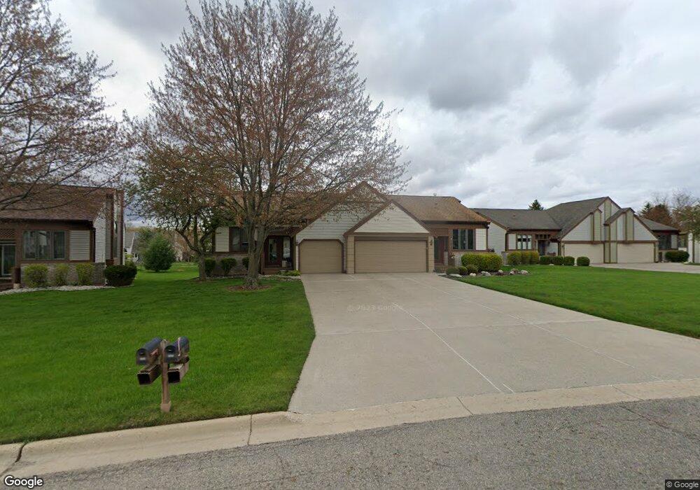
1312 Brookside Dr Unit 80 Lansing, MI 48917
Estimated Value: $222,903 - $245,000
2
Beds
2
Baths
991
Sq Ft
$235/Sq Ft
Est. Value
About This Home
This home is located at 1312 Brookside Dr Unit 80, Lansing, MI 48917 and is currently estimated at $232,976, approximately $235 per square foot. 1312 Brookside Dr Unit 80 is a home located in Eaton County with nearby schools including Willow Ridge Elementary School, Leon W. Hayes Middle School, and Grand Ledge High School.
Ownership History
Date
Name
Owned For
Owner Type
Purchase Details
Closed on
Oct 25, 2023
Sold by
Shattuck Dawn L
Bought by
Owings Renee M
Current Estimated Value
Purchase Details
Closed on
Oct 29, 2019
Sold by
Shattuck Dawn L and Owings Renee M
Bought by
Shattuck Dawn L and Owings Renee M
Purchase Details
Closed on
Dec 3, 2009
Sold by
Shattuck Dawn L and Owings Renee M
Bought by
Shattuck Dawn L and Dawn Shattuck Revocable Trust
Purchase Details
Closed on
Apr 29, 2005
Sold by
Rapelje Harold E
Bought by
Shattuck Dawn L and Owings Renee M
Home Financials for this Owner
Home Financials are based on the most recent Mortgage that was taken out on this home.
Original Mortgage
$126,400
Interest Rate
6.06%
Mortgage Type
Fannie Mae Freddie Mac
Create a Home Valuation Report for This Property
The Home Valuation Report is an in-depth analysis detailing your home's value as well as a comparison with similar homes in the area
Home Values in the Area
Average Home Value in this Area
Purchase History
| Date | Buyer | Sale Price | Title Company |
|---|---|---|---|
| Owings Renee M | -- | None Listed On Document | |
| Shattuck Dawn L | -- | None Available | |
| Shattuck Dawn L | -- | None Available | |
| Shattuck Dawn L | $158,000 | Midstate |
Source: Public Records
Mortgage History
| Date | Status | Borrower | Loan Amount |
|---|---|---|---|
| Previous Owner | Shattuck Dawn L | $126,400 |
Source: Public Records
Tax History
| Year | Tax Paid | Tax Assessment Tax Assessment Total Assessment is a certain percentage of the fair market value that is determined by local assessors to be the total taxable value of land and additions on the property. | Land | Improvement |
|---|---|---|---|---|
| 2025 | $3,820 | $104,900 | $0 | $0 |
| 2024 | $2,484 | $95,900 | $0 | $0 |
| 2023 | $2,338 | $89,700 | $0 | $0 |
| 2022 | $3,303 | $85,100 | $0 | $0 |
| 2021 | $3,170 | $79,100 | $0 | $0 |
| 2020 | $3,127 | $75,600 | $0 | $0 |
| 2019 | $3,076 | $70,272 | $0 | $0 |
| 2018 | $2,927 | $68,400 | $0 | $0 |
| 2017 | $2,864 | $63,900 | $0 | $0 |
| 2016 | -- | $59,800 | $0 | $0 |
| 2015 | -- | $57,700 | $0 | $0 |
| 2014 | -- | $50,495 | $0 | $0 |
| 2013 | -- | $49,700 | $0 | $0 |
Source: Public Records
Map
Nearby Homes
- 6542 Brook Trail
- 6528 Brook Trail Unit 21
- 6527 Brook Trail Unit 18
- 6525 Brook Trail Unit 17
- 1026 Brookside Dr
- 1205 Woodmeadow Unit 201
- 1527 Lindy Dr
- 1156 Wolf Run Dr
- 1106 S Ridge Rd
- 7234 Farm Hill Dr Unit 36
- 1738 Willow Creek Dr Unit 63
- 6142 W Saginaw Hwy
- 6403 Willow Bend Dr
- 6102 Bradford Ln
- 1510 Sand Point Dr
- 2120 Walmar Dr
- 0 Lot B Willow
- 7315 Chellmar Dr Unit 49
- 7225 Creekside Dr Unit 37
- 0 Lot C Willow
- 1318 Brookside Dr
- 1320 Brookside Dr Unit 82
- 1308 Brookside Dr Unit 78
- 1322 Brookside Dr Unit 83
- 1306 Brookside Dr
- 1306 Brookside Dr Unit 77
- 1324 Brookside Dr Unit 84
- 1313 Brookside Dr
- 1304 Brookside Dr Unit 76
- 1302 Brookside Dr
- 1302 Brookside Dr Unit 75
- 1319 Brookside Dr
- 1319 Brookside Dr Unit 94
- 1226 Brookside Dr
- 6719 Conestoga Dr
Your Personal Tour Guide
Ask me questions while you tour the home.