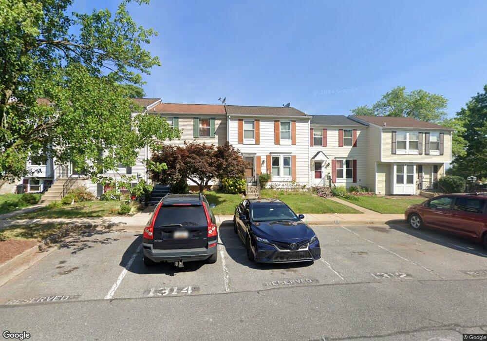
1312 David Ln Frederick, MD 21703
Frederick Heights/Overlook NeighborhoodEstimated Value: $311,743 - $331,000
Studio
2
Baths
1,120
Sq Ft
$285/Sq Ft
Est. Value
About This Home
This home is located at 1312 David Ln, Frederick, MD 21703 and is currently estimated at $318,936, approximately $284 per square foot. 1312 David Ln is a home located in Frederick County with nearby schools including Hillcrest Elementary School, West Frederick Middle School, and Frederick High School.
Ownership History
Date
Name
Owned For
Owner Type
Purchase Details
Closed on
Nov 7, 2022
Sold by
Starkey Linda Carol
Bought by
Musgrove Howard Franklin
Current Estimated Value
Purchase Details
Closed on
Jun 21, 2004
Sold by
Helmka Carol A
Bought by
Musgrove Howard F and Musgrove Nancy L
Purchase Details
Closed on
Jul 17, 1989
Sold by
Benjamin Andrew C and Benjamin Janice I
Bought by
Helmka Carol A
Home Financials for this Owner
Home Financials are based on the most recent Mortgage that was taken out on this home.
Original Mortgage
$94,300
Interest Rate
9.82%
Purchase Details
Closed on
May 13, 1988
Sold by
Beazell John C and Beazell Karen R
Bought by
Benjamin Andrew C and Benjamin Janice I
Home Financials for this Owner
Home Financials are based on the most recent Mortgage that was taken out on this home.
Original Mortgage
$65,809
Interest Rate
10.4%
Create a Home Valuation Report for This Property
The Home Valuation Report is an in-depth analysis detailing your home's value as well as a comparison with similar homes in the area
Home Values in the Area
Average Home Value in this Area
Purchase History
| Date | Buyer | Sale Price | Title Company |
|---|---|---|---|
| Musgrove Howard Franklin | -- | -- | |
| Musgrove Howard F | $175,000 | -- | |
| Helmka Carol A | $90,000 | -- | |
| Benjamin Andrew C | $83,000 | -- |
Source: Public Records
Mortgage History
| Date | Status | Borrower | Loan Amount |
|---|---|---|---|
| Previous Owner | Helmka Carol A | $94,300 | |
| Previous Owner | Benjamin Andrew C | $65,809 |
Source: Public Records
Tax History
| Year | Tax Paid | Tax Assessment Tax Assessment Total Assessment is a certain percentage of the fair market value that is determined by local assessors to be the total taxable value of land and additions on the property. | Land | Improvement |
|---|---|---|---|---|
| 2025 | $3,566 | $256,200 | $85,000 | $171,200 |
| 2024 | $3,566 | $233,400 | $0 | $0 |
| 2023 | $3,297 | $210,600 | $0 | $0 |
| 2022 | $3,152 | $187,800 | $55,000 | $132,800 |
| 2021 | $2,013 | $177,500 | $0 | $0 |
| 2020 | $3,621 | $167,200 | $0 | $0 |
| 2019 | $2,695 | $156,900 | $42,000 | $114,900 |
| 2018 | $2,620 | $146,867 | $0 | $0 |
| 2017 | $1,226 | $156,900 | $0 | $0 |
| 2016 | $1,911 | $126,800 | $0 | $0 |
| 2015 | $1,911 | $126,800 | $0 | $0 |
| 2014 | $1,911 | $126,800 | $0 | $0 |
Source: Public Records
Map
Nearby Homes
- 1228 Danielle Dr
- 1249 A Danielle Dr Unit 1249A
- 1236C Danielle Dr
- 29 Mountaingate Dr
- 1339 Orchard Way
- 58 Apple Way
- 496 Sulky Ln
- 584 Pumphouse Rd
- 1139 Providence Ct
- 1159 Daffodil Dr
- 525 Beebe Ct
- 543 Wellington Ct
- 524 Lancaster Place Unit 524
- 18 S Pendleton Ct Unit 10C
- 534 Lancaster Place
- 526 Essex Place
- 1123 Keswick Place
- 336 Paca Gardens Ln
- 615 Himes Ave Unit 108
- 615 Himes Ave Unit 106
Your Personal Tour Guide
Ask me questions while you tour the home.