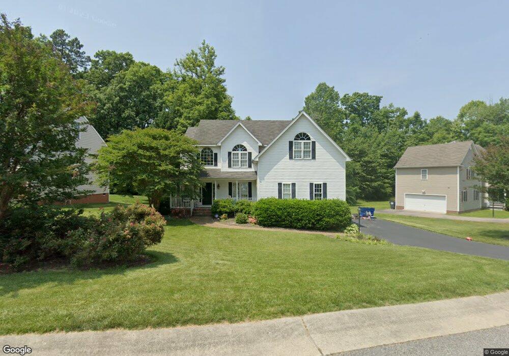
1312 Lomond Dr Midlothian, VA 23114
Estimated Value: $486,392 - $506,000
4
Beds
3
Baths
2,298
Sq Ft
$217/Sq Ft
Est. Value
About This Home
This home is located at 1312 Lomond Dr, Midlothian, VA 23114 and is currently estimated at $498,348, approximately $216 per square foot. 1312 Lomond Dr is a home located in Chesterfield County with nearby schools including W W Gordon Elementary School, Midlothian Middle School, and Monacan High School.
Ownership History
Date
Name
Owned For
Owner Type
Purchase Details
Closed on
Mar 16, 2016
Sold by
Wood Harold Edward and Wood Melissa P
Bought by
Hopke Lindsay M and Hopke Linda H
Current Estimated Value
Home Financials for this Owner
Home Financials are based on the most recent Mortgage that was taken out on this home.
Original Mortgage
$255,494
Outstanding Balance
$206,926
Interest Rate
4.37%
Mortgage Type
FHA
Estimated Equity
$291,422
Purchase Details
Closed on
Mar 31, 2004
Sold by
Long Long and Long Kelleman
Bought by
Wood Harold
Home Financials for this Owner
Home Financials are based on the most recent Mortgage that was taken out on this home.
Original Mortgage
$216,000
Interest Rate
5.56%
Mortgage Type
New Conventional
Purchase Details
Closed on
Nov 7, 2002
Sold by
Capitol Builders Inc
Bought by
Wood Harold E and Wood Melissa P
Home Financials for this Owner
Home Financials are based on the most recent Mortgage that was taken out on this home.
Original Mortgage
$207,840
Interest Rate
6.04%
Mortgage Type
New Conventional
Create a Home Valuation Report for This Property
The Home Valuation Report is an in-depth analysis detailing your home's value as well as a comparison with similar homes in the area
Home Values in the Area
Average Home Value in this Area
Purchase History
| Date | Buyer | Sale Price | Title Company |
|---|---|---|---|
| Hopke Lindsay M | $279,000 | Attorney | |
| Wood Harold | $216,000 | -- | |
| Wood Harold E | $207,840 | -- |
Source: Public Records
Mortgage History
| Date | Status | Borrower | Loan Amount |
|---|---|---|---|
| Open | Hopke Lindsay M | $255,494 | |
| Previous Owner | Wood Harold | $216,000 | |
| Previous Owner | Wood Harold E | $207,840 |
Source: Public Records
Tax History Compared to Growth
Tax History
| Year | Tax Paid | Tax Assessment Tax Assessment Total Assessment is a certain percentage of the fair market value that is determined by local assessors to be the total taxable value of land and additions on the property. | Land | Improvement |
|---|---|---|---|---|
| 2025 | $3,880 | $433,200 | $72,000 | $361,200 |
| 2024 | $3,880 | $403,500 | $67,000 | $336,500 |
| 2023 | $3,512 | $385,900 | $65,000 | $320,900 |
| 2022 | $3,250 | $353,300 | $62,000 | $291,300 |
| 2021 | $3,040 | $313,000 | $60,000 | $253,000 |
| 2020 | $2,974 | $313,000 | $60,000 | $253,000 |
| 2019 | $2,861 | $301,200 | $60,000 | $241,200 |
| 2018 | $2,775 | $292,100 | $60,000 | $232,100 |
| 2017 | $2,612 | $272,100 | $60,000 | $212,100 |
| 2016 | $2,557 | $266,400 | $60,000 | $206,400 |
| 2015 | $2,463 | $254,000 | $60,000 | $194,000 |
| 2014 | $2,453 | $252,900 | $60,000 | $192,900 |
Source: Public Records
Map
Nearby Homes
- 11625 Nevis Dr
- 1418 Crawford Wood Place
- 1526 Crawford Wood Dr
- 1009 Woodlet Meadow Ln
- 1002 Wedgemont Place
- 1606 Bantry Loop
- 11907 Exbury Ct
- 11301 Mansfield Crossing Ct
- 11933 Exbury Terrace
- 11950 Lucks Ln
- 11960 Lucks Ln
- 1937 Bantry Dr
- 11970 Lucks Ln
- 11120 Pennway Dr
- 1712 Porters Mill Ln
- 11101 Pennway Dr
- 11205 Lantern Way Unit B
- 1331 Burlington Rd
- 914 Spirea Rd
- 11312 McCauliff Ct