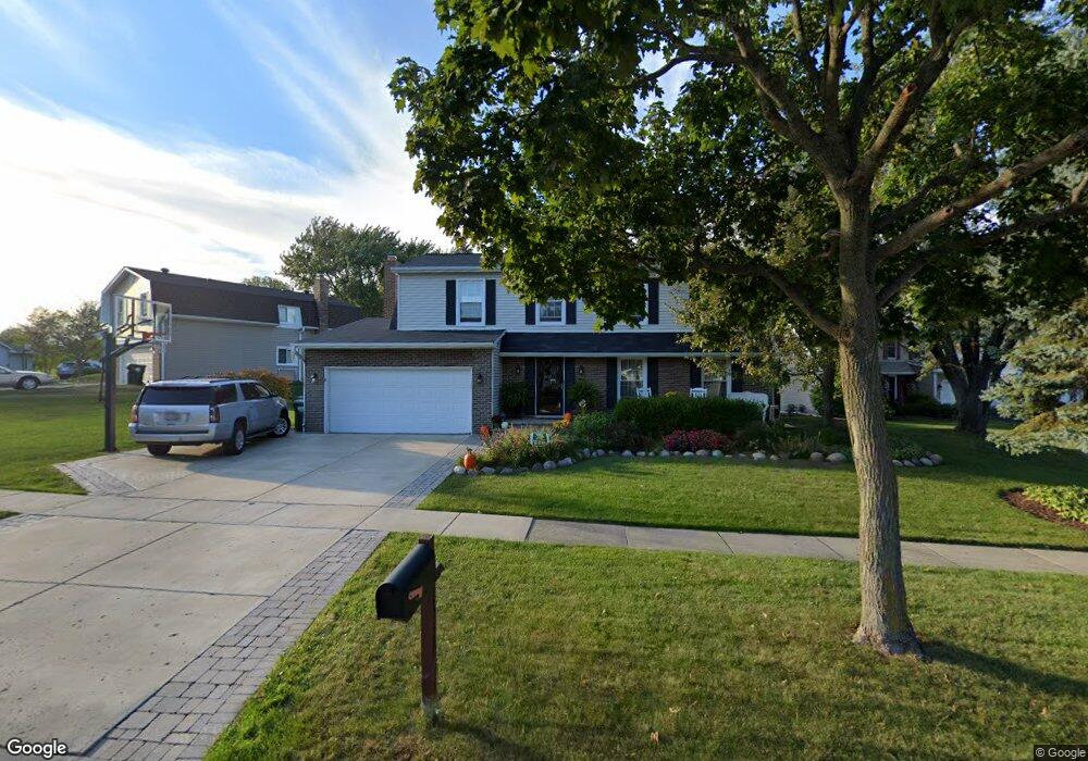
1312 Rolling Prairie Ct Hoffman Estates, IL 60192
South Ridge NeighborhoodEstimated Value: $536,000 - $599,000
5
Beds
3
Baths
2,246
Sq Ft
$248/Sq Ft
Est. Value
About This Home
This home is located at 1312 Rolling Prairie Ct, Hoffman Estates, IL 60192 and is currently estimated at $556,026, approximately $247 per square foot. 1312 Rolling Prairie Ct is a home located in Cook County with nearby schools including Thomas Jefferson Elementary School, Frank C. Whiteley Elementary School, and William Fremd High School.
Ownership History
Date
Name
Owned For
Owner Type
Purchase Details
Closed on
Oct 19, 2001
Sold by
Harris Leroy and Harris Arlene
Bought by
Morel Thomas J and Morel Anne M
Current Estimated Value
Home Financials for this Owner
Home Financials are based on the most recent Mortgage that was taken out on this home.
Original Mortgage
$241,600
Outstanding Balance
$90,803
Interest Rate
6.8%
Estimated Equity
$465,223
Create a Home Valuation Report for This Property
The Home Valuation Report is an in-depth analysis detailing your home's value as well as a comparison with similar homes in the area
Home Values in the Area
Average Home Value in this Area
Purchase History
| Date | Buyer | Sale Price | Title Company |
|---|---|---|---|
| Morel Thomas J | $302,000 | -- |
Source: Public Records
Mortgage History
| Date | Status | Borrower | Loan Amount |
|---|---|---|---|
| Open | Morel Thomas J | $241,600 |
Source: Public Records
Tax History Compared to Growth
Tax History
| Year | Tax Paid | Tax Assessment Tax Assessment Total Assessment is a certain percentage of the fair market value that is determined by local assessors to be the total taxable value of land and additions on the property. | Land | Improvement |
|---|---|---|---|---|
| 2025 | $12,263 | $50,000 | $10,581 | $39,419 |
| 2024 | $12,263 | $40,000 | $9,069 | $30,931 |
| 2023 | $11,852 | $40,000 | $9,069 | $30,931 |
| 2022 | $11,852 | $40,000 | $9,069 | $30,931 |
| 2021 | $10,747 | $32,095 | $6,298 | $25,797 |
| 2020 | $10,511 | $32,095 | $6,298 | $25,797 |
| 2019 | $10,400 | $35,583 | $6,298 | $29,285 |
| 2018 | $12,274 | $38,741 | $5,794 | $32,947 |
| 2017 | $12,045 | $38,741 | $5,794 | $32,947 |
| 2016 | $11,179 | $38,741 | $5,794 | $32,947 |
| 2015 | $10,495 | $33,768 | $5,290 | $28,478 |
| 2014 | $10,297 | $33,768 | $5,290 | $28,478 |
| 2013 | $10,037 | $33,768 | $5,290 | $28,478 |
Source: Public Records
Map
Nearby Homes
- 4675 Olmstead Dr
- 1478 W Sapphire Dr
- 1213 Silver Pine Dr
- 4100 N Victoria Dr
- 13 Chipping Campden Dr
- 4950 Tarrington Dr
- 3830 Anjou Ln
- 5190 Chambers Dr
- 5187 Chambers Dr
- 2072 Palatine Rd
- 3835 Huntington Blvd
- 70 Ela Rd
- 61 E Rd
- 61 E Rd
- 61 E Palatine #4 Rd
- 61 E Palatine Rd
- 1030 Ridgeview Dr
- 2204 Shetland Rd
- 1860 Burr Ridge Dr
- 1987 Selkirk Ct
- 1324 Rolling Prairie Ct
- 4464 Sundance Cir
- 1338 Rolling Prairie Ct
- 4470 Sundance Cir
- 1301 Rolling Prairie Ct
- 4463 Sundance Cir
- 1313 Rolling Prairie Ct
- 1325 Rolling Prairie Ct Unit 2
- 1348 Rolling Prairie Ct
- 4469 Sundance Cir
- 4476 Sundance Cir
- 1337 Rolling Prairie Ct
- 4446 Sundance Cir
- 4535 Opal Dr
- 4537 Opal Dr
- 1349 Rolling Prairie Ct
- 4533 Opal Dr
- 4475 Sundance Cir
- 4531 Opal Dr Unit 1
- 4539 Opal Dr