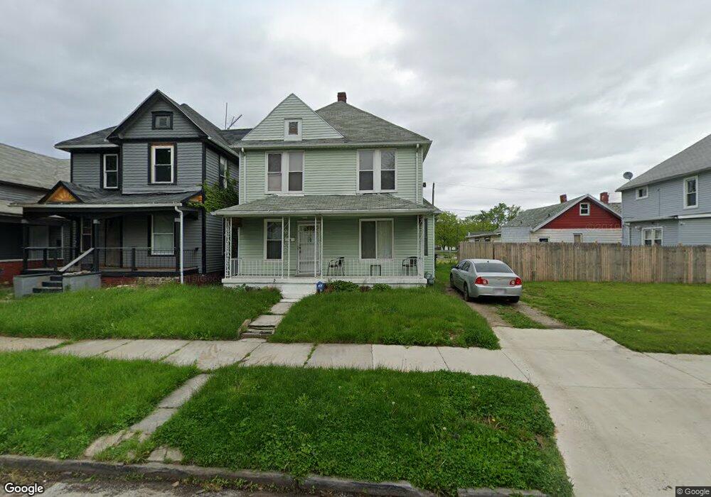
1312 Woodland Ave Toledo, OH 43607
ONYX NeighborhoodEstimated Value: $54,680 - $88,000
3
Beds
1
Bath
1,364
Sq Ft
$52/Sq Ft
Est. Value
About This Home
This home is located at 1312 Woodland Ave, Toledo, OH 43607 and is currently estimated at $71,170, approximately $52 per square foot. 1312 Woodland Ave is a home located in Lucas County with nearby schools including Pickett Elementary School, Jesup W. Scott High School, and Explorers Academy.
Ownership History
Date
Name
Owned For
Owner Type
Purchase Details
Closed on
Oct 25, 2021
Sold by
Harris Byron F
Bought by
Byron F Harris
Current Estimated Value
Purchase Details
Closed on
Apr 8, 2013
Sold by
Harris Byron F and Harris Alisha C
Bought by
Harris Byron F and Harris Alisha C
Purchase Details
Closed on
Dec 31, 2012
Sold by
Harris Joseph and Harris Georgian
Bought by
Harris Byron F
Purchase Details
Closed on
Sep 14, 2012
Sold by
Harris Janice M
Bought by
Harris Byron F
Purchase Details
Closed on
Nov 12, 2011
Sold by
Harris William
Bought by
Harris Byron F
Create a Home Valuation Report for This Property
The Home Valuation Report is an in-depth analysis detailing your home's value as well as a comparison with similar homes in the area
Home Values in the Area
Average Home Value in this Area
Purchase History
| Date | Buyer | Sale Price | Title Company |
|---|---|---|---|
| Byron F Harris | -- | -- | |
| Harris Byron F | -- | None Available | |
| Harris Byron F | $4,800 | None Available | |
| Harris Byron F | $4,800 | None Available | |
| Harris Byron F | $4,800 | None Available |
Source: Public Records
Tax History Compared to Growth
Tax History
| Year | Tax Paid | Tax Assessment Tax Assessment Total Assessment is a certain percentage of the fair market value that is determined by local assessors to be the total taxable value of land and additions on the property. | Land | Improvement |
|---|---|---|---|---|
| 2024 | $2,515 | $8,260 | $805 | $7,455 |
| 2023 | $546 | $7,210 | $735 | $6,475 |
| 2022 | $549 | $7,210 | $735 | $6,475 |
| 2021 | $556 | $7,210 | $735 | $6,475 |
| 2020 | $582 | $6,545 | $700 | $5,845 |
| 2019 | $570 | $6,545 | $700 | $5,845 |
| 2018 | $578 | $6,545 | $700 | $5,845 |
| 2017 | $4,844 | $6,265 | $1,015 | $5,250 |
| 2016 | $4,261 | $17,900 | $2,900 | $15,000 |
| 2015 | $585 | $17,900 | $2,900 | $15,000 |
| 2014 | $608 | $6,270 | $1,020 | $5,250 |
| 2013 | $405 | $6,270 | $1,020 | $5,250 |
Source: Public Records
Map
Nearby Homes
- 1264 Fernwood Ave
- 901 N Detroit Ave
- 834 N Detroit Ave
- 1627 Fernwood Ave
- 1222 Lincoln Ave
- 1401 Foster Ave
- 1063 Norwood Ave
- 1434 Nebraska Ave
- 1510 Lincoln Ave
- 1133 Blum St
- 1267 Nebraska Ave
- 1255 Nebraska Ave
- 1422 Tecumseh St
- 635 N Detroit Ave
- 929 Norwood Ave
- 927 Norwood Ave
- 1163 W Woodruff Ave
- 1157 W Woodruff Ave
- 1211 Manila St
- 820 N Miller St
- 1310 Woodland Ave
- 1314 Woodland Ave
- 1205 Heston St
- 1316 Woodland Ave
- 1211 Heston St
- 1123 Heston St
- 1324 Woodland Ave
- 1121 Heston St
- 1326 Woodland Ave
- 1313 Woodland Ave
- 1328 Woodland Ave
- 1202 Heston St
- 1319 Woodland Ave
- 1210 Heston St
- 1334 Woodland Ave
- 1124 Heston St
- 1329 Woodland Ave
- 1122 Heston St
- 1262 Woodland Ave
- 1333 Woodland Ave