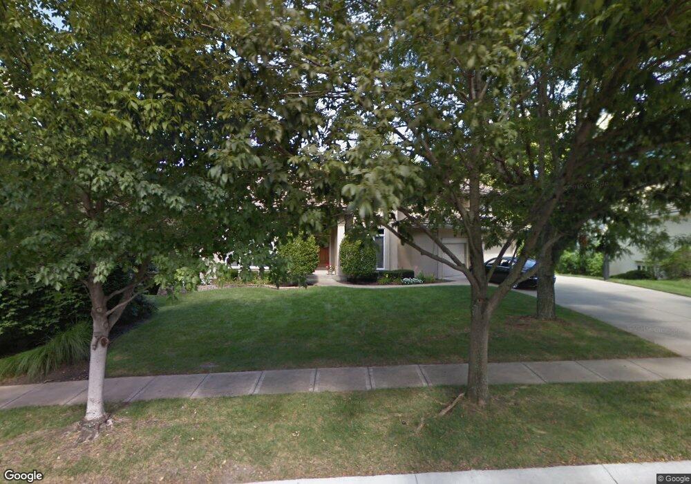
13121 Cedar St Leawood, KS 66209
Estimated Value: $839,644 - $962,000
4
Beds
4
Baths
3,517
Sq Ft
$251/Sq Ft
Est. Value
About This Home
This home is located at 13121 Cedar St, Leawood, KS 66209 and is currently estimated at $883,911, approximately $251 per square foot. 13121 Cedar St is a home located in Johnson County with nearby schools including Overland Trail Elementary School, Overland Trail Middle School, and Blue Valley North High School.
Ownership History
Date
Name
Owned For
Owner Type
Purchase Details
Closed on
Jan 11, 2024
Sold by
Indiveri James
Bought by
Indiveri Brooke
Current Estimated Value
Purchase Details
Closed on
Jan 8, 2001
Sold by
Mcelvain Van A and Mcelvain Onalisa
Bought by
Indiveri James B and Indiveri Brooke A
Home Financials for this Owner
Home Financials are based on the most recent Mortgage that was taken out on this home.
Original Mortgage
$516,000
Interest Rate
7.32%
Create a Home Valuation Report for This Property
The Home Valuation Report is an in-depth analysis detailing your home's value as well as a comparison with similar homes in the area
Home Values in the Area
Average Home Value in this Area
Purchase History
| Date | Buyer | Sale Price | Title Company |
|---|---|---|---|
| Indiveri Brooke | -- | None Listed On Document | |
| Indiveri James B | -- | Guaranty Title |
Source: Public Records
Mortgage History
| Date | Status | Borrower | Loan Amount |
|---|---|---|---|
| Previous Owner | Indiveri James B | $516,000 |
Source: Public Records
Tax History Compared to Growth
Tax History
| Year | Tax Paid | Tax Assessment Tax Assessment Total Assessment is a certain percentage of the fair market value that is determined by local assessors to be the total taxable value of land and additions on the property. | Land | Improvement |
|---|---|---|---|---|
| 2024 | $11,095 | $99,084 | $22,057 | $77,027 |
| 2023 | $10,525 | $93,001 | $22,057 | $70,944 |
| 2022 | $9,824 | $84,997 | $22,057 | $62,940 |
| 2021 | $9,309 | $77,039 | $22,057 | $54,982 |
| 2020 | $9,240 | $81,788 | $22,057 | $59,731 |
| 2019 | $9,682 | $77,085 | $20,024 | $57,061 |
| 2018 | $9,920 | $91,023 | $20,024 | $70,999 |
| 2017 | $11,416 | $87,711 | $16,698 | $71,013 |
| 2016 | $10,541 | $81,098 | $15,389 | $65,709 |
| 2015 | $10,377 | $78,867 | $15,389 | $63,478 |
| 2013 | -- | $77,659 | $15,389 | $62,270 |
Source: Public Records
Map
Nearby Homes
- 4989 W 131st Place
- 13216 Granada Dr
- 4908 W 131st Terrace
- 4801 W 133rd St Unit 301
- 13143 Rosewood St
- 13008 Fontana St
- 13009 Fontana St
- 4951 W 134th St Unit 101
- 4951 W 134th St Unit 401
- 4417 W 130th St
- 4444 W 130th Terrace
- 3349 W 133rd Terrace
- 3345 W 133rd Terrace
- 3357 W 133rd Terrace
- 4610 W 136th St
- The Del Mar SE Plan at Aventino - Leawood
- The Regency II Plan at Aventino - Leawood
- The Rosemount Villa Plan at Aventino - Leawood
- The Delray Plan at Aventino
- The Manchester Plan at Aventino
- 13201 Cedar St
- 13117 Cedar St
- 13205 Cedar St
- 13113 Cedar St
- 4900 W 132nd St
- 4901 W 132nd St
- 13120 Linden St
- 13116 Linden St
- 4740 W 132nd Terrace
- 13109 Cedar St
- 13209 Cedar St
- 4904 W 132nd St
- 4905 W 132nd St
- 4981 W 131st Place
- 4940 W 132nd Terrace
- 13112 Linden St
- 13105 Cedar St
- 4944 W 132nd Terrace
- 4909 W 132nd St
- 4985 W 131st Place