Estimated Value: $346,195 - $385,000
3
Beds
2
Baths
1,952
Sq Ft
$185/Sq Ft
Est. Value
About This Home
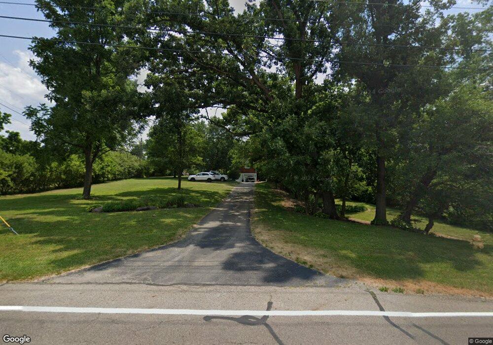
This home is located at 1313 Barnhart Rd, Troy, OH 45373 and is currently estimated at $360,799, approximately $184 per square foot. 1313 Barnhart Rd is a home located in Miami County with nearby schools including Concord Elementary School, Van Cleve Elementary School, and Troy Junior High School.
Ownership History
Date
Name
Owned For
Owner Type
Purchase Details
Closed on
Mar 28, 2023
Sold by
Cotrell Rick G and Cotrell Lisa J
Bought by
Cft Living Trust
Current Estimated Value
Purchase Details
Closed on
Mar 19, 2002
Sold by
Bank One Na
Bought by
Cotrell Rick G and Cotrell Lisa J
Home Financials for this Owner
Home Financials are based on the most recent Mortgage that was taken out on this home.
Original Mortgage
$100,000
Interest Rate
7.11%
Mortgage Type
New Conventional
Purchase Details
Closed on
Sep 19, 2001
Sold by
Skidmore Wallace O
Bought by
Bank One
Purchase Details
Closed on
Aug 20, 1991
Bought by
Markley Bernice E Trustee
Create a Home Valuation Report for This Property
The Home Valuation Report is an in-depth analysis detailing your home's value as well as a comparison with similar homes in the area
Home Values in the Area
Average Home Value in this Area
Purchase History
| Date | Buyer | Sale Price | Title Company |
|---|---|---|---|
| Cft Living Trust | -- | -- | |
| Cotrell Rick G | $75,500 | -- | |
| Bank One | $124,000 | -- | |
| Markley Bernice E Trustee | -- | -- |
Source: Public Records
Mortgage History
| Date | Status | Borrower | Loan Amount |
|---|---|---|---|
| Previous Owner | Bank One | $100,000 |
Source: Public Records
Tax History Compared to Growth
Tax History
| Year | Tax Paid | Tax Assessment Tax Assessment Total Assessment is a certain percentage of the fair market value that is determined by local assessors to be the total taxable value of land and additions on the property. | Land | Improvement |
|---|---|---|---|---|
| 2024 | $3,643 | $93,630 | $19,670 | $73,960 |
| 2023 | $3,643 | $93,630 | $19,670 | $73,960 |
| 2022 | $3,053 | $93,630 | $19,670 | $73,960 |
| 2021 | $2,501 | $72,000 | $15,120 | $56,880 |
| 2020 | $2,504 | $72,000 | $15,120 | $56,880 |
| 2019 | $2,526 | $72,000 | $15,120 | $56,880 |
| 2018 | $2,261 | $61,360 | $14,000 | $47,360 |
| 2017 | $2,282 | $61,360 | $14,000 | $47,360 |
| 2016 | $2,250 | $61,360 | $14,000 | $47,360 |
| 2015 | $2,340 | $61,360 | $14,000 | $47,360 |
| 2014 | $2,340 | $61,360 | $14,000 | $47,360 |
| 2013 | $2,355 | $61,360 | $14,000 | $47,360 |
Source: Public Records
Map
Nearby Homes
- 00 W
- 1965 Quail Nest Ct
- 1985 Fox Run
- 2206 Northbridge Trail
- 2537 Huntington Dr
- 1350 Winchester Dr
- 2295 Shenandoah Dr
- 1118 Winchester Dr
- 1550 Creekwood Dr
- Holcombe Plan at Reserve at Cliff Oaks
- Chatham Plan at Reserve at Cliff Oaks
- Bridgeport Plan at Reserve at Cliff Oaks
- Newcastle Plan at Reserve at Cliff Oaks
- 1965 Nashville Rd
- 2936 Hoying Dr
- 2944 Hoying Dr
- 2952 Hoying Dr
- 2960 Hoying Dr
- 2968 Hoying Dr
- 650 Swailes Rd
- 1295 Barnhart Rd
- 1365 Barnhart Rd
- 1385 Barnhart Rd
- 1364 Barnhart Rd
- 1418 Barnhart Rd
- 1895 Lakeshore Dr
- 1883 Lakeshore Dr
- 1865 Lakeshore Dr
- 1434 Barnhart Rd
- 1397 Barnhart Rd
- 1450 Barnhart Rd
- 1415 Barnhart Rd
- 1819 Lakeshore Dr
- 1888 Lakeshore Dr
- 1845 Lakeshore Dr
- 1435 Barnhart Rd
- 1466 Barnhart Rd
- 1791 Lakeshore Dr
- 1455 Barnhart Rd
- 1840 Lakeshore Dr