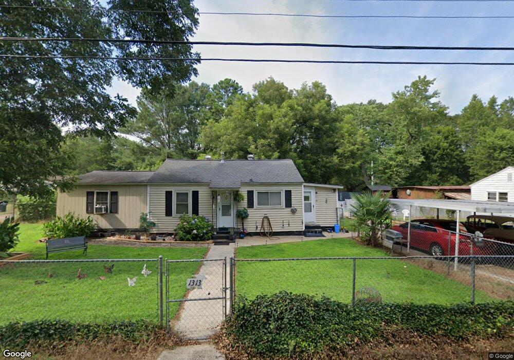
1313 P and N Dr Anderson, SC 29621
Estimated Value: $126,764 - $210,000
2
Beds
--
Bath
1,057
Sq Ft
$141/Sq Ft
Est. Value
About This Home
This home is located at 1313 P and N Dr, Anderson, SC 29621 and is currently estimated at $149,191, approximately $141 per square foot. 1313 P and N Dr is a home located in Anderson County with nearby schools including Nevitt Forest Elementary School, Glenview Middle School, and T.L. Hanna High School.
Ownership History
Date
Name
Owned For
Owner Type
Purchase Details
Closed on
Oct 15, 2008
Sold by
Fountain Priscilla S and Clinkscales Priscilla
Bought by
Lollis Terry
Current Estimated Value
Home Financials for this Owner
Home Financials are based on the most recent Mortgage that was taken out on this home.
Original Mortgage
$41,000
Interest Rate
6.34%
Mortgage Type
Purchase Money Mortgage
Purchase Details
Closed on
Feb 7, 2002
Sold by
Duncan Lillian C
Bought by
Duncan Carol L
Purchase Details
Closed on
Nov 27, 2001
Sold by
Fountain Rodney E
Bought by
Fountain Priscilla S
Create a Home Valuation Report for This Property
The Home Valuation Report is an in-depth analysis detailing your home's value as well as a comparison with similar homes in the area
Home Values in the Area
Average Home Value in this Area
Purchase History
| Date | Buyer | Sale Price | Title Company |
|---|---|---|---|
| Lollis Terry | $41,000 | -- | |
| Duncan Carol L | $1,000 | -- | |
| Fountain Priscilla S | $3,190 | -- |
Source: Public Records
Mortgage History
| Date | Status | Borrower | Loan Amount |
|---|---|---|---|
| Closed | Lollis Terry | $41,000 |
Source: Public Records
Tax History Compared to Growth
Tax History
| Year | Tax Paid | Tax Assessment Tax Assessment Total Assessment is a certain percentage of the fair market value that is determined by local assessors to be the total taxable value of land and additions on the property. | Land | Improvement |
|---|---|---|---|---|
| 2024 | $246 | $1,300 | $410 | $890 |
| 2023 | $246 | $1,300 | $410 | $890 |
| 2022 | $216 | $1,300 | $410 | $890 |
| 2021 | $212 | $1,200 | $320 | $880 |
| 2020 | $208 | $1,200 | $320 | $880 |
| 2019 | $208 | $1,200 | $320 | $880 |
| 2018 | $211 | $1,200 | $320 | $880 |
| 2017 | -- | $1,200 | $320 | $880 |
| 2016 | $233 | $1,400 | $300 | $1,100 |
| 2015 | $235 | $1,400 | $300 | $1,100 |
| 2014 | $230 | $1,400 | $300 | $1,100 |
Source: Public Records
Map
Nearby Homes
- 1414 P and Dr N
- 1313 Phyllis Dr
- 109 Woodfern Cir
- 209 Blue Ridge Cir
- 1205 Ramona Dr
- 1425 Amity Rd
- 0 Highway 29 N Unit 20292906
- 0 Highway 29 N Unit 20292905
- 0 Highway 29 N Unit 20292904
- 0 Highway 29 N Unit 20292903
- 0 Highway 29 N Unit 22331558
- 0 Highway 29 N Unit 22331556
- 0 Highway 29 N Unit 22331557
- 606 Highway 29 Bypass N
- 701 Shamrock Ln
- 2537 Belhaven Rd
- 2335 Snow Rd
- 2703 Leftwich Ln
- 611 Wh Kay Ln
- 404 Sarah Dr